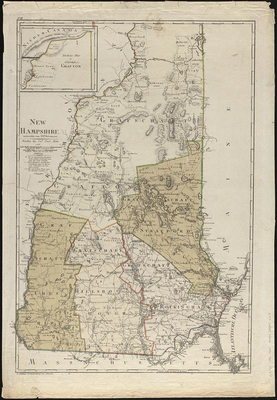
New Hampshire
This map is also available in American Revolutionary Geographies Online (ARGO), a collections portal especially built for material relating to the American Revolutionary War Era. Visit ARGO to learn more about this item and explore the historical geography of North America in the late eighteenth century.
Item Information
- Title:
- New Hampshire
- Cartographer:
- Sotzmann, D. F.
- Publisher:
- Bohn, Carl Ernst
- Contributor:
- Ebeling, Christoph Daniel, 1741-1817
- Engraver:
- Schmidt, Paulus (Engraver)
- Name on Item:
-
entworfen von D.F. Sotzmann ; P. Schmidt, sculpsit
- Date:
-
1796
- Format:
-
Maps/Atlases
- Location:
-
Boston Public Library
Norman B. Leventhal Map & Education Center - Collection (local):
-
Norman B. Leventhal Map & Education Center Collection
- Subjects:
-
Masonian Patent (N.H.)--Boundaries--Maps--Early works to 1800
New Hampshire--Maps--Early works to 1800
Landowners--New Hampshire--Maps--Early works to 1800
- Places:
-
New Hampshire
- Extent:
- 1 map : hand color ; 67 x 46 cm
- Terms of Use:
-
No known copyright restrictions.
No known restrictions on use.
- Publisher:
-
Hamburg :
bey Carl Ernst Bohn
- Scale:
-
Scale approximately 1:375,000
- Language:
-
German
English
- Notes:
-
Relief shown by hachures.
Prime meridians: Washington and Greenwich.
Shows counties and minor civil subdivisions.
Continuation inset: Nördlicher theil der grafschaft Grafton.
In upper left margin: No. II.
In lower left margin: zu Ebelings Erdbeschreibung von Amerika.
- Notes (citation):
-
Cobb, D.A. New Hampshire maps to 1900, 75
- Notes (language):
-
Map in German. Some place names also in English.
- Identifier:
-
06_01_017369
- Call #:
-
G3740 1796 .S68
- Barcode:
-
39999085956215


