Toggle navigation
LMEC Home
Exhibitions
Georeferencing
Tools for Teachers
Collections
My Favorites
Sign Up / Log In
Search
Search the map portal
Map Collection
Map Collection
Map Sets
Search
Search
Search for
Search In
All Fields
Creator
Title
Subject
Place
Search All Digital Collections
Advanced Search
8683 Results
My Search
Start Over
More Like
commonwealth:tt44pw742
Remove constraint More Like: commonwealth:tt44pw742
Filter your Search
Place
North and Central America
5,923
United States
4,843
Massachusetts
2,069
Europe
1,392
Suffolk (county)
1,079
Boston
1,052
Canada
449
Asia
436
more
Place
»
Topic
Boston (Mass.)--Maps
583
United States--Maps
279
Real property--Massachusetts--Boston--Maps
180
Massachusetts--Maps
161
Landowners--Massachusetts--Boston--Maps
138
North America--Maps--Early works to 1800
102
New England--Maps
101
City planning--Massachusetts--Boston--Maps
96
more
Topic
»
Date
Date range begin
–
Date range end
Current results range from
1482
to
2023
View distribution
Creator
United States. Hydrographic Office
595
O.H. Bailey & Co
148
Des Barres, Joseph F. W. (Joseph Frederick Wallet), 1722-1824
123
United States. Post Office Dept
120
Boston Redevelopment Authority
100
Ptolemy, 2nd cent
100
Walling, Henry Francis, 1825-1888
94
Geological Survey (U.S.)
86
more
Creator
»
Format
Maps/Atlases
8,623
Manuscripts
215
Prints
56
Books
36
Objects/Artifacts
10
Drawings/Illustrations
8
Posters
5
Georeferenced
Yes
870
No
7,813
Collection
Norman B. Leventhal Map & Education Center Collection
8,646
Boston and New England Maps
2,254
Urban Maps
2,023
Maritime Charts and Atlases
1,083
American Revolutionary War-Era Maps
614
Boston Redevelopment Authority Collection
119
Massachusetts Real Estate Atlases
5
Applied Geographics, Inc. Records
1
more
Collection
»
Available to use
No known restrictions
8,535
Creative Commons license
48
Search Constraints
Sort by relevance
relevance
title
date (asc)
date (desc)
Number of results to display per page
20 per page
10
per page
20
per page
50
per page
100
per page
View results as:
grid view
map view
Search Results
2981.
Jamaica Park and Bussey Farm Parkway : West Roxbury district
2982.
Jamaica Plain, Massachusetts : Ward 23, City of Boston, 1891
2983.
Jamaica Plain view of the world
2984.
Jamaica Pond master plan
2985.
James Hayes Park
2986.
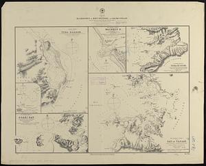
Japan - n.w. coast of Nipon, Nanao Harbors : south harbor, surveyed by Commander C.J. Bullock and the officers of H.M.S....
2987.
Japan, anchorages in the Seto-Uchi or Inland Sea
2988.
Japan, anchorages on the coasts of Yezo Id
2989.
Japan and its relation to the territory bordering on the Pacific Ocean
2990.
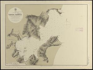
Japan, east coast of Nipon, Yamada Harbor
2991.
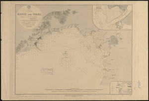
Japan, Gulf of Ösaka, Hiogo and Ösaka : compiled from British and French surveys to 1878
2992.
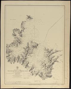
Japan, Gulf of Yezo, Ura-No-Go-Ura and Yokoska Bays : from a French survey in 1870
2993.
Japan, harbors and anchorages on the north-west coast of Nipon
2994.
Japan, harbors in Kii Channel and Isumi Strait : from British surveys in 1861 with auditions in 1866-7 ; republication of Brit....
2995.
Japan-- Inland Sea, channels between Misima Nada and Bingo Nada : republication of Brit. Admlty. chart no. 132, corrected to 1874
2996.
Japan-- Inland Sea, channels into the Harima Nada : from British surveys in 1869, corrected to 1874
2997.
Japan, Inland Sea, Hiroshima Wan, Ujina Ko : from a Japanese survey in 1895
2998.
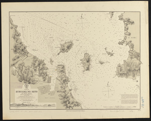
Japan, Inland Sea, Kurusima no Seto and adjacent channels : republication of Brit. Admty. chart no. 131, corrected to 1874
2999.
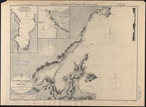
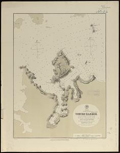
Japan, Kiusiu Island, n.w. coast, Yobuko Harbor
3000.
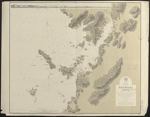
Japan, Kiusiu Island, west coast, Nagasaki Harbor : from Brit. surveys in 1855 & 1861 ; republication of British Admty chart...
‹ Prev
Next ›
1
2
…
146
147
148
149
150
151
152
153
154
…
434
435