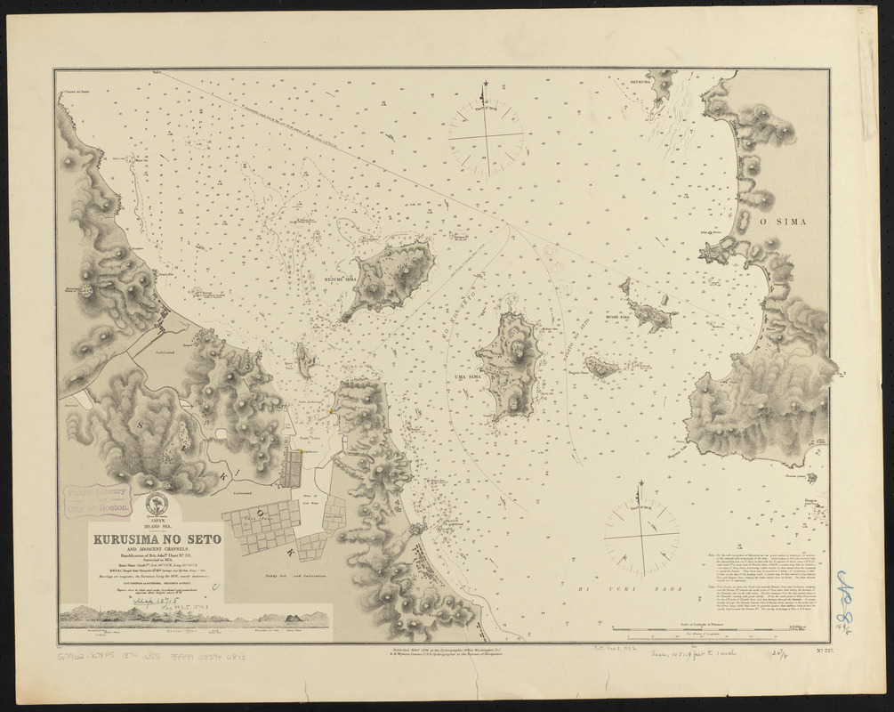
Japan, Inland Sea, Kurusima no Seto and adjacent channels : republication of Brit. Admty. chart no. 131, corrected to 1874
Item Information
- Title:
- Japan, Inland Sea, Kurusima no Seto and adjacent channels : republication of Brit. Admty. chart no. 131, corrected to 1874
- Title (alt.):
-
Kurusima no Seto and adjacent channels
- Issuing body:
- United States. Hydrographic Office
- Date:
-
1874
- Format:
-
Maps/Atlases
- Location:
-
Boston Public Library
Norman B. Leventhal Map & Education Center - Collection (local):
-
Norman B. Leventhal Map & Education Center Collection
- Subjects:
-
Nautical charts--Japan--Kurushima Strait
Kurushima Strait (Japan)--Maps
- Places:
-
JapanKurushima-kaikyō (strait)
- Extent:
- 1 map ; 47 x 64 cm
- Terms of Use:
-
No known copyright restrictions.
No known restrictions on use.
- Publisher:
-
Washington, D.C. :
Hydrographic Office
- Scale:
-
Scale approximately 1:12,700
- Language:
-
English
- Notes:
-
Relief shown by hachures and spot heights. Depths shown by soundings and isolines.
Includes view of Nezumi Sima.
- Identifier:
-
06_01_015919
- Call #:
-
G9096.P5 svar .U55
- Barcode:
-
39999085940813


