Toggle navigation
LMEC Home
Exhibitions
Georeferencing
Tools for Teachers
Collections
My Favorites
Sign Up / Log In
Search
Search the map portal
Map Collection
Map Collection
Map Sets
Search
Search
Search for
Search In
All Fields
Creator
Title
Subject
Place
Search All Digital Collections
Advanced Search
8815 Results
My Search
Start Over
More Like
commonwealth:tt44pw04c
Remove constraint More Like: commonwealth:tt44pw04c
Filter your Search
Place
North and Central America
6,046
United States
4,964
Massachusetts
2,091
Europe
1,396
Suffolk (county)
1,166
Boston
1,139
Canada
449
Asia
438
more
Place
»
Topic
Boston (Mass.)--Maps
607
United States--Maps
282
Real property--Massachusetts--Boston--Maps
253
Landowners--Massachusetts--Boston--Maps
169
Massachusetts--Maps
162
City planning--Massachusetts--Boston--Maps
145
North America--Maps--Early works to 1800
103
New England--Maps
102
more
Topic
»
Date
Date range begin
–
Date range end
Current results range from
1482
to
2023
View distribution
Creator
United States. Hydrographic Office
595
O.H. Bailey & Co
148
Boston Redevelopment Authority
144
Des Barres, Joseph F. W. (Joseph Frederick Wallet), 1722-1824
123
United States. Post Office Dept
120
Ptolemy, 2nd cent
100
Walling, Henry Francis, 1825-1888
94
Geological Survey (U.S.)
86
more
Creator
»
Format
Maps/Atlases
8,755
Manuscripts
215
Prints
56
Books
36
Objects/Artifacts
10
Drawings/Illustrations
8
Posters
5
Georeferenced
Yes
870
No
7,945
Collection
Norman B. Leventhal Map & Education Center Collection
8,697
Boston and New England Maps
2,318
Urban Maps
2,107
Maritime Charts and Atlases
1,083
American Revolutionary War-Era Maps
616
Boston Redevelopment Authority Collection
170
Massachusetts Real Estate Atlases
35
Applied Geographics, Inc. Records
2
more
Collection
»
Available to use
No known restrictions
8,637
Creative Commons license
48
Search Constraints
Sort by relevance
relevance
title
date (asc)
date (desc)
Number of results to display per page
20 per page
10
per page
20
per page
50
per page
100
per page
View results as:
grid view
map view
Search Results
7301.
Route of the Providence and Worcester rail road
7302.
Routes of Grand Trunk Pacific Steamships : Pacific coast service
7303.
Le Royaume d'Angleterre : divisé selon les sept Royaumes, ou Heptarchie des Saxons, avec la Principauté de Galles, et...
7304.
Royaume de Danemarck : qui comprend le Nort-Jutland divisé en ses quatre dioceses, le Sud-Jutland divisé en ses deux duchés...
7305.
Le Royaume de Hongrie, divisé en Haute et Basse Hongrie, Transilvanie, Esclavonie et Croatie
7306.
Royaume d'Irlande : divisé en ses quatre provinces et subdivisé en comtés
7307.
Ruatan or Rattan
7308.
Rumänien und Bulgarien
7309.
Rural cultural regions in the United States
7310.
Russell
7311.
Russell's map of Boston from the latest surveys
7312.
Russell's map of Boston from the latest surveys : colored to show the burned district of the Great Fire Nov 9th & 10th 1872
7313.
Russell's map of Massachusetts
7314.
Russell's map of Paris and fortifications
7315.
Russia
7316.
Russia in Europe
7317.
The Russian Empire, in Europe and Asia
7318.
Russisch-Türkischer Kriegsschauplatz, 1877
7319.
Rutland, Vt
7320.
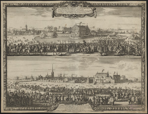
Sacræ Regiæ Majtis. Caroli Gustavi solennis ingressus, in urbem Landscrona habitus 7 Marij ao. 1658, cum vi pactorum Pacis...
‹ Prev
Next ›
1
2
…
362
363
364
365
366
367
368
369
370
…
440
441