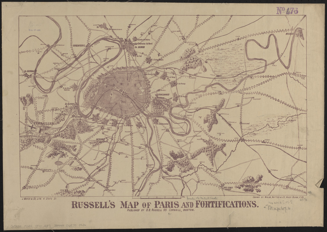
Russell's map of Paris and fortifications
Item Information
- Title:
- Russell's map of Paris and fortifications
- Publisher:
- Russell, B. B. (Benjamin B.)
- Printer:
- J. Mayer & Co.
- Cartographer:
- Walsh, Natter & Co.
- Name on Item:
-
drawn by Walsh, Natter & Co.
- Date:
-
[ca. 1870–1879]
- Format:
-
Maps/Atlases
- Location:
-
Boston Public Library
Norman B. Leventhal Map & Education Center - Collection (local):
-
Norman B. Leventhal Map & Education Center Collection
- Subjects:
-
Paris (France)--Maps
- Places:
-
FranceÎle-de-France (region)Paris
- Extent:
- 1 map ; 34 x 54 cm
- Terms of Use:
-
No known copyright restrictions.
No known restrictions on use.
- Publisher:
-
Boston :
B.B. Russell
- Scale:
-
Scale approximately 1:107,500
- Language:
-
English
- Identifier:
-
06_01_014189
- Call #:
-
G5834.P3R4 1870 .R87
- Barcode:
-
39999065700526