Toggle navigation
LMEC Home
Exhibitions
Georeferencing
Tools for Teachers
Collections
My Favorites
Sign Up / Log In
Search
Search the map portal
Map Collection
Map Collection
Map Sets
Search
Search
Search for
Search In
All Fields
Creator
Title
Subject
Place
Search All Digital Collections
Advanced Search
8995 Results
My Search
Start Over
More Like
commonwealth:tt44pv95m
Remove constraint More Like: commonwealth:tt44pv95m
Filter your Search
Place
North and Central America
6,226
United States
5,142
Massachusetts
2,145
Europe
1,396
Suffolk (county)
1,341
Boston
1,314
Canada
449
Asia
438
more
Place
»
Topic
Boston (Mass.)--Maps
752
United States--Maps
282
City planning--Massachusetts--Boston--Maps
253
Real property--Massachusetts--Boston--Maps
253
Landowners--Massachusetts--Boston--Maps
169
Massachusetts--Maps
166
Urban renewal--Massachusetts--Boston--Maps
150
New England--Maps
104
more
Topic
»
Date
Date range begin
–
Date range end
Current results range from
1482
to
2023
View distribution
Creator
United States. Hydrographic Office
595
Boston Redevelopment Authority
256
O.H. Bailey & Co
148
Des Barres, Joseph F. W. (Joseph Frederick Wallet), 1722-1824
124
United States. Post Office Dept
120
Ptolemy, 2nd cent
100
Walling, Henry Francis, 1825-1888
94
Geological Survey (U.S.)
87
more
Creator
»
Format
Maps/Atlases
8,935
Manuscripts
215
Prints
56
Books
36
Objects/Artifacts
10
Drawings/Illustrations
8
Posters
5
Georeferenced
Yes
886
No
8,109
Collection
Norman B. Leventhal Map & Education Center Collection
8,725
Boston and New England Maps
2,465
Urban Maps
2,248
Maritime Charts and Atlases
1,083
American Revolutionary War-Era Maps
638
Boston Redevelopment Authority Collection
297
Massachusetts Real Estate Atlases
38
Mapping Boston Collection
20
more
Collection
»
Available to use
No known restrictions
8,772
Creative Commons license
70
Search Constraints
Sort by relevance
relevance
title
date (asc)
date (desc)
Number of results to display per page
20 per page
10
per page
20
per page
50
per page
100
per page
View results as:
grid view
map view
Search Results
4921.
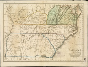
Map of the southern states of America, comprehending Maryland, Virginia, Kentucky, Territory s'th of the Ohio, North Carolina,...
4922.
Map of the Southern States, showing the relative proportion of slaves in the different localities
4923.
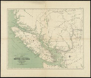
Map of the south-western part of British Columbia
4924.
Map of the state of Alabama
4925.
Map of the state of Georgia
4926.
Map of the state of Illinois
4927.
Map of the state of Louisiana
4928.
Map of the state of Maine : exhibiting the disputed territory in connexion with the adjacent British provinces of N. Brunswick...
4929.
Map of the state of Maine
4930.
A map of the state of Maine
4931.
Map of the state of Maine with the province of New Brunswick
4932.
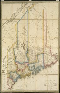
[Map] of the state of Massachusetts
4933.
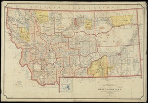
Map of the State of Montana
4934.
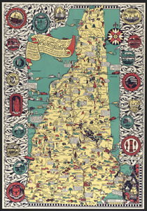
Map of the state of New Hampshire : looking over our whole country from east to west, let me ask if such a map was ever before...
4935.
Map of the state of New York
4936.
Map of the State of New York
4937.
A map of the State of New York
4938.
Map of the State of New York with part of the states of Pennsylvania, New Jersey &c
4939.
Map of the State of New-York : showing its water and rail road lines, Jany. 1854
4940.
Map of the State of New-York exhibiting the several towns and counties together with the population as determined by the census...
‹ Prev
Next ›
1
2
…
243
244
245
246
247
248
249
250
251
…
449
450


![[Map] of the state of Massachusetts](https://bpldcassets.blob.core.windows.net/derivatives/images/commonwealth:wd376589g/image_thumbnail_300.jpg)