Toggle navigation
LMEC Home
Exhibitions
Georeferencing
Tools for Teachers
Collections
My Favorites
Sign Up / Log In
Search
Search the map portal
Map Collection
Map Collection
Map Sets
Search
Search
Search for
Search In
All Fields
Creator
Title
Subject
Place
Search All Digital Collections
Advanced Search
9085 Results
My Search
Start Over
More Like
commonwealth:sn00dg70r
Remove constraint More Like: commonwealth:sn00dg70r
Filter your Search
Place
North and Central America
6,316
United States
5,234
Massachusetts
2,152
Suffolk (county)
1,436
Boston
1,409
Europe
1,396
Canada
449
Asia
438
more
Place
»
Topic
Boston (Mass.)--Maps
686
City planning--Massachusetts--Boston--Maps
418
United States--Maps
282
Urban renewal--Massachusetts--Boston--Maps
253
Real property--Massachusetts--Boston--Maps
252
Landowners--Massachusetts--Boston--Maps
169
Massachusetts--Maps
162
Buildings--Massachusetts--Boston--Maps
125
more
Topic
»
Date
Date range begin
–
Date range end
Current results range from
1482
to
2023
View distribution
Creator
United States. Hydrographic Office
595
Boston Redevelopment Authority
392
O.H. Bailey & Co
148
Des Barres, Joseph F. W. (Joseph Frederick Wallet), 1722-1824
123
United States. Post Office Dept
120
Ptolemy, 2nd cent
100
Walling, Henry Francis, 1825-1888
94
Geological Survey (U.S.)
86
more
Creator
»
Format
Maps/Atlases
9,025
Manuscripts
215
Prints
56
Books
36
Objects/Artifacts
10
Drawings/Illustrations
8
Posters
5
Georeferenced
Yes
869
No
8,216
Collection
Norman B. Leventhal Map & Education Center Collection
8,695
Boston and New England Maps
2,589
Urban Maps
2,377
Maritime Charts and Atlases
1,083
American Revolutionary War-Era Maps
616
Boston Redevelopment Authority Collection
442
Massachusetts Real Estate Atlases
34
Applied Geographics, Inc. Records
1
Available to use
No known restrictions
8,909
Creative Commons license
47
Search Constraints
Sort by relevance
relevance
title
date (asc)
date (desc)
Number of results to display per page
20 per page
10
per page
20
per page
50
per page
100
per page
View results as:
grid view
map view
Search Results
7701.
Segusiani : partie du dioecese et archevesche de Lyon : Le Bas Forez et Beaujolois : eslectons de Roanne et de Villefranche
7702.
Segusiani : partie du dioese et archevche de Lyon : le Lyonnois et le haut forez : eslections de Lyon, de St. Chamont, et de...
7703.
Selected hurricanes affecting the southern United States 1954-1977
7704.
Senones : Evesché d'Auxerre : Comté et Ballge d'Auxerre : Eslectons. de Clamecy, de Gien, de la Charité, et de Vezelay
7705.
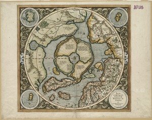
Septentrionalium terrarum descriptio
7706.
Septima Asia tabula continet Margianam, Bactrianam, Sogdianos, Sacas & Scythiam intra Imaū mōtē
7707.
Septima Asiae tabula
7708.
Septima Europa tabula continet Sardininiam & Sicilia insulas
7709.
Septima Europae tabula
7710.
Ser. Reg. Caroli Gustavi victoriolus e Sialandia disccssus facta pace Rothschildenli d. 5 Martij 1658 ; Ser. Reg. Sueciæ...
7711.
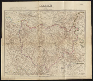
Serbien : nach Österreichischen und Russischen aufnahmen und ortsbestimmungen, und den karten von Viquesnel und Bugarski
7712.
Serio-comic war map for the year 1877
7713.
Al sermo. Ferdinando. II. Grandvca di Toscana svo signore Don Roberto Dudleo, Duca di Northumbria
7714.
Seven miles around Jerusalem : from original surveys and observations
7715.
The Seven United Provinces of Holland, Groningen, Gelders, Friesland, Overyssel, Utrecht and Zealand : from the best authorities
7716.
The Seven United Provinces of Netherland : with its circumjacent borders
7717.
The seven United Provinces, with their roads and divisions
7718.
The Seventh Ward of Philadelphia : the distribution of Negro inhabitants throughout the ward, and their social conditions
7719.
Sexta Asiae tabula
7720.
Sexta Asie tabula continet Arabiam, Felice atq[ue] Carmania cu adiacentibus insulis
‹ Prev
Next ›
1
2
…
382
383
384
385
386
387
388
389
390
…
454
455


![Sexta Asie tabula continet Arabiam, Felice atq[ue] Carmania cu adiacentibus insulis](https://bpldcassets.blob.core.windows.net/derivatives/images/commonwealth:7h14b122w/image_thumbnail_300.jpg)