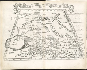
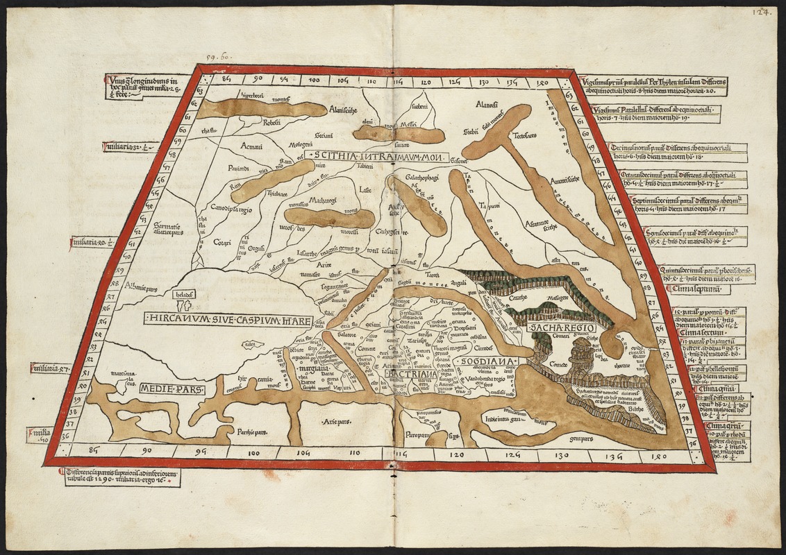
Septima Asia tabula continet Margianam, Bactrianam, Sogdianos, Sacas & Scythiam intra Imaū mōtē
Item Information
- Title:
- Septima Asia tabula continet Margianam, Bactrianam, Sogdianos, Sacas & Scythiam intra Imaū mōtē
- Creator:
- Ptolemy, 2nd cent
- Printer:
- Hol, Lienhart
- Date:
-
[1482]
- Format:
-
Maps/Atlases
- Location:
-
Boston Public Library
Norman B. Leventhal Map & Education Center - Collection (local):
-
Norman B. Leventhal Map & Education Center Collection
- Subjects:
-
Tajikistan--Maps--Early works to 1800
Kyrgyzstan--Maps--Early works to 1800
Turkmenistan--Maps--Early works to 1800
Uzbekistan--Maps--Early works to 1800
Kazakhstan--Maps--Early works to 1800
- Places:
-
Tajikistan
Kyrgyzstan
Turkmenistan
Uzbekistan
Kazakhstan
- Extent:
- 1 map : col. ; 27 x 45 cm.
- Terms of Use:
-
No known copyright restrictions.
No known restrictions on use.
- Publisher:
-
Ulm :
Lienhart Hol
- Scale:
-
Scale [ca. 1:9,000,000]
- Language:
-
Latin
- Notes:
-
Title from verso.
Map of ancient Scythian lands in Central Asia, to the west of the Pamir Mountain range.
Relief shown by brown coloring.
Engraved on wood with place names in moveable type.
Includes names of places and natural features.
In margin: notes on latitude.
Descriptive text within ornamental borders on verso.
Appears in the author's Geographia. Ulm : Lienhart Hol, 16 July 1482.
Text in Latin.
Cataloging, conservation, and digitization made possible in part by The National Endowment for the Humanities: Exploring the human endeavor.
Atlas scanned by Internet Archive http://www.archive.org/details/cosmographia00ptol
- Notes (date):
-
This date is inferred.
- Identifier:
-
06_01_000860
- Call #:
-
G1005 .P7 1482
- Barcode:
-
30000003825180