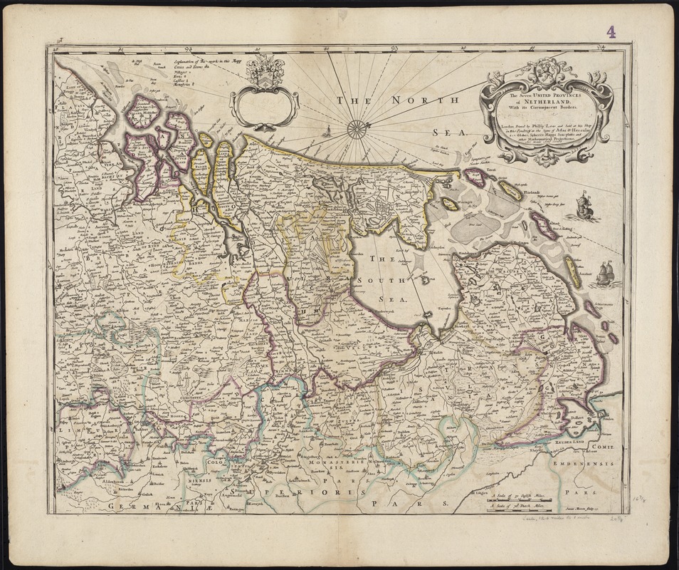
The Seven United Provinces of Netherland : with its circumjacent borders
Item Information
- Title:
- The Seven United Provinces of Netherland : with its circumjacent borders
- Title (alt.):
-
Collection of old maps
- Creator:
- Lea, Philip, fl. 1683-1700
- Date:
-
[1686]
- Format:
-
Maps/Atlases
- Location:
-
Boston Public Library
Norman B. Leventhal Map & Education Center - Collection (local):
-
Norman B. Leventhal Map & Education Center Collection
- Subjects:
-
Netherlands--Maps--Early works to 1800
Belgium--Maps--Early works to 1800
- Places:
-
Netherlands
Belgium
- Extent:
- 1 map : col. ; 43 x 53 cm.
- Terms of Use:
-
No known copyright restrictions.
No known restrictions on use.
- Publisher:
-
London :
Printed with Philip Lea and sold at his shop in the Poultrey at the signe of Atlas & Hercules ...
- Scale:
-
Scale [ca. 1: 800,000]
- Language:
-
English
- Notes:
-
Map of the Netherlands and northern Belgium.
Relief shown pictorially.
Oriented with north toward the upper right.
James Moxon sculp.
Cataloging, conservation, and digitization made possible in part by The National Endowment for the Humanities: Exploring the human endeavor.
Part of composite portfolio atlas with title "Collection of old maps."
- Notes (date):
-
This date is inferred.
- Identifier:
-
06_01_009527
- Call #:
-
G1015 .C651 1630
- Barcode:
-
30000003862867