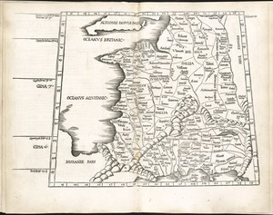
Carte chorographique des Pays-Bas Autrichiens
Item Information
- Title:
- Carte chorographique des Pays-Bas Autrichiens
- Cartographer:
- Ferraris, Josef Johan, Graf, 1726-1814
- Engraver:
- Cochin, Charles Nicolas, 1715-1790
- Engraver:
- Dupuis, L. A. (Louis-André)
- Engraver:
- Eisen, Charles, 1720-1778
- Engraver:
- Nicolet, Bénédict Alphonse, 1743-1806
- Engraver:
- Patas
- Engraver:
- Stagnon, Antonio Maria, 1751-1805
- Name on Item:
-
dédiée à leurs majestés impériales et royales par le Comte de Ferraris, lieutenant-général de leurs armées ; gravée par L.A. Dupuis, géographe de S.A.R. ; Mgr. le Duc Charles Alexandre de Lorraine et de Bar
- Date:
-
1777
- Format:
-
Maps/Atlases
- Location:
-
Boston Public Library
Norman B. Leventhal Map & Education Center - Collection (local):
-
Norman B. Leventhal Map & Education Center Collection
- Series:
- Vattemare Collection
- Subjects:
-
Belgium--Maps--Early works to 1800
Brussels (Belgium)--Maps--Early works to 1800
- Places:
-
Belgium
BelgiumBrussels-Capital Region (region)Brussels
- Extent:
- 1 atlas (25 sheets) : color maps ; 67 cm
- Terms of Use:
-
No known copyright restrictions.
No known restrictions on use.
- Publisher:
-
[Place of publication not identified] :
[publisher not identified]
- Scale:
-
Scale approximately 1:86,400
- Language:
-
French
- Notes:
-
Relief shown by hachures.
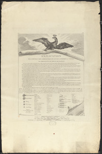
Set complete in 25 sheets. Geographic coverage complete in 22 sheets (sheets 1-15, 17-20, and 23-25). Title cartouche on lower half of sheet 11. Presentation to Emperor Joseph II on sheet 16. Scale bars in cartouche on lower half of sheet 17. Map of Brussels on sheet 21. Map of Belgium on sheet 22. Index map on lower half of sheet 23.
Includes coats of arms.
- Identifier:
-
06_01_014993
06_01_014994
06_01_014995
06_01_014996
06_01_014997
06_01_014998
06_01_014999
06_01_015000
06_01_015001
06_01_015002
06_01_015003
06_01_015004
06_01_015005
06_01_015006
06_01_015007
06_01_015008
06_01_015009
06_01_015010
06_01_015011
06_01_015012
06_01_015013
06_01_015014
06_01_015015
06_01_015016
06_01_015017
- Call #:
-
G6010 1777 .F47
- Barcode:
-
39999065708297