Toggle navigation
LMEC Home
Exhibitions
Georeferencing
Tools for Teachers
Collections
My Favorites
Sign Up / Log In
Search
Search the map portal
Map Collection
Map Collection
Map Sets
Search
Search
Search for
Search In
All Fields
Creator
Title
Subject
Place
Search All Digital Collections
Advanced Search
9046 Results
My Search
Start Over
More Like
commonwealth:sj13ch771
Remove constraint More Like: commonwealth:sj13ch771
Filter your Search
Place
North and Central America
6,277
United States
5,195
Massachusetts
2,149
Suffolk (county)
1,397
Europe
1,396
Boston
1,370
Canada
449
Asia
438
more
Place
»
Topic
Boston (Mass.)--Maps
676
City planning--Massachusetts--Boston--Maps
418
United States--Maps
282
Urban renewal--Massachusetts--Boston--Maps
252
Real property--Massachusetts--Boston--Maps
216
Massachusetts--Maps
162
Landowners--Massachusetts--Boston--Maps
135
North America--Maps--Early works to 1800
103
more
Topic
»
Date
Date range begin
–
Date range end
Current results range from
1482
to
2023
View distribution
Creator
United States. Hydrographic Office
595
Boston Redevelopment Authority
391
O.H. Bailey & Co
148
Des Barres, Joseph F. W. (Joseph Frederick Wallet), 1722-1824
123
United States. Post Office Dept
120
Ptolemy, 2nd cent
100
Walling, Henry Francis, 1825-1888
94
Geological Survey (U.S.)
86
more
Creator
»
Format
Maps/Atlases
8,986
Manuscripts
215
Prints
56
Books
36
Objects/Artifacts
10
Drawings/Illustrations
8
Posters
5
Georeferenced
Yes
869
No
8,177
Collection
Norman B. Leventhal Map & Education Center Collection
8,694
Boston and New England Maps
2,584
Urban Maps
2,372
Maritime Charts and Atlases
1,083
American Revolutionary War-Era Maps
616
Boston Redevelopment Authority Collection
438
Available to use
No known restrictions
8,904
Creative Commons license
47
Search Constraints
Sort by relevance
relevance
title
date (asc)
date (desc)
Number of results to display per page
20 per page
10
per page
20
per page
50
per page
100
per page
View results as:
grid view
map view
Search Results
8001.
State of Colorado
8002.
The State of Florida : compiled in the Bureau of Topographical Engineers from the best authorities
8003.
State of Florida
8004.
State of Florida
8005.
State of Idaho
8006.
State of Illinois
8007.
State of Illinois
8008.
State of Illinois
8009.
State of Illinois coal fields and producing districts
8010.
State of Indiana
8011.
State of Indiana
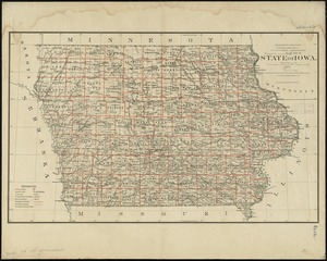
8012.
State of Indiana coal fields and producing districts
8013.
State of Iowa
8014.
State of Iowa
8015.
State of Kansas
8016.
State of Kansas
8017.
State of Kentucky coal fields and producing districts
8018.
State of Kentucky, stations and transmission lines used in public service in 1921
8019.
State of Louisiana
8020.
State of Louisiana, highlighting low-lying areas derived from USGS digital elevation data
‹ Prev
Next ›
1
2
…
397
398
399
400
401
402
403
404
405
…
452
453