Toggle navigation
LMEC Home
Exhibitions
Georeferencing
Tools for Teachers
Collections
My Favorites
Sign Up / Log In
Search
Search the map portal
Map Collection
Map Collection
Map Sets
Search
Search
Search for
Search In
All Fields
Creator
Title
Subject
Place
Search All Digital Collections
Advanced Search
8773 Results
My Search
Start Over
More Like
commonwealth:qj72rq70n
Remove constraint More Like: commonwealth:qj72rq70n
Filter your Search
Place
North and Central America
6,004
United States
4,922
Massachusetts
2,088
Europe
1,396
Suffolk (county)
1,124
Boston
1,097
Canada
449
Asia
438
more
Place
»
Topic
Boston (Mass.)--Maps
606
United States--Maps
282
Real property--Massachusetts--Boston--Maps
253
Landowners--Massachusetts--Boston--Maps
170
Massachusetts--Maps
162
City planning--Massachusetts--Boston--Maps
108
North America--Maps--Early works to 1800
103
New England--Maps
102
more
Topic
»
Date
Date range begin
–
Date range end
Current results range from
1482
to
2023
View distribution
Creator
United States. Hydrographic Office
595
O.H. Bailey & Co
148
Des Barres, Joseph F. W. (Joseph Frederick Wallet), 1722-1824
123
United States. Post Office Dept
120
Boston Redevelopment Authority
110
Ptolemy, 2nd cent
100
Walling, Henry Francis, 1825-1888
94
Geological Survey (U.S.)
86
more
Creator
»
Format
Maps/Atlases
8,713
Manuscripts
215
Prints
56
Books
36
Objects/Artifacts
10
Drawings/Illustrations
8
Posters
5
Georeferenced
Yes
869
No
7,904
Collection
Norman B. Leventhal Map & Education Center Collection
8,695
Boston and New England Maps
2,276
Urban Maps
2,066
Maritime Charts and Atlases
1,083
American Revolutionary War-Era Maps
616
Boston Redevelopment Authority Collection
129
Massachusetts Real Estate Atlases
35
Applied Geographics, Inc. Records
1
Available to use
No known restrictions
8,596
Creative Commons license
47
Search Constraints
Sort by relevance
relevance
title
date (asc)
date (desc)
Number of results to display per page
20 per page
10
per page
20
per page
50
per page
100
per page
View results as:
grid view
map view
Search Results
2521.
From Monomoy and Nantucket Shoals to Muskeget Channel, Mass
2522.
From Muskeget Channel to Buzzard's Bay and entrance to Vineyard Sound, Mass
2523.
From Muskeget Channel to Buzzard's Bay and entrance to Vineyard Sound, Mass
2524.
From Vicksburg to New Orleans
2525.
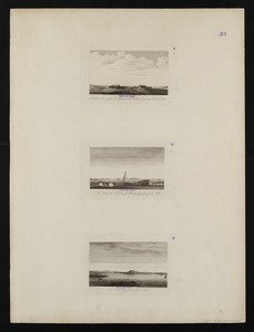
A front view of the lines taken from the advanced post near Browns house : A view of the harbour of Boston taken from Fort Hill...
2526.
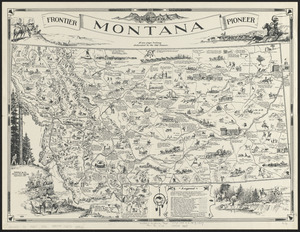
Frontier, Montana, pioneer : a one page history dedicated to the Old Timers
2527.
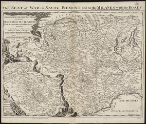
Les Frontieres de France et d'Italie ou se trouvent les Etats du Duc de Savoye partie de ceux de Milan et de la République de...
2528.
F.T. Neely's new commercial map of the United States, Canada, British Columbia, and Northern Mexico, showing all the railroads,...
2529.
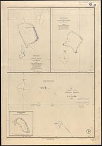
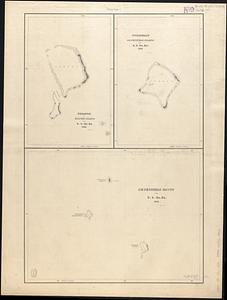
Funafuti or Ellice Island ; Nukufetau or De Peysters Island ; Ellice Group ; Nukulailai (Mitchell I.) from a sketch by Captain...
2530.
Funafuti or Ellices Island ; Nukufetau or De Peysters Island ; De Peysters Group
2531.
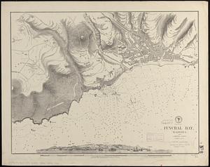
Funchal Bay, Madeira : from a British survey, corrected to 1871
2532.
G. Freytags völker- und sprachenkarte von Österreich-Ungarn
2533.
G. Woolworth Colton's new guide map of the United States & Canada : with railroads, counties etc
2534.
G. Woolworth Colton's railroad, township & distance map of New England : with adjacent portions of New York, Canada & New...
2535.
G. Woolworth Colton's railroad, township & distance map of New England with adjacent portions of New York, Canada & New Brunswick
2536.
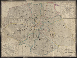
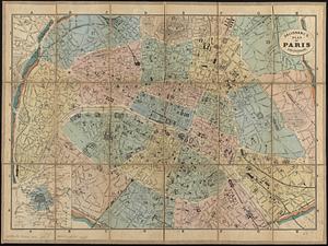
Galignani's plan of Paris and environs
2537.
Galignani's plan of Paris and environs
2538.
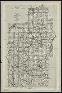
Gallatin National Forest, Montana
2539.
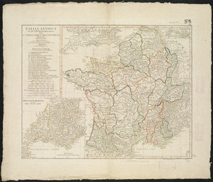
Gallia Antiqua ex Aevi Romani monumentis eruta et serenissimi Carnutum Ducis munificientia publicijuris facta
2540.
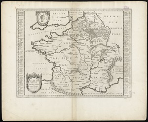
Gallia vetus : ad Iul Caesaris commentaria ex conatibus geographicis
‹ Prev
Next ›
1
2
…
123
124
125
126
127
128
129
130
131
…
438
439