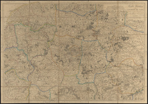
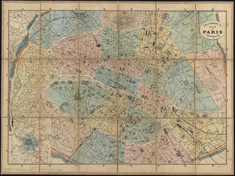
Galignani's plan of Paris and environs
Item Information
- Title:
- Galignani's plan of Paris and environs
- Publisher:
- A. and W. Galignani and Co.
- Engraver:
- Erhard (Firm)
- Printer:
- Thierry frères (Firm)
- Name on Item:
-
gravé chez Erhard
- Date:
-
[1860–1869]
- Format:
-
Maps/Atlases
- Location:
-
Boston Public Library
Norman B. Leventhal Map & Education Center - Collection (local):
-
Norman B. Leventhal Map & Education Center Collection
- Subjects:
-
Paris (France)--Maps
- Places:
-
FranceÎle-de-France (region)Paris
- Extent:
- 1 map : hand color ; 41 x 58 cm, folded in cover 17 x 12 cm + index (xii pages ; 16 cm)
- Terms of Use:
-
No known copyright restrictions.
No known restrictions on use.
- Publisher:
-
[Paris] :
[A. and W. Galignani and Co.]
- Scale:
-
Scale approximately 1:16,000
- Language:
-
English
- Notes:
-
Inset: Environs of Paris.
Bound in covers with index List of the streets, squares, etc., in Paris (xii pages ; 16 cm).
- Notes (date):
-
This date is inferred.
- Identifier:
-
06_01_017150
- Call #:
-
G5834.P3 1860z .A26
- Barcode:
-
39999085955035