Toggle navigation
LMEC Home
Exhibitions
Georeferencing
Tools for Teachers
Collections
My Favorites
Sign Up / Log In
Search
Search the map portal
Map Collection
Map Collection
Map Sets
Search
Search
Search for
Search In
All Fields
Creator
Title
Subject
Place
Search All Digital Collections
Advanced Search
506 Results
My Search
Start Over
More Like
commonwealth:q524nk777
Remove constraint More Like: commonwealth:q524nk777
Filter your Search
Place
North and Central America
445
United States
313
New York
58
Canada
21
Florida
19
Alabama
15
Chatham (county)
15
Savannah
13
more
Place
»
Topic
Manuscript maps--Early works to 1800
92
Manuscript maps
21
New York (State)--Maps, Manuscript--Early works to 1800
14
Gulf Coast (U.S.)--Maps, Manuscript--Early works to 1800
12
Fortification--New York (State)--New York--Maps--Early works to 1800
11
New York (N.Y.)--Buildings, structures, etc--Maps, Manuscript--Early works to 1800
9
New York (N.Y.)--Pictorial works--Early works to 1800
9
United States--History--French and Indian War, 1754-1763--Maps, Manuscript--Early works to 1800
9
more
Topic
»
Date
Date range begin
–
Date range end
Current results range from
1700
to
1899
View distribution
Creator
Hills, John, (Surveyor)
18
Montrésor, John, 1736-1799
16
George, III, King of Great Britain, 1738-1820
13
George, IV, King of Great Britain, 1762-1830
13
Bingham, William, 1752-1804
12
Adlum, John, 1759-1836
10
Washington, George, 1732-1799
9
Faden, William, 1749-1836
7
more
Creator
»
Format
Maps/Atlases
498
Manuscripts
489
Prints
7
Objects/Artifacts
2
Georeferenced
Yes
5
No
501
Collection
American Revolutionary War-Era Maps
502
Library of Congress Collection
480
Maritime Charts and Atlases
32
British Library Collection
16
Urban Maps
15
Richard H. Brown Revolutionary War Map Collection at Mount Vernon
9
Boston and New England Maps
4
Norman B. Leventhal Map & Education Center Collection
1
Available to use
Creative Commons license
505
No known restrictions
1
Search Constraints
Sort by relevance
relevance
title
date (asc)
date (desc)
Number of results to display per page
20 per page
10
per page
20
per page
50
per page
100
per page
View results as:
grid view
map view
Search Results
121.
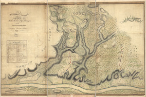
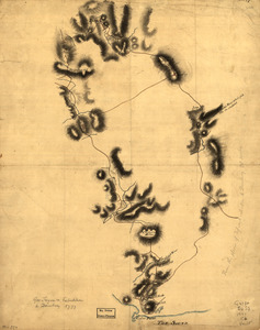
The encampment & position of the army under His Excy. Lt. Gl: Burgoyne : at Swords's and Freeman's Farms on Hudsons River near...
122.
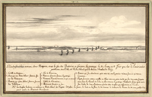
L'escadre françoise entrant dans Newport sous le feu des batteries et forcant le passage le 8 Aoust 1778 : jour que les...
123.
Esquisse du plan de la ville du Mole à St. Domingue
124.
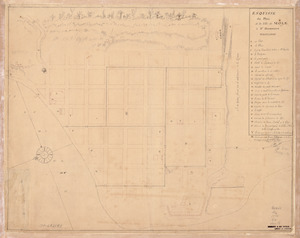
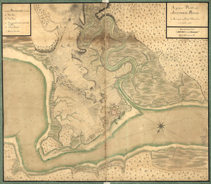
An exact-plan of George-Town : so named by Patrick Graham, Esqr., President of the Province of Georgia, in honr. to His Royal...
125.
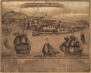
't Eÿland Curacao, anno 1800
126.
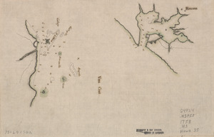
Fort Edward to Crown Point
127.
Fort La Fayette on Verplancks Point, with British and Hessian troop positions
128.
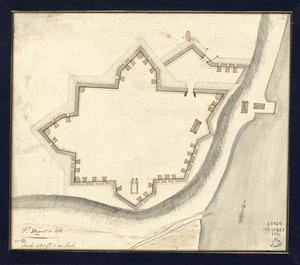
Fort Provost in 1782
129.
Fort Washington & vicinity
130.
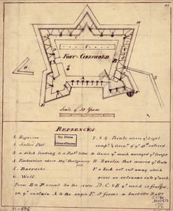
Fort-Griswold
131.
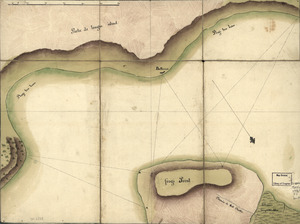
Frog's Point avec batteries de Partie de Longue Island
132.
From Battle of Brandywine
133.
Ft. Provost in 1781
134.
A general plan of Annapolis Royal
135.
Gov. Tryon's expedition to Danbury, 1777
136.
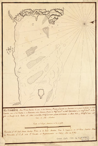
El Guarico, alias, el cavo Frances, es una de las colonias y puertos qe. poseen los Franceses en la parte occidental de la Ysla...
137.
Havana : Vera Cruz
138.
Indiana Fort Wayne : ms. map of Fort Wayne said to have been made on July 18, 1795, for General Anthony Wayne
139.
The Investiture of Charleston, S.C. by the English army, in 1780 : With the position of each corps
140.
Jefferson, Venango & Armstrong
‹ Prev
Next ›
1
2
3
4
5
6
7
8
9
10
11
…
25
26