Toggle navigation
LMEC Home
Exhibitions
Georeferencing
Tools for Teachers
Collections
My Favorites
Sign Up / Log In
Search
Search the map portal
Map Collection
Map Collection
Map Sets
Search
Search
Search for
Search In
All Fields
Creator
Title
Subject
Place
Search All Digital Collections
Advanced Search
513 Results
My Search
Start Over
More Like
commonwealth:q524nf16p
Remove constraint More Like: commonwealth:q524nf16p
Filter your Search
Place
North and Central America
452
United States
326
New York
41
District of Columbia
30
Washington
29
Florida
19
Canada
17
Alabama
15
more
Place
»
Topic
Manuscript maps--Early works to 1800
92
Washington (D.C.)--Maps
31
Manuscript maps
21
Gulf Coast (U.S.)--Maps, Manuscript--Early works to 1800
12
Fortification--New York (State)--New York--Maps--Early works to 1800
11
New York (N.Y.)--Buildings, structures, etc--Maps, Manuscript--Early works to 1800
9
New York (N.Y.)--Maps, Manuscript--Early works to 1800
8
Saratoga Campaign, N.Y., 1777--Maps, Manuscript--Early works to 1800
8
more
Topic
»
Date
Date range begin
–
Date range end
Current results range from
1700
to
1926
View distribution
Creator
Hills, John, (Surveyor)
18
Montrésor, John, 1736-1799
16
Bingham, William, 1752-1804
12
Adlum, John, 1759-1836
10
Washington, George, 1732-1799
9
Faden, William, 1749-1836
7
Morgan, Benjamin, (Draftsman)
7
Wangenheim, Friedrich Adam Julius von
7
more
Creator
»
Format
Maps/Atlases
511
Manuscripts
475
Objects/Artifacts
2
Georeferenced
Yes
13
No
500
Collection
American Revolutionary War-Era Maps
484
Library of Congress Collection
480
Maritime Charts and Atlases
30
Norman B. Leventhal Map & Education Center Collection
29
Urban Maps
19
William L. Clements Library Collection
2
MacLean Collection Map Library
1
New York Public Library Collection
1
Available to use
Creative Commons license
481
No known restrictions
29
Search Constraints
Sort by relevance
relevance
title
date (asc)
date (desc)
Number of results to display per page
20 per page
10
per page
20
per page
50
per page
100
per page
View results as:
grid view
map view
Search Results
261.
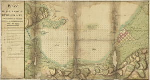
Plan du Petit Goâve et de son acul pour servir au projet général de sa défense par mer en 1752
262.
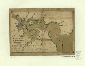
Plan du port de Portsmouth levé à vue
263.
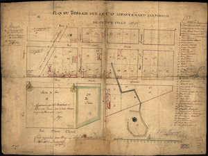
Plan du terrain sur le cap appartenant à la paroise de cette uille 1756
264.
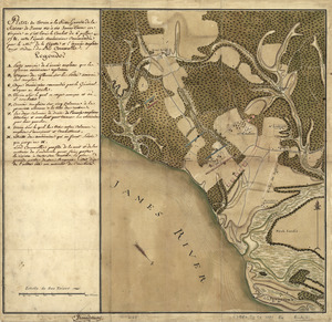
Plan du terrein à la rive gauche de la rivière de James vis-à-vis Jamestown en Virginie : ou s'est livré le combat du 6...
265.
Plan d'York en Virginie avec les attaques faites par les Armées françoise et américaine en 8bre. 1781
266.
Plan general des operations de l'Armée Britanique contre les rebelles dans l'Amerique : depuis l'arrivée des troupes...
267.
Plan, Lake Champlain from Fort St. John's to Ticonderoga : with the soundings, rocks, shoals, and sands, surveyed in the years...
268.
Plan of a rout undertaken in winter, Jany. 26th : from Quebec, the capital of Canada, to the frontier settlements of the...
269.
A plan of a survey made to explore the country for a road between Connecticut River & St. Francis
270.
A Plan of Albany, as it was in the year 1758
271.
A Plan of Cape Antonia
272.
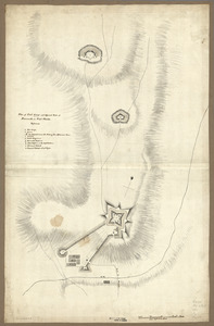
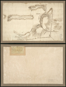
Plan of Carillon ou [sic] Ticonderoga : which was quitted by the Americaines in the night from the 5th to the 6th of July 1777
273.
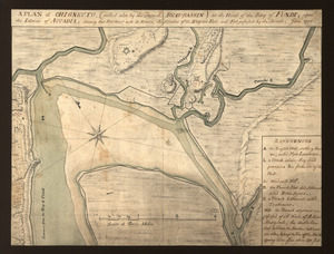
A plan of Chignecto (called also by the French Beau-Bassin) at the head of the Bay of Fundi upon the Istmus of Accadia shewing...
274.
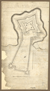
Plan of Fort George and adjacent works at Pensacola in West Florida
275.
Plan of Fort George at Pensacola
276.
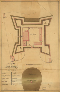
A plan of Fort George at the city of New-York
277.
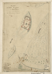
Plan of Fort Mifflin on Mud Island, with the batteries on Province Island
278.
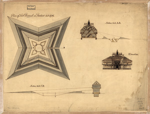
Plan of Fort Pownal at Penobscot built 1759
279.
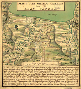
Plan of Fort William Henry and camp at Lake George
280.
Plan of Genl Du Portail : Plan of the position of Valley Forge after Jany. 1778
‹ Prev
Next ›
1
2
…
10
11
12
13
14
15
16
17
18
…
25
26


![Plan of Carillon ou [sic] Ticonderoga](https://bpldcassets.blob.core.windows.net/derivatives/images/commonwealth:q524nk513/image_thumbnail_300.jpg)