Toggle navigation
LMEC Home
Exhibitions
Georeferencing
Tools for Teachers
Collections
My Favorites
Sign Up / Log In
Search
Search the map portal
Map Collection
Map Collection
Map Sets
Search
Search
Search for
Search In
All Fields
Creator
Title
Subject
Place
Search All Digital Collections
Advanced Search
498 Results
My Search
Start Over
More Like
commonwealth:q524nb37t
Remove constraint More Like: commonwealth:q524nb37t
Filter your Search
Place
North and Central America
437
United States
311
New York
40
Philadelphia
26
Philadelphia (county)
26
Florida
19
Pennsylvania
18
Canada
17
more
Place
»
Topic
Manuscript maps--Early works to 1800
92
Manuscript maps
21
Philadelphia (Pa.)--Maps--Early works to 1800
21
Gulf Coast (U.S.)--Maps, Manuscript--Early works to 1800
12
Fortification--New York (State)--New York--Maps--Early works to 1800
11
New York (N.Y.)--Buildings, structures, etc--Maps, Manuscript--Early works to 1800
9
New York (N.Y.)--Maps, Manuscript--Early works to 1800
8
Saratoga Campaign, N.Y., 1777--Maps, Manuscript--Early works to 1800
8
more
Topic
»
Date
Date range begin
–
Date range end
Current results range from
1689
to
1899
View distribution
Creator
Hills, John, (Surveyor)
19
Montrésor, John, 1736-1799
16
Bingham, William, 1752-1804
12
Adlum, John, 1759-1836
10
Washington, George, 1732-1799
9
Faden, William, 1749-1836
8
Morgan, Benjamin, (Draftsman)
7
Wangenheim, Friedrich Adam Julius von
7
more
Creator
»
Format
Maps/Atlases
496
Manuscripts
476
Objects/Artifacts
2
Georeferenced
Yes
7
No
491
Collection
American Revolutionary War-Era Maps
496
Library of Congress Collection
480
Maritime Charts and Atlases
32
Urban Maps
19
Norman B. Leventhal Map & Education Center Collection
6
MacLean Collection Map Library
4
Richard H. Brown Revolutionary War Map Collection at Mount Vernon
4
New York Public Library Collection
3
more
Collection
»
Available to use
Creative Commons license
488
No known restrictions
6
Search Constraints
Sort by relevance
relevance
title
date (asc)
date (desc)
Number of results to display per page
20 per page
10
per page
20
per page
50
per page
100
per page
View results as:
grid view
map view
Search Results
301.
A plan of the attacks against Fort Miflin on Mud Island : which surrendered 16th, November 1777 to the Kings troops under the...
302.
Plan of the battle fought near Camden, August 16th, 1780
303.
A Plan of the Battle of Bunker Hill
304.
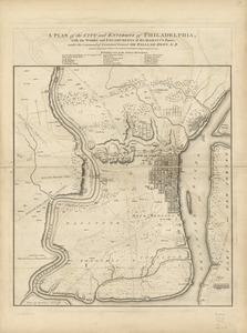
A plan of the city and environs of Philadelphia : with the works and encampments of His Majesty's forces under the command of...
305.
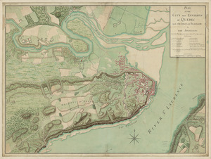
Plan of the city and environs of Quebec, with its siege and blockade by the Americans : from the 8th of December, 1775 to the...
306.
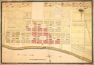
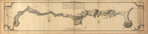
Plan of the city intended for the permanent seat of the government of t[he] United States : projected agreeable to the...
307.
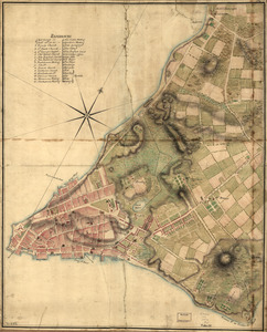
A Plan of the city of New York
308.
A plan of the city of Savannah : with a drawing of the part of the city burnt in the dreadful fires of the 26 November & 6...
309.
A plan of the coast of Gabarus Bay from the west end of Kennington Cove to White Point shewing the several batteries and...
310.
Plan of the country at and in the vicinity of Forts Lee and Independency, showing the position of the British Army
311.
A plan of the division line between the provinces of New-York and Quebec : In the 45th degree of north latitude. Survey'd in...
312.
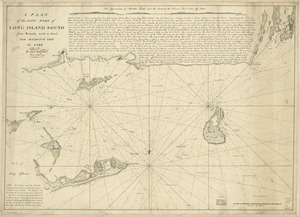
A plan of the east part of Long Island Sound : from remarks made on board His Majesty's ship the Lark, A.D. 1777
313.
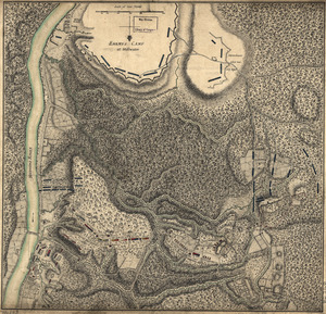
Plan of the encampment and position of the army under His Excelly. Lt. General Burgoyne : at Bræmus Heights on Hudson's River...
314.
Plan of the encampment and position of the army under His Excelly. Lt. General Burgoyne : at Swords House on Hudson's River on...
315.
A Plan of the entrance of Chesapeak [sic] Bay, with James and York Rivers : wherein are shewn the respective positions (in the...
316.
Plan of the fort and fortress at Crown Point with their environs : With the disposition of the English Army under the command...
317.
A plan of the Forts Montgomery & Clinton : as taken by His Majesty's forces under the command of Genl. Sr. Henry Clinton the...
318.
Plan of the French and rebells sieg[e] of Savannah in Georgia, in South [sic] America, deffend : t[h]rough the Br: Gen: August...
319.
A plan of the harbour of Cape Lookout surveyed and sounded by His Majesty's sloop Viper
320.
A plan of the harbour of Pensacola in West-Florida
‹ Prev
Next ›
1
2
…
12
13
14
15
16
17
18
19
20
…
24
25

![Plan of the city intended for the permanent seat of the government of t[he] United States](https://bpldcassets.blob.core.windows.net/derivatives/images/commonwealth:q524nf917/image_thumbnail_300.jpg)

![A Plan of the entrance of Chesapeak [sic] Bay, with James and York Rivers](https://bpldcassets.blob.core.windows.net/derivatives/images/commonwealth:q524nf233/image_thumbnail_300.jpg)
![Plan of the French and rebells sieg[e] of Savannah in Georgia, in South [sic] America, deffend](https://bpldcassets.blob.core.windows.net/derivatives/images/commonwealth:q524nc699/image_thumbnail_300.jpg)