Toggle navigation
LMEC Home
Exhibitions
Georeferencing
Tools for Teachers
Collections
My Favorites
Sign Up / Log In
Search
Search the map portal
Map Collection
Map Collection
Map Sets
Search
Search
Search for
Search In
All Fields
Creator
Title
Subject
Place
Search All Digital Collections
Advanced Search
498 Results
My Search
Start Over
More Like
commonwealth:q524n7707
Remove constraint More Like: commonwealth:q524n7707
Filter your Search
Place
North and Central America
434
United States
311
New York
40
Boston Harbor
20
Florida
19
Canada
17
Alabama
15
Chatham (county)
15
more
Place
»
Topic
Manuscript maps--Early works to 1800
95
Manuscript maps
21
Nautical charts--Massachusetts--Boston Harbor--Early works to 1800
16
Gulf Coast (U.S.)--Maps, Manuscript--Early works to 1800
12
Boston Harbor (Mass.)--Maps--Early works to 1800
11
Fortification--New York (State)--New York--Maps--Early works to 1800
11
Nautical charts--Massachusetts--Boston Bay--Early works to 1800
9
New York (N.Y.)--Buildings, structures, etc--Maps, Manuscript--Early works to 1800
9
more
Topic
»
Date
Date range begin
–
Date range end
Current results range from
1688
to
1899
View distribution
Creator
Hills, John, (Surveyor)
18
Montrésor, John, 1736-1799
16
Bingham, William, 1752-1804
12
Adlum, John, 1759-1836
10
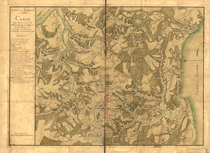
Washington, George, 1732-1799
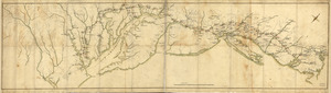
9
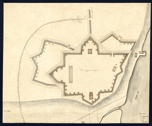
Faden, William, 1749-1836
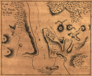
7
Morgan, Benjamin, (Draftsman)
7
Wangenheim, Friedrich Adam Julius von
7
more
Creator
»
Format
Maps/Atlases
496
Manuscripts
479
Objects/Artifacts
2
Georeferenced
Yes
8
No
490
Collection
American Revolutionary War-Era Maps
494
Library of Congress Collection
483
Maritime Charts and Atlases
44
Urban Maps
15
Norman B. Leventhal Map Center Collection
14
Boston and New England Maps
13
Mapping Boston Collection
7
Richard H. Brown Revolutionary War Map Collection at Mount Vernon
1
Available to use
Creative Commons license
491
No known restrictions
7
Search Constraints
Sort by date (desc)
relevance
title
date (asc)
date (desc)
Number of results to display per page
20 per page
10
per page
20
per page
50
per page
100
per page
View results as:
grid view
map view
Search Results
81.
Plano de la Bahía de Ocoa situado en la banda del sur de la Ysla Española
82.
Pto. Rico
83.
El Guarico, alias, el cavo Frances, es una de las colonias y puertos qe. poseen los Franceses en la parte occidental de la Ysla...
84.
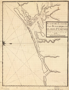
Plano del Lago de San Bernardo en el Seno Mexicano
85.
Plano del puertecito de la Chorrera cituado una legua al O. de la Havana
86.
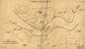
Sketch of West Point
87.
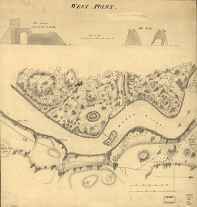
West Point
88.
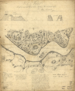
West Point : surveyed a coup d'oeil the 24th October, laid down the 27th October 1783
89.
Armée de Rochambeau, 1782 : Carte des environs de Williamsburg en Virginie où les armées françoise et américaine ont...
90.
Côte de York-town à Boston: Marches de l'armée
91.
Fort Provost in 1782
92.
Plan de West-Pointe du nord levé a vue
93.
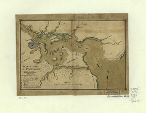
Plan du port de Portsmouth levé à vue
94.
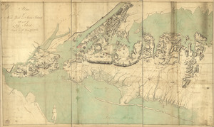
Plan of New York and Staten Islands with part of Long Island, survey'd in the years 1781, & 82
95.
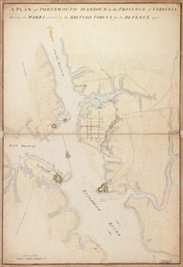
A plan of Portsmouth Harbour in the province of Virginia : shewing the works erected by the British forces for its defence, 1781
96.
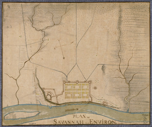
Plan of Savannah & its environs in 1782
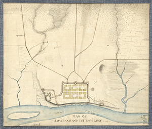
97.
Plan of Savannah and its environs in 1782
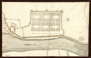
98.
Plan of Savannah and its fortifications in 1782
99.
Plan of the attack of Fort Clinton and Montgomery which where [sic] stormed by His Majesty's forces : under the command of Sr....
100.
Plano de la bahia de Pansacola
‹ Prev
Next ›
1
2
3
4
5
6
7
8
9
…
24
25

![Plan of the attack of Fort Clinton and Montgomery which where [sic] stormed by His Majesty's forces](https://bpldcassets.blob.core.windows.net/derivatives/images/commonwealth:q524nj90k/image_thumbnail_300.jpg)