Toggle navigation
LMEC Home
Exhibitions
Georeferencing
Tools for Teachers
Collections
My Favorites
Sign Up / Log In
Search
Search the map portal
Map Collection
Map Collection
Map Sets
Search
Search
Search for
Search In
All Fields
Creator
Title
Subject
Place
Search All Digital Collections
Advanced Search
8688 Results
My Search
Start Over
More Like
commonwealth:q524n306c
Remove constraint More Like: commonwealth:q524n306c
Filter your Search
Place
North and Central America
5,919
United States
4,843
Massachusetts
2,067
Europe
1,392
Suffolk (county)
1,040
Boston
1,013
Canada
463
Asia
437
more
Place
»
Topic
Boston (Mass.)--Maps
582
United States--Maps
321
Real property--Massachusetts--Boston--Maps
175
Massachusetts--Maps
161
Landowners--Massachusetts--Boston--Maps
133
North America--Maps--Early works to 1800
103
New England--Maps
101
Europe--Maps
79
more
Topic
»
Date
Date range begin
–
Date range end
Current results range from
1482
to
2023
View distribution
Creator
United States. Hydrographic Office
595
O.H. Bailey & Co
148
Des Barres, Joseph F. W. (Joseph Frederick Wallet), 1722-1824
123
United States. Post Office Dept
120
Ptolemy, 2nd cent
100
Walling, Henry Francis, 1825-1888
94
Geological Survey (U.S.)
87
Jefferys, Thomas, -1771
85
more
Creator
»
Format
Maps/Atlases
8,629
Manuscripts
215
Prints
56
Books
36
Objects/Artifacts
10
Drawings/Illustrations
8
Posters
4
Georeferenced
Yes
870
No
7,818
Collection
Norman B. Leventhal Map & Education Center Collection
8,651
Boston and New England Maps
2,221
Urban Maps
1,992
Maritime Charts and Atlases
1,083
American Revolutionary War-Era Maps
650
Boston Redevelopment Authority Collection
87
American Antiquarian Society Collection
20
William L. Clements Library Collection
13
more
Collection
»
Available to use
No known restrictions
8,508
Creative Commons license
50
Search Constraints
Sort by relevance
relevance
title
date (asc)
date (desc)
Number of results to display per page
20 per page
10
per page
20
per page
50
per page
100
per page
View results as:
grid view
map view
Search Results
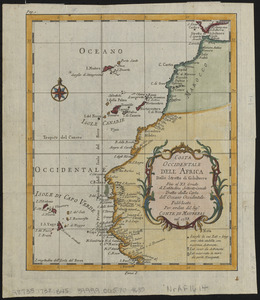
2081.
Costa occidentale dell' Africa dallo Stretto di Gibilterra fino al XI grado di latitudine settentrionale tratta dalla carta...
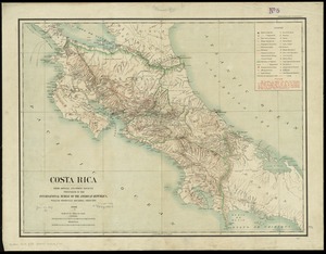
2082.
Costa Rica : from official and other sources
2083.
Coste occidentale d'Afrique, depuis le Détroit de Gibraltar jusqu' au XIe dégré de latitude septentrionale : tirée de la...
2084.
Les costes aux environs de la Riviere de Misisipi : decouvertes par Mr. de la Salle en 1683 et reconnues par Mr. le Chevallier...
2085.
Cottage City, Martha's Vineyard, Mass
2086.
The cotton kingdom
2087.
The counti of Warwick the shire towne and citie of Coventre described
2088.
The counties of Southern California
2089.
The countries of the Caribbean : including Mexico, Central America, the West Indies and the Panama Canal
2090.
The country around Herat : projected from Major Holditch's map
2091.
The country of So red the rose, by Stark Young, Scribners
2092.
The country round Washington : the Chesapeake and the Potomac
2093.
County atlas of Berkshire Massachusetts
2094.
County atlas of Hampshire, Massachusetts : from actual surveys
2095.
County atlas of Middlesex, Massachusetts : from actual surveys
2096.
County map of Boone, McHenry, Lake, De Kalb, Kane, Du Page, Cook, Kendall, Grundy, Will, and Kankakee
2097.
The County of Essex from actual survey
2098.
The County of Kerry
2099.
County of Ohio, West Virginia
2100.
Course of canal to Charlestown Millpond
‹ Prev
Next ›
1
2
…
101
102
103
104
105
106
107
108
109
…
434
435