Toggle navigation
LMEC Home
Exhibitions
Georeferencing
Tools for Teachers
Collections
My Favorites
Sign Up / Log In
Search
Search the map portal
Map Collection
Map Collection
Map Sets
Search
Search
Search for
Search In
All Fields
Creator
Title
Subject
Place
Search All Digital Collections
Advanced Search
311 Results
My Search
Start Over
More Like
commonwealth:q524mv577
Remove constraint More Like: commonwealth:q524mv577
Filter your Search
Place
North and Central America
241
United States
166
New York
32
Suffolk (county)
32
Boston
30
Canada
28
North America
27
Barbados
11
more
Place
»
Topic
North America--Maps--Early works to 1800
18
Boston (Mass.)--History--Revolution, 1775-1783--Maps--Early works to 1800
16
Barbados--Maps--Early works to 1800
11
Vues d'optique
10
Gibraltar--History--Siege, 1779-1783--Maps--Early works to 1800
9
New York (N.Y.)--Pictorial works--Early works to 1800
9
United States--History--French and Indian War, 1754-1763--Maps--Early works to 1800
9
United States--Maps--Early works to 1800
9
more
Topic
»
Date
Date range begin
–
Date range end
Current results range from
1656
to
1799
View distribution
Creator
Faden, William, 1749-1836
33
Jefferys, Thomas, -1771
32
Le Rouge, Georges-Louis
23
Sayer, Robert, 1725-1794
22
Des Barres, Joseph F. W. (Joseph Frederick Wallet), 1722-1824
21
Korn, Christoph Heinrich, 1726-1783
11
Raspe, Gabriel Nicolaus, 1712-1785
11
Simcoe, John Graves, 1752-1806
10
more
Creator
»
Format
Maps/Atlases
268
Prints
32
Manuscripts
24
Drawings/Illustrations
9
Books
2
Georeferenced
Yes
14
No
297
Collection
American Revolutionary War-Era Maps
302
Richard H. Brown Revolutionary War Map Collection at Mount Vernon
293
Norman B. Leventhal Map & Education Center Collection
17
Maritime Charts and Atlases
5
Boston and New England Maps
4
Urban Maps
2
Newberry Library Collection
1
Available to use
Creative Commons license
293
No known restrictions
17
Search Constraints
Sort by relevance
relevance
title
date (asc)
date (desc)
Number of results to display per page
20 per page
10
per page
20
per page
50
per page
100
per page
View results as:
grid view
map view
Search Results
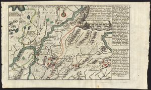
181.
Plan der gegend des Ohio Flusses, wo ohnweit da von am 9 July 1755, zwischen denen Franzofichen u. Engl trouppen ein hiziges...
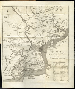
182.
Plan der gegend und stadt von Philadelphia
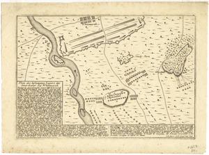
183.
Plan des befestigten lagers der Amerikaner bey Whitemarsh
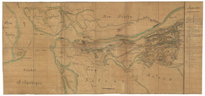
184.
Plan des environs de New York (manuscrit) - Position du camp de l'armée combinée à Philippsburg du 6 juillet au 19 août -...
185.
Plan des jenigen treffen welches am 8. Sept 1755. zwischen dem Engl. Gen. Johnson, und dem Franz. Gen. Diesckau welcher dabey...
186.
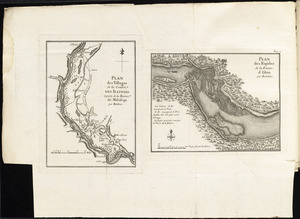
Plan des villages de la contrée des Illinois et partie de la Riviere de Mississipi ; plan des Rapides de la Riviere d'Ohio
187.
Plan du fort et ville de Louisbourg dans l'Isle Roale
188.
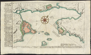
Plan du Havre et de la barre de Ste. Marie par les Angloises appellée Amélia, ainsi que de la Barre dans la Floride orientale
189.
Plan du port et de la ville de Louisbourg en l'Isle Royale, et des attaques faites par les Anglois pendant le siége dépuis le...
190.
A plan of Boston, and its environs : shewing the true situation of His Majesty's army, and also those of the rebels
191.
A plan of Boston in New England with its environs : including Milton, Dorchester, Roxbury, Brooklin, Cambridge, Medford,...
192.
Plan of Fort le Quesne, built by the French at the fork of the Ohio and Monongahela in 1754
193.
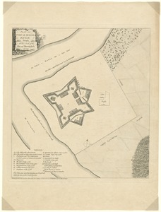
A plan of Fort Montgomery & Fort Clinton, taken by His Majesty's forces, under the command of Maj. Genl. Sir Henry Clinton, K:B
194.
A plan of New York Island, and part of Long Island, with the circumjacent country, as far as Dobbs's Ferry to the north, and...
195.
A plan of New York Island, with part of Long Island, Staten Island & east New Jersey, with a particular description of the...
196.
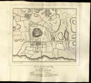
Plan of Oyster Bay, as fortified by the Queen's Rangers
197.
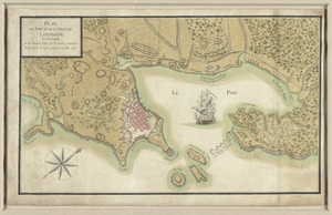
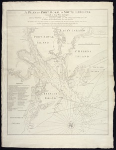
A plan of Port Royal in South Carolina
198.
A plan of the action at Bunkers Hill, on the 17th. of June, 1775 : between His Majesty's troops under the command of Major...
199.
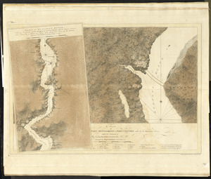
Plan of the action at Huberton under Brigadier Genl. Frazer, supported by Major Genl. Reidesel, on the 7th July 1777
200.
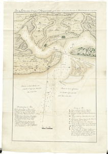
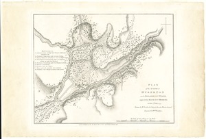
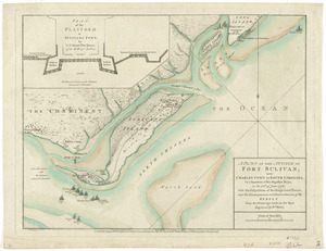
A plan of the attack of Fort Sulivan, near Charles Town in South Carolina : by a squadron of His Majesty's ships, on the 28th...
‹ Prev
Next ›
1
2
…
6
7
8
9
10
11
12
13
14
15
16