Toggle navigation
LMEC Home
Exhibitions
Georeferencing
Tools for Teachers
Collections
My Favorites
Sign Up / Log In
Search
Search the map portal
Map Collection
Map Collection
Map Sets
Search
Search
Search for
Search In
All Fields
Creator
Title
Subject
Place
Search All Digital Collections
Advanced Search
370 Results
My Search
Start Over
More Like
commonwealth:q524mv470
Remove constraint More Like: commonwealth:q524mv470
Filter your Search
Place
North and Central America
303
United States
232
Pennsylvania
40
New York
37
Virginia
37
Canada
31
North America
31
Suffolk (county)
31
more
Place
»
Topic
Virginia--Maps--Early works to 1800
38
Pennsylvania--Maps--Early works to 1800
37
North America--Maps--Early works to 1800
23
Maryland--Maps--Early works to 1800
22
United States--History--French and Indian War, 1754-1763--Maps--Early works to 1800
17
Boston (Mass.)--History--Revolution, 1775-1783--Maps--Early works to 1800
16
New Jersey--Maps--Early works to 1800
12
Middle Atlantic States--Maps--Early works to 1800
10
more
Topic
»
Date
Date range begin
–
Date range end
Current results range from
1590
to
1799
View distribution
Creator
Jefferys, Thomas, -1771
37
Faden, William, 1749-1836
34
Sayer, Robert, 1725-1794
24
Le Rouge, Georges-Louis
23
Des Barres, Joseph F. W. (Joseph Frederick Wallet), 1722-1824
22
Korn, Christoph Heinrich, 1726-1783
11
Raspe, Gabriel Nicolaus, 1712-1785
11
Robert Sayer and John Bennett (Firm)
10
more
Creator
»
Format
Maps/Atlases
327
Prints
32
Manuscripts
25
Drawings/Illustrations
9
Books
2
Georeferenced
Yes
16
No
354
Collection
American Revolutionary War-Era Maps
352
Richard H. Brown Revolutionary War Map Collection at Mount Vernon
293
Norman B. Leventhal Map & Education Center Collection
42
MacLean Collection Map Library
18
New York Public Library Collection
8
Maritime Charts and Atlases
5
Boston and New England Maps
4
British Library Collection
3
more
Collection
»
Available to use
Creative Commons license
306
No known restrictions
44
Search Constraints
Sort by relevance
relevance
title
date (asc)
date (desc)
Number of results to display per page
20 per page
10
per page
20
per page
50
per page
100
per page
View results as:
grid view
map view
Search Results
341.
[The burnt ruins of Charlestown from across the Charles River]
342.
[The coasts, rivers and inlets of the province of Georgia]
343.
Théatre de la guerre en Amerique, avec les Isles Antilles : projetté et assujettie aux observations
344.
The theatre of war in North America, with the roads and a table of the distances
345.
Theatrum belli in America Septentrionali
346.
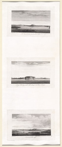
[Three views of South Carolina]
347.
To His Excellency Genl. Washington, Commander in Chief of the armies of the United States of America : this plan of the...
348.
To His Excellency Sr. Henry Moore, Bart., captain general and governour in chief in & over the province of New York & the...
349.
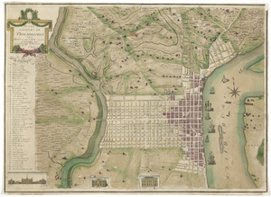
To the citizens of Philadelphia this plan of the city and its environs : is respectfully dedicated by the editors
350.
To the Hone. Jno. Hancock, Esqre. president of ye Continental Congress, this map of the seat of civil war in America, is...
351.
To the right honourable, the Earl of Shelbourne, His Majesty's principal Secretary of State for the Southern Department : this...
352.
To the rt. honble. the Earl of Halifax, first lord commissioner of trade & plantations, &c &c this chart of Chibucto Harbour,...
353.
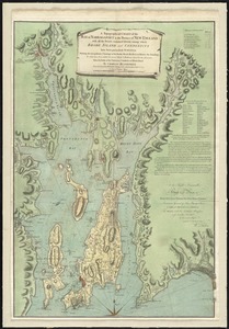
A topographical chart of the bay of Narraganset in the province of New England : with all the isles contained therein, among...
354.
A topographical map of the northn. part of New York Island, exhibiting the plan of Fort Washington, now Fort Knyphausen, with...
355.
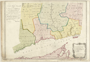
A topographical map of the Province of New Hampshire
356.
[Troops on parade, the Charles River and Castle Island]
357.
The United States of America laid down from the best authorities, agreeable to the Peace of 1783
358.
The United States of America with the British possessions of Canada, Nova Scotia, & of Newfoundland, divided with the French :...
359.
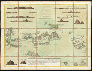
Les Vierges, levées par les Anglais, et par les Dannois : traduit de l'Anglais
360.
A view of Boston from Dorchester neck : Long Island open on the north side of Nicks Mate Island ; Boston from Willis Creek
‹ Prev
Next ›
1
2
…
14
15
16
17
18
19
![[The burnt ruins of Charlestown from across the Charles River]](https://bpldcassets.blob.core.windows.net/derivatives/images/commonwealth:dz010v71m/image_thumbnail_300.jpg)
![[The coasts, rivers and inlets of the province of Georgia]](https://bpldcassets.blob.core.windows.net/derivatives/images/commonwealth:z603vv37x/image_thumbnail_300.jpg)


![[Three views of South Carolina]](https://bpldcassets.blob.core.windows.net/derivatives/images/commonwealth:dz010v13q/image_thumbnail_300.jpg)

![[Troops on parade, the Charles River and Castle Island]](https://bpldcassets.blob.core.windows.net/derivatives/images/commonwealth:dz010v69k/image_thumbnail_300.jpg)