Toggle navigation
LMEC Home
Exhibitions
Georeferencing
Tools for Teachers
Collections
My Favorites
Sign Up / Log In
Search
Search the map portal
Map Collection
Map Collection
Map Sets
Search
Search
Search for
Search In
All Fields
Creator
Title
Subject
Place
Search All Digital Collections
Advanced Search
9047 Results
My Search
Start Over
More Like
commonwealth:q237m946q
Remove constraint More Like: commonwealth:q237m946q
Filter your Search
Place
North and Central America
6,278
United States
5,196
Massachusetts
2,150
Suffolk (county)
1,398
Europe
1,396
Boston
1,371
Canada
449
Asia
438
more
Place
»
Topic
Boston (Mass.)--Maps
676
City planning--Massachusetts--Boston--Maps
418
United States--Maps
282
Urban renewal--Massachusetts--Boston--Maps
253
Real property--Massachusetts--Boston--Maps
216
Massachusetts--Maps
162
Landowners--Massachusetts--Boston--Maps
135
North America--Maps--Early works to 1800
103
more
Topic
»
Date
Date range begin
–
Date range end
Current results range from
1482
to
2023
View distribution
Creator
United States. Hydrographic Office
595
Boston Redevelopment Authority
391
O.H. Bailey & Co
148
Des Barres, Joseph F. W. (Joseph Frederick Wallet), 1722-1824
123
United States. Post Office Dept
120
Ptolemy, 2nd cent
100
Walling, Henry Francis, 1825-1888
94
Geological Survey (U.S.)
86
more
Creator
»
Format
Maps/Atlases
8,987
Manuscripts
215
Prints
56
Books
36
Objects/Artifacts
10
Drawings/Illustrations
8
Posters
5
Georeferenced
Yes
869
No
8,178
Collection
Norman B. Leventhal Map & Education Center Collection
8,694
Boston and New England Maps
2,585
Urban Maps
2,373
Maritime Charts and Atlases
1,083
American Revolutionary War-Era Maps
616
Boston Redevelopment Authority Collection
439
Available to use
No known restrictions
8,905
Creative Commons license
47
Search Constraints
Sort by relevance
relevance
title
date (asc)
date (desc)
Number of results to display per page
20 per page
10
per page
20
per page
50
per page
100
per page
View results as:
grid view
map view
Search Results
261.
Mattapan project : property map
262.
Mattapan project : proposed zoning under proposed code
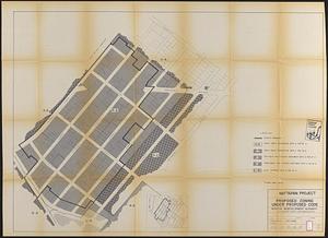
263.
Mattapan project : right-of-way adjustment plan
264.
Mattapan project : land use and disposition plan
265.
Mattapan project : existing zoning under proposed code
266.
Mattapan project : existing land use
267.
Mattapan project : proposed zoning
268.
Mattapan project : existing zoning
269.
McConnell Park
270.
McConnell Park Dorchester : site plan
271.
Metropolitan District Commission combined sewer overflow project Dorchester Bay area
272.
Midtown area plan for the public realm
273.
Midtown improvement area
274.
NASA Electronic Research Center : evaluation of proposed sites in Boston
275.
North Harvard project area : location map
276.
North Harvard project area : land use of project area
277.
North Harvard project area : conditions in project area
278.
North Harvard project area : locality map
279.
Open space management program index map
280.
Parcel 10 : Sears Crescent, Government Center
‹ Prev
Next ›
1
2
…
10
11
12
13
14
15
16
17
18
…
452
453