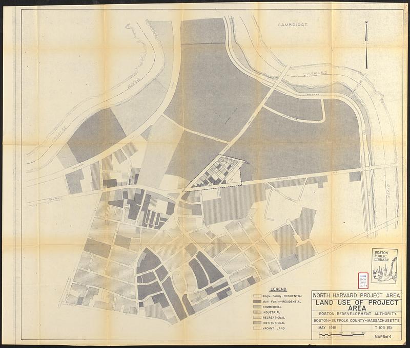
North Harvard project area : land use of project area
Item Information
- Title:
- North Harvard project area : land use of project area
- Cartographer:
- Boston Redevelopment Authority
- Name on Item:
-
Boston Redevelopment Authority
- Date:
-
May 1961
- Format:
-
Maps/Atlases
- Location:
-
Boston Public Library
Central Library in Copley Square - Collection (local):
-
Boston Public Library Collection
- Subjects:
-
Allston (Boston, Mass.)--Maps
City planning--Massachusetts--Boston--Maps
Urban renewal--Massachusetts--Boston--Maps
Land use--Massachusetts--Boston--Maps
- Places:
-
Suffolk (county)BostonAllston
- Extent:
- 1 map ; 76 x 87 cm
- Terms of Use:
-
No known copyright restrictions.
No known restrictions on use.
- Publisher:
-
Boston :
Boston Redevelopment Authority
- Language:
-
English
- Notes:
-
Part of a set of 4 maps concerning proposed urban renewal projects in the North Harvard area of Boston's Allston / Brighton neighborhood.
Indicates residential, commercial, industrial, recreational, institutional and vacant land.
- Identifier:
-
06_01_017336c
- Call #:
-
BRA/280 map 3
- Barcode:
-
39999063523268


