Toggle navigation
LMEC Home
Exhibitions
Georeferencing
Tools for Teachers
Collections
My Favorites
Sign Up / Log In
Search
Search the map portal
Map Collection
Map Collection
Map Sets
Search
Search
Search for
Search In
All Fields
Creator
Title
Subject
Place
Search All Digital Collections
Advanced Search
419 Results
My Search
Start Over
More Like
commonwealth:p8418t63d
Remove constraint More Like: commonwealth:p8418t63d
Filter your Search
Place
North and Central America
412
United States
368
New York
91
Virginia
70
New Jersey
52
York (county)
33
Yorktown
33
South Carolina
31
more
Place
»
Topic
United States--History--Revolution, 1775-1783--Maps
330
Virginia--Maps--Early works to 1800
38
Newport (R.I.)--Maps
24
Yorktown (Va.)--History--Siege, 1781--Maps--Early works to 1800
19
Maryland--Maps--Early works to 1800
18
Charleston (S.C.)--Maps
16
Hudson River (N.Y. and N.J.)--Maps
15
New Jersey--Maps
14
more
Topic
»
Date
Date range begin
–
Date range end
Current results range from
1590
to
1881
View distribution
Creator
Clinton, Henry, Sir, 1738?-1795
17
Hills, John, active 1777-1819
13
André, John, 1751-1780
11
Faden, William, 1749-1836
11
Montrésor, John, 1736-1799
10
Fage, Edward
9
Castries, Charles Eugène Gabriel de La Croix, marquis de, 1727-1801
8
D'Ethy, captain
8
more
Creator
»
Format
Maps/Atlases
413
Manuscripts
20
Drawings/Illustrations
5
Prints
1
Georeferenced
Yes
6
No
413
Collection
American Revolutionary War-Era Maps
396
William L. Clements Library Collection
305
Norman B. Leventhal Map & Education Center Collection
35
New-York Historical Society Collection
24
Richard H. Brown Revolutionary War Map Collection at Mount Vernon
15
MacLean Collection Map Library
9
Maps from AAS
7
Maritime Charts and Atlases
6
more
Collection
»
Available to use
No known restrictions
58
Creative Commons license
35
Search Constraints
Sort by relevance
relevance
title
date (asc)
date (desc)
Number of results to display per page
20 per page
10
per page
20
per page
50
per page
100
per page
View results as:
grid view
map view
Search Results
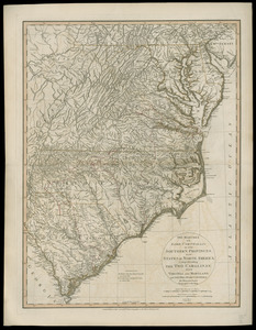
161.
The marches of Lord Cornwallis in the Southern Provinces, now states of North America : comprehending the two Carolinas, with...
162.
Monmouth County, New Jersey
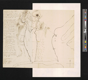
163.
Moore's sketch of the navigation of the Highlands
164.
Narragansett Bay and Rhode Island
165.
A new and correct plan of the town of Boston
166.
The New York campaign of 1776
167.
The New York campaign of 1776
168.
Newark Bay and its immediate vicinity
169.
Newark, New Jersey
170.
Newport and its environs, ca. 1778
171.
Newport County, ca. 1779
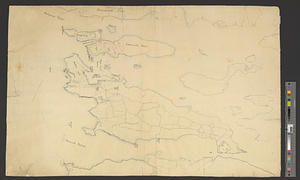
172.
Northern New Jersey
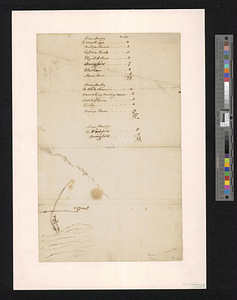
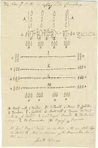
173.
The order of battle in crossing Lake Champlane
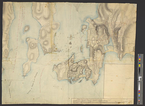
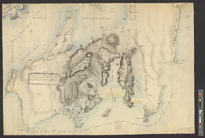
174.
Original plan of Brentons Neck; and all the ground to the southward of the town of New-port Rhode Island, 1779
175.
Part of modern Brunswick County
176.
Part of modern Brunswick County
177.
Part of modern Charleston County
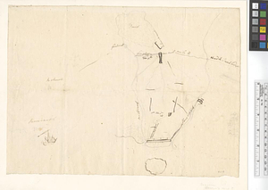
178.
Part of modern Monmouth County, 1778
179.
Part of modern Westchester County
180.
Part of modern Westchester County
‹ Prev
Next ›
1
2
…
5
6
7
8
9
10
11
12
13
…
20
21