Toggle navigation
LMEC Home
Exhibitions
Georeferencing
Tools for Teachers
Collections
My Favorites
Sign Up / Log In
Search
Search the map portal
Map Collection
Map Collection
Map Sets
Search
Search
Search for
Search In
All Fields
Creator
Title
Subject
Place
Search All Digital Collections
Advanced Search
280 Results
My Search
Start Over
More Like
commonwealth:p8418t45g
Remove constraint More Like: commonwealth:p8418t45g
Filter your Search
Place
North America
170
North and Central America
94
United States
91
Canada
42
New France
14
New England
12
New York
11
South America
8
more
Place
»
Topic
North America--Maps--Early works to 1800
180
United States--Maps--Early works to 1800
60
Canada--Maps--Early works to 1800
41
Great Britain--Colonies--America--Maps--Early works to 1800
18
United States--History--Revolution, 1775-1783--Maps--Early works to 1800
15
New England--Maps--Early works to 1800
12
British--America--Maps--Early works to 1800
10
Indians of North America--Maps--Early works to 1800
9
more
Topic
»
Date
Date range begin
–
Date range end
Current results range from
1528
to
1850
View distribution
Creator
Jefferys, Thomas, -1771
15
Bellin, Jacques Nicolas, 1703-1772
14
Mitchell, John, 1711-1768
13
Sayer, Robert, 1725-1794
13
Moll, Herman, d. 1732
11
Anville, Jean Baptiste Bourguignon d', 1697-1782
9
Faden, William, 1749-1836
7
L'Isle, Guillaume de, 1675-1726
7
more
Creator
»
Format
Maps/Atlases
280
Manuscripts
14
Georeferenced
Yes
7
No
273
Collection
American Revolutionary War-Era Maps
201
Norman B. Leventhal Map Center Collection
148
New York Public Library Collection
46
Richard H. Brown Revolutionary War Map Collection at Mount Vernon
31
New-York Historical Society Collection
24
Mapping Boston Collection
11
Sidney R. Knafel Map Collection at Phillips Academy
9
Library and Archives Canada Collection
8
more
Collection
»
Available to use
No known restrictions
161
Creative Commons license
96
Search Constraints
Sort by relevance
relevance
title
date (asc)
date (desc)
Number of results to display per page
20 per page
10
per page
20
per page
50
per page
100
per page
View results as:
grid view
map view
Search Results
41.
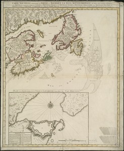
Carte nouvelle contenant la partie d'Amerique la plus septentrionale, ou sont exactement dêcrites les provinces suivantes...
42.
Cours du fleuve St. Laurent : deuxieme feuille : depuis Quebec jusqu'au havre des Papinachouas
43.
Cours du fleuve St. Laurent : premiere feuille : contenant depuis le Lac Ontario jusqu'a Quebec
44.
Cours du fleuve St. Laurent : troisieme feuille : depuis le mont Camille jusqu'a l'isle d'Anticosti
45.
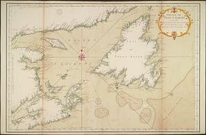
Golphe de Saint Laurent, contenant l'Isle de Terreneuve, Detroit de Belle-Isle, entrée du Fleuve St. Laurent, Isle Royale, et...
46.
A map of part of Canada for the use of His Majesty's Secretary of State, compiled in the Surveyor Generals Office, pursuant to...
47.
A new chart of the coast of New England, Nova Scotia, New France or Canada, with the islands of Newfoundld. Cape Breton St....
48.
A new map of Nova Scotia and Cape Breton Island : with the adjacent parts of New England and Canada composed from a great...
49.
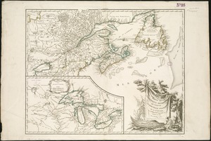
Partie de l'Amérique septent? qui comprend la Nouvelle France ou le Canada
50.
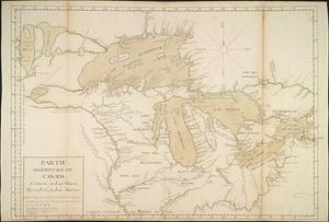
Partie occidentale du Canada contenant les lacs Ontario, Huron, Erié, et Lac Superieur
51.
Partie orientale de la Nouvelle France ou du Canada : avec l'isle de Terre-Neuve et de Nouvelle Escosse, Acadie et Nouv....
52.
Partie orientale de la Nouvelle France ou du Canada
53.
Partie orientale de la Nouvelle France ou du Canada
54.
Partie orientale du Canada, avec la Nouvelle Angleterre, l'Acadie, et la Terre-Neuve
55.
Paskaerte Zÿnde de Noordelijckfte Zeekuften van America van Groenland door de Straet Davis en de Straet Hudson tot Terra Neuf
56.
Théatre de la guerre en Amerique, avec les Isles Antilles : projetté et assujettie aux observations
57.
Théatre de la guerre en Amerique, avec les Isles Antilles : projetté et assujettie aux observations
58.
Théatre de la guerre en Amerique, avec les Isles Antilles : projetté et assujettie aux observations
59.
An accurate map of the English colonies in North America, bordering on the river Ohio
60.
An accurate map of the United States of America : according to the Treaty of Peace of 1783
‹ Prev
Next ›
1
2
3
4
5
6
7
…
13
14