Toggle navigation
LMEC Home
Exhibitions
Georeferencing
Tools for Teachers
Collections
My Favorites
Sign Up / Log In
Search
Search the map portal
Map Collection
Map Collection
Map Sets
Search
Search
Search for
Search In
All Fields
Creator
Title
Subject
Place
Search All Digital Collections
Advanced Search
8928 Results
My Search
Start Over
More Like
commonwealth:m900r839w
Remove constraint More Like: commonwealth:m900r839w
Filter your Search
Place
North and Central America
6,159
United States
5,075
Massachusetts
2,140
Europe
1,396
Suffolk (county)
1,274
Boston
1,247
Canada
449
Asia
438
more
Place
»
Topic
Boston (Mass.)--Maps
753
United States--Maps
282
Real property--Massachusetts--Boston--Maps
254
City planning--Massachusetts--Boston--Maps
192
Landowners--Massachusetts--Boston--Maps
170
Massachusetts--Maps
166
New England--Maps
104
North America--Maps--Early works to 1800
103
more
Topic
»
Date
Date range begin
–
Date range end
Current results range from
1482
to
2023
View distribution
Creator
United States. Hydrographic Office
595
Boston Redevelopment Authority
194
O.H. Bailey & Co
148
Des Barres, Joseph F. W. (Joseph Frederick Wallet), 1722-1824
124
United States. Post Office Dept
120
Ptolemy, 2nd cent
100
Walling, Henry Francis, 1825-1888
94
Geological Survey (U.S.)
87
more
Creator
»
Format
Maps/Atlases
8,868
Manuscripts
215
Prints
56
Books
36
Objects/Artifacts
10
Drawings/Illustrations
8
Posters
5
Georeferenced
Yes
885
No
8,043
Collection
Norman B. Leventhal Map & Education Center Collection
8,726
Boston and New England Maps
2,398
Urban Maps
2,181
Maritime Charts and Atlases
1,083
American Revolutionary War-Era Maps
638
Boston Redevelopment Authority Collection
229
Massachusetts Real Estate Atlases
38
Mapping Boston Collection
20
more
Collection
»
Available to use
No known restrictions
8,705
Creative Commons license
70
Search Constraints
Sort by relevance
relevance
title
date (asc)
date (desc)
Number of results to display per page
20 per page
10
per page
20
per page
50
per page
100
per page
View results as:
grid view
map view
Search Results
2601.
Cruchley's map of Central Europe, shewing the new political divisions : also all the railways, &c.
2602.
Cruchley's new plan of London shewing all the new and intended improvements to the present time
2603.
Cruchley's new plan of London shewing all the new and intended improvements to the present time
2604.
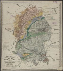
Cruchley's railway & telegraphic map of Wiltshire : showing all the railways & names of stations, also the telegraph lines &...
2605.
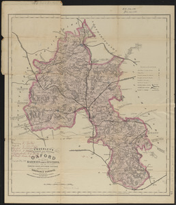
Cruchley's railway and station map of Oxford : showing all the railways & names of stations, also the turnpike roads,...
2606.
Cruchley's travelling railway map of England & Wales
2607.
Cruchley's visitors' map of the environs of Norwich, from the Ordnance Survey
2608.
Cuatreros
2609.
Cuba en Iamaica : soo als die door Kolumbus ontdekt, en by de Kastilianen bevolkt sijn = Iles de Cuba et de la Jamaique : ainsi...
2610.
Cuba Insula ; Hispaniola Insula
2611.
Cuba, south coast, approaches to Ports Casilda and Masio with the adjacent anchorages : from a Spanish government chart of 1879
2612.
Culiacanae, Americae regionis, descriptio : Hispaniolae, Cubae, aliarumque insularum circumiacientium, delineatio
2613.
Cumbria & Westmoria : vulgo Cumberland & Westmorland
2614.
Cummings' map of Columbia and Montour counties, Penn'a : from actual surveys
2615.
Curaçao
2616.
De cust van Barbaria, Gualata, Arguyn en Geneheo van Capo S Vincente tot Capo Verde
2617.
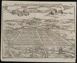
Il Cvscho citta principale della provincia del Perv
2618.
Cyclists' road map of Massachusetts
2619.
Cyclists' road map of the Philadelphia District
2620.
Dagbladets kart over krigsskuepladsen
‹ Prev
Next ›
1
2
…
127
128
129
130
131
132
133
134
135
…
446
447