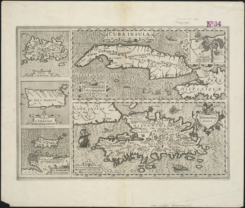
Cuba Insula ; Hispaniola Insula
Item Information
- Title:
- Cuba Insula ; Hispaniola Insula
- Title (alt.):
-
Cuba insula, Hispaniola insula, insula Iamaica, Ins. S. Ioannis, I.S. Margareta cum confiniis
- Creator:
- Mercator, Gerhard, 1512-1594
- Date:
-
[1633]
- Format:
-
Maps/Atlases
- Location:
-
Boston Public Library
Norman B. Leventhal Map & Education Center - Collection (local):
-
Norman B. Leventhal Map & Education Center Collection
- Subjects:
-
West Indies--Maps--Early works to 1800
Antilles, Greater--Maps--Early works to 1800
Virgin Islands of the United States--Maps--Early works to 1800
- Places:
-
Greater Antilles (area)
Virgin Islands of the United States (territory)
West Indies
- Extent:
- 5 maps on 1 sheet ; 17 x 36 cm. or smaller, on sheet 48 x 57 cm.
- Terms of Use:
-
No known copyright restrictions.
No known restrictions on use.
- Publisher:
-
Amsterdam :
Hendrik Hondius
- Scale:
-
Scale [ca. 1:5 000 000]
Scale [ca. 1:3 300 000]
- Language:
-
Latin
- Notes:
-
Relief shown pictorially.
Prime meridian: [Ferro].
Cuba Insula includes inset "Havana portus celeberimus totius indiae Occidentalis."
Ancillary maps: Insula Iamaica -- Ins. S. Ioannis -- Is. Margareta cum confiniis.
French text on verso; with caption title "Les isles de la Cuba, Espaignole, Iamaique, de S. Iean et Margarite," paginated 701, 704, with signatures 8P.
Bar scale in "miliaria Germanica" and "leucae Hispanicae."
From Hendrik Hondius's Gerardi Mercatoris et I. Hondii Atlas ... A Amsterdam : Chez Henry Hondius, 1633.
Cataloging, conservation, and digitization made possible in part by The National Endowment for the Humanities: Exploring the human endeavor.
- Notes (date):
-
This date is inferred.
- Identifier:
-
06_01_006349
- Call #:
-
G4900 1633 .M47
- Barcode:
-
39999059024917
![[Alleen de Caribische Eilanden, vervat in 't groot]](https://bpldcassets.blob.core.windows.net/derivatives/images/commonwealth:st74cw59p/image_thumbnail_300.jpg)


