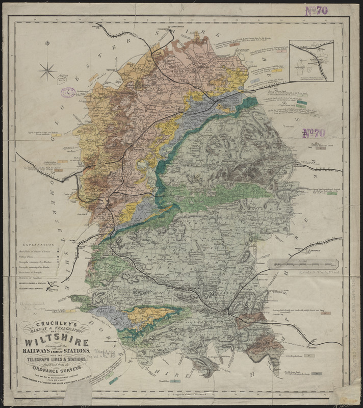
Cruchley's railway & telegraphic map of Wiltshire : showing all the railways & names of stations, also the telegraph lines & stations, improved from the Ordnance Surveys
Item Information
- Title:
- Cruchley's railway & telegraphic map of Wiltshire : showing all the railways & names of stations, also the telegraph lines & stations, improved from the Ordnance Surveys
- Title (alt.):
-
Cruchley's railway and telegraphic map of Wiltshire
- Publisher:
- Cruchley, G. F.
- Date:
-
1858
- Format:
-
Maps/Atlases
- Location:
-
Boston Public Library
Norman B. Leventhal Map & Education Center - Collection (local):
-
Norman B. Leventhal Map & Education Center Collection
- Subjects:
-
Geology--England--Wiltshire--Maps
Railroads--England--Wiltshire--Maps
Railroad stations--England--Wiltshire--Maps
Telegraph lines--England--Wiltshire--Maps
Telegraph stations--England--Wiltshire--Maps
Wiltshire (England)--Maps
- Places:
-
EnglandWiltshire (county)
- Extent:
- 1 map : hand colored ; 52 x 47 cm
- Terms of Use:
-
No known copyright restrictions.
No known restrictions on use.
- Publisher:
-
London :
Published by G.F. Cruchley
- Scale:
-
Scale approximately 1:176,000
- Language:
-
English
- Notes:
-
Relief shown by hachures.
Inset: These parts of Wilts. are situated in the eastern part of Berkshire.
Also includes coloring and notes indicating geology.
- Identifier:
-
06_01_015023
- Call #:
-
G5753.W5P3 1858 .C78
- Barcode:
-
39999065708230


