Toggle navigation
LMEC Home
Exhibitions
Georeferencing
Tools for Teachers
Collections
My Favorites
Sign Up / Log In
Search
Search the map portal
Map Collection
Map Collection
Map Sets
Search
Search
Search for
Search In
All Fields
Creator
Title
Subject
Place
Search All Digital Collections
Advanced Search
8900 Results
My Search
Start Over
More Like
commonwealth:m900r689p
Remove constraint More Like: commonwealth:m900r689p
Filter your Search
Place
North and Central America
6,139
United States
5,056
Massachusetts
2,154
Europe
1,392
Suffolk (county)
1,289
Boston
1,262
Canada
449
Asia
437
more
Place
»
Topic
Boston (Mass.)--Maps
748
United States--Maps
279
Real property--Massachusetts--Boston--Maps
254
City planning--Massachusetts--Boston--Maps
213
Landowners--Massachusetts--Boston--Maps
170
Massachusetts--Maps
165
New England--Maps
103
North America--Maps--Early works to 1800
103
more
Topic
»
Date
Date range begin
–
Date range end
Current results range from
1482
to
2023
View distribution
Creator
United States. Hydrographic Office
595
Boston Redevelopment Authority
220
O.H. Bailey & Co
148
Des Barres, Joseph F. W. (Joseph Frederick Wallet), 1722-1824
124
United States. Post Office Dept
120
Ptolemy, 2nd cent
100
Walling, Henry Francis, 1825-1888
94
Geological Survey (U.S.)
87
more
Creator
»
Format
Maps/Atlases
8,840
Manuscripts
215
Prints
56
Books
36
Objects/Artifacts
10
Drawings/Illustrations
8
Posters
5
Georeferenced
Yes
885
No
8,015
Collection
Norman B. Leventhal Map & Education Center Collection
8,676
Boston and New England Maps
2,406
Urban Maps
2,172
Maritime Charts and Atlases
1,083
American Revolutionary War-Era Maps
637
Boston Redevelopment Authority Collection
251
Massachusetts Real Estate Atlases
38
Mapping Boston Collection
20
more
Collection
»
Available to use
No known restrictions
8,677
Creative Commons license
70
Search Constraints
Sort by relevance
relevance
title
date (asc)
date (desc)
Number of results to display per page
20 per page
10
per page
20
per page
50
per page
100
per page
View results as:
grid view
map view
Search Results
1681.
Boston shoreline composite
1682.
Boston to Nantasket Beach and Plymouth
1683.
Boston University buildings
1684.
[Boston wharves, from Long Wharf]
1685.
Boston with its environs
1686.
Boston with its environs
1687.
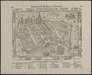
Bovrdeavx
1688.
Bowles's map of the seat of war in New England, comprehending the provinces of Massachusets Bay, and New Hampshire : with the...
1689.
Bowles's new map of the River Thames, from it's spring in Gloucester-shire, to it's influx into the sea : with a table of all...
1690.
Bowles's new one-sheet map of the independent states of Virginia, Maryland, Delaware, Pensylvania, New Jersey, New York,...
1691.
Boyle and Mercer counties
1692.
Boylston Street improvements
1693.
Bradford, Massachusetts
1694.
Bradshaw's map of Europe shewing the railways opened and in progress
1695.
Bradshaw's map of the railways, in Central Europe
1696.
Bradshaw's map of the Rhine from Rotterdam to Schafhausen
1697.
Bradshaw's new map of the railways in Great Britain for 1872
1698.
Bradshaw's plan of Paris, and map of the environs
1699.
Brasilia
1700.
Brattleboro, Vt : 1876
‹ Prev
Next ›
1
2
…
81
82
83
84
85
86
87
88
89
…
444
445


![[Boston wharves, from Long Wharf]](https://bpldcassets.blob.core.windows.net/derivatives/images/commonwealth:9s161966z/image_thumbnail_300.jpg)