Toggle navigation
LMEC Home
Exhibitions
Georeferencing
Tools for Teachers
Collections
My Favorites
Sign Up / Log In
Search
Search the map portal
Map Collection
Map Collection
Map Sets
Search
Search
Search for
Search In
All Fields
Creator
Title
Subject
Place
Search All Digital Collections
Advanced Search
8938 Results
My Search
Start Over
More Like
commonwealth:js956k875
Remove constraint More Like: commonwealth:js956k875
Filter your Search
Place
North and Central America
6,169
United States
5,085
Massachusetts
2,128
Europe
1,396
Suffolk (county)
1,284
Boston
1,257
Canada
449
Asia
438
more
Place
»
Topic
Boston (Mass.)--Maps
752
United States--Maps
282
City planning--Massachusetts--Boston--Maps
224
Real property--Massachusetts--Boston--Maps
208
Massachusetts--Maps
166
Landowners--Massachusetts--Boston--Maps
145
Urban renewal--Massachusetts--Boston--Maps
133
New England--Maps
104
more
Topic
»
Date
Date range begin
–
Date range end
Current results range from
1482
to
2023
View distribution
Creator
United States. Hydrographic Office
595
Boston Redevelopment Authority
227
O.H. Bailey & Co
148
Des Barres, Joseph F. W. (Joseph Frederick Wallet), 1722-1824
124
United States. Post Office Dept
120
Ptolemy, 2nd cent
100
Walling, Henry Francis, 1825-1888
94
Geological Survey (U.S.)
87
more
Creator
»
Format
Maps/Atlases
8,878
Manuscripts
215
Prints
56
Books
36
Objects/Artifacts
10
Drawings/Illustrations
8
Posters
5
Georeferenced
Yes
885
No
8,053
Collection
Norman B. Leventhal Map & Education Center Collection
8,724
Boston and New England Maps
2,431
Urban Maps
2,214
Maritime Charts and Atlases
1,083
American Revolutionary War-Era Maps
638
Boston Redevelopment Authority Collection
264
Mapping Boston Collection
20
Massachusetts Real Estate Atlases
15
more
Collection
»
Available to use
No known restrictions
8,738
Creative Commons license
70
Search Constraints
Sort by relevance
relevance
title
date (asc)
date (desc)
Number of results to display per page
20 per page
10
per page
20
per page
50
per page
100
per page
View results as:
grid view
map view
Search Results
7621.
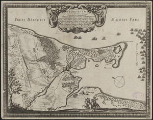
Situs locorum circa Neoburgum in Fionia, et positus exercituum vtriusq: partis, ante conflictum, d. 14. Nouemb. 1659
7622.
Siuslaw National Forest, Oregon
7623.
Skeleton map of rail-roads between Cape Canso and St. Louis
7624.
Skeleton map of the territory of the United States west of the Mississippi River : exhibiting the relations existing between...
7625.
Skeleton map showing the rail roads completed and in progress in the United States and their connection as proposed with the...
7626.
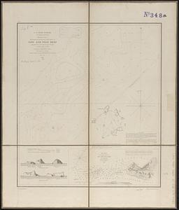
Sketch A no. 5 showing proposed site for a light house on Sow and Pigs Reef
7627.
Sketch map from the Dardanelles to the Bosphorus showing the positions of the British fleet
7628.
Sketch map of New South Wales showing the localities of the principal minerals 1876
7629.
Sketch map of part of Cassiar District : shewing Atlin Gold Fields B.C. ; to accompany report of Minister of Mines Victoria 1898
7630.
Sketch map of the British coast showing the relative positions of Liverpool, Beaumaris, Moelfra Bay & Point Lynas (taken from...
7631.
Sketch of Boston Harbor and Bay
7632.
Sketch of Bunker Hill Battle
7633.
Sketch of Charleston Harbor
7634.
Sketch of Charleston Harbor
7635.
Sketch of Charleston Harbor
7636.
Sketch of Guadalupe Island : west coast of Lower California
7637.
A sketch of part of the Island of New York shewing the operations of His Majesty's troops on the 16 Novr. 1776 which terminated...
7638.
Sketch of Pensacola Navy Yard and Fort Pickens from U.S. coast surveys
7639.
Sketch of sea coast of South Carolina and Georgia from Bull's Bay to Ossabaw Sound
7640.
Sketch of sea coast of South Carolina and Georgia from Bull's Bay to Ossabaw Sound
‹ Prev
Next ›
1
2
…
378
379
380
381
382
383
384
385
386
…
446
447