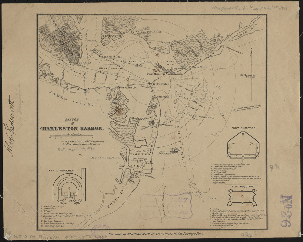
Sketch of Charleston Harbor
Item Information
- Title:
- Sketch of Charleston Harbor
- Cartographer:
- Williams, W. A., active 19th century
- Publisher:
- Redding & Co.
- Name on Item:
-
by W.A. Williams, Civil Engineer
- Date:
-
[1861]
- Format:
-
Maps/Atlases
- Location:
-
Boston Public Library
Norman B. Leventhal Map & Education Center - Collection (local):
-
Norman B. Leventhal Map & Education Center Collection
- Subjects:
-
Fortification--South Carolina--Charleston Region--Maps
Charleston Harbor (S.C.)--History--Civil War, 1861-1865--Maps
- Places:
-
South CarolinaCharleston (county)Charleston Harbor (bay)
- Extent:
- 1 map ; 24 x 25 cm
- Terms of Use:
-
No known copyright restrictions.
No known restrictions on use.
- Publisher:
-
Boston :
Redding & Co.
- Scale:
-
Scale approximately 1:70,000
- Language:
-
English
- Notes:
-
Shows fortifications, street pattern of Charleston and vegetation.
Depths shown by soundings.
Insets: Castle Pinckney -- Fort Sumpter [sic] -- Fort Moultrie.
Compare LC Civil War maps (2nd ed.), 385 for similar printing distributed by L. Prang & Co.
Variation of LC copy; some military information not included.
- Notes (date):
-
This date is inferred.
- Identifier:
-
06_01_014624
- Call #:
-
G3912.C4 1861 .W55
- Barcode:
-
39999065704700


