Toggle navigation
LMEC Home
Exhibitions
Georeferencing
Tools for Teachers
Collections
My Favorites
Sign Up / Log In
Search
Search the map portal
Map Collection
Map Collection
Map Sets
Search
Search
Search for
Search In
All Fields
Creator
Title
Subject
Place
Search All Digital Collections
Advanced Search
8553 Results
My Search
Start Over
More Like
commonwealth:jh343z21h
Remove constraint More Like: commonwealth:jh343z21h
Filter your Search
Place
North and Central America
5,848
United States
4,772
Massachusetts
2,054
Europe
1,359
Suffolk (county)
1,035
Boston
1,008
Canada
448
Asia
422
more
Place
»
Topic
Boston (Mass.)--Maps
578
United States--Maps
273
Real property--Massachusetts--Boston--Maps
174
Massachusetts--Maps
160
Landowners--Massachusetts--Boston--Maps
132
North America--Maps--Early works to 1800
103
New England--Maps
99
Europe--Maps
78
more
Topic
»
Date
Date range begin
–
Date range end
Current results range from
1482
to
2023
View distribution
Creator
United States. Hydrographic Office
594
O.H. Bailey & Co
148
Des Barres, Joseph F. W. (Joseph Frederick Wallet), 1722-1824
123
United States. Post Office Dept
120
Ptolemy, 2nd cent
100
Walling, Henry Francis, 1825-1888
94
Geological Survey (U.S.)
86
Jefferys, Thomas, -1771
85
more
Creator
»
Format
Maps/Atlases
8,494
Manuscripts
215
Prints
56
Books
36
Objects/Artifacts
10
Drawings/Illustrations
8
Posters
4
Georeferenced
Yes
869
No
7,684
Collection
Norman B. Leventhal Map & Education Center Collection
8,552
Boston and New England Maps
2,207
Urban Maps
1,937
Maritime Charts and Atlases
1,081
American Revolutionary War-Era Maps
616
Boston Redevelopment Authority Collection
88
David Judkins Weaver Papers
2
Applied Geographics, Inc. Records
1
Available to use
No known restrictions
8,412
Creative Commons license
46
Search Constraints
Sort by relevance
relevance
title
date (asc)
date (desc)
Number of results to display per page
20 per page
10
per page
20
per page
50
per page
100
per page
View results as:
grid view
map view
Search Results
3421.
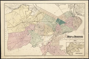
Map of Boston from the latest surveys
3422.
Map of Boston from the latest surveys
3423.
Map of Boston from the latest surveys
3424.
Map of Boston from the latest surveys
3425.
Map of Boston Harbor : showing commissioners' lines, wharves &c
3426.
Map of Boston Harbor
3427.
Map of Boston in the state of Massachusetts
3428.
Map of Boston in the state of Massachusetts
3429.
Map of Boston inner harbor
3430.
Map of Boston inner harbor to accompany report under chapter 93, resolves of 1907, December 1, 1907
3431.
Map of Boston postal stations
3432.
Map of Boston proper
3433.
Map of Boston proper, Charlestown, South Boston and East Boston : showing original territory of old Boston, the areas filled...
3434.
Map of Boston showing location of the Lenox
3435.
Map of Boston showing new division of wards
3436.
Map of Boston showing proposed new division of wards Oct. 1875
3437.
[Map of Boston, showing surface lines, proposed elevated lines, connecting surface lines and route of subway
3438.
[Map of Boston, showing the new wards]
3439.
Map of Boyd, Carter and Greenup Counties
3440.
Map of Bretton Woods and surroundings
‹ Prev
Next ›
1
2
…
168
169
170
171
172
173
174
175
176
…
427
428


![[Map of Boston, showing the new wards]](https://bpldcassets.blob.core.windows.net/derivatives/images/commonwealth:9s161h691/image_thumbnail_300.jpg)

