Toggle navigation
LMEC Home
Exhibitions
Georeferencing
Tools for Teachers
Collections
My Favorites
Sign Up / Log In
Search
Search the map portal
Map Collection
Map Collection
Map Sets
Search
Search
Search for
Search In
All Fields
Creator
Title
Subject
Place
Search All Digital Collections
Advanced Search
391 Results
My Search
Start Over
More Like
commonwealth:hx11z600p
Remove constraint More Like: commonwealth:hx11z600p
Filter your Search
Place
North and Central America
351
United States
230
Canada
105
Essex (county)
24
Louisbourg
22
Saint Lawrence River
19
Charleston (county)
18
Charleston
17
more
Place
»
Topic
United States--History--French and Indian War, 1754-1763--Maps, Manuscript--Early works to 1800
58
Louisbourg (N.S.)--Maps, Manuscript--Early works to 1800
18
Fort Edward (N.Y.)--Maps, Manuscript--Early works to 1800
16
Fort Ticonderoga (N.Y.)--Maps, Manuscript--Early works to 1800
15
Saint Lawrence River--Maps, Manuscript--Early works to 1800
15
Louisbourg (N.S.)--History--Siege, 1745--Maps, Manuscript--Early works to 1800
14
Charleston (S.C.)--Maps--Early works to 1800
13
Fortification--New York (State)--Fort Edward--Maps, Manuscript--Early works to 1800
13
more
Topic
»
Date
Date range begin
–
Date range end
Current results range from
1664
to
1816
View distribution
Creator
Royal United Services Institute for Defence and Security Studies
160
George, III, King of Great Britain, 1738-1820
151
George, IV, King of Great Britain, 1762-1830
150
Amherst, Jeffery Amherst, Baron, 1717-1797
128
Skinner, Monier
28
Skinner, William, 1700-1780
28
Brasier, William
16
Bastide, John Henry, approximately 1700-1770
15
more
Creator
»
Format
Maps/Atlases
374
Manuscripts
151
Drawings/Illustrations
15
Georeferenced
Yes
7
No
384
Collection
British Library Collection
376
American Revolutionary War-Era Maps
364
Boston and New England Maps
22
Norman B. Leventhal Map & Education Center Collection
10
Maritime Charts and Atlases
7
Urban Maps
4
Harvard Map Collection
2
Library of Congress Collection
1
more
Collection
»
Available to use
Creative Commons license
380
No known restrictions
10
Search Constraints
Sort by relevance
relevance
title
date (asc)
date (desc)
Number of results to display per page
20 per page
10
per page
20
per page
50
per page
100
per page
View results as:
grid view
map view
Search Results
281.
PLAN of the Great Falls on Hudsons River
282.
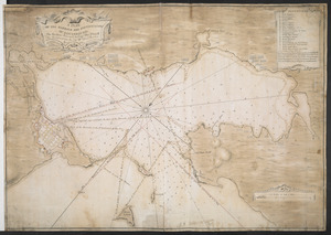
A PLAN OF THE HARBOUR AND FORTIFICATIONS OF LOUISBOURG
283.
A PLAN OF THE HARBOUR AND FORTIFICATIONS OF LOUISBOURG
284.
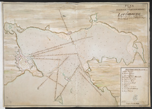
Plan of the HARBOUR and FORTIFICATIONS OF LOUISBOURG
285.
A PLAN OF THE HARBOUR AND FORTIFICATIONS OF LOUISBOURG : The Harbour Survey'd by Cap.t Phi; Durrell The Fortifications by Cap.t...
286.
PLAN of the HARBOUR and FORTIFICATIONS of LOUISBOURG : The Harbour Survey'd by Capt Phill Durell the Town & Fortifications by...
287.
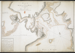
PLAN of the HARBOUR and Part of the RIVER S.T JOHNS in the BAY of FUNDY
288.
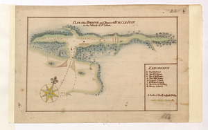
PLAN of the HARBOUR and Rivers of PORT LE JOYE in the Island of S.t Iohn
289.
Plan of the Harbour of St John's in the Bay of Fundy= Plan & Section of the Fort as it is Near Finish'd= Plan & Section's of...
290.
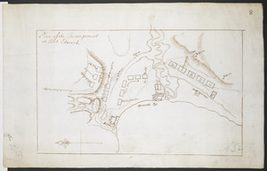
Plan of the Incampement at Fort Edward
291.
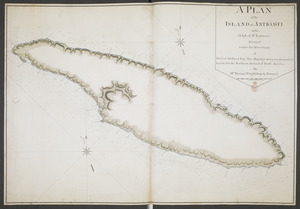
A PLAN of the ISLAND of ANTICOSTI in the Gulph of S.T Lawrence Surveyed under the Directions of Samuel Holland Esq.r His...
292.
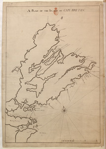
A PLAN OF THE ISLAND OF CAPE BRETON
293.
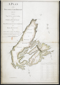
A PLAN of the ISLAND of CAPE BRITAIN reduced from the large Survey made according to the ORDERS and INSTRUCTIONS of the RIGHT...
294.
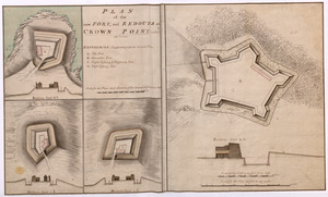
PLAN of the new FORT, and REDOUTS at CROWN POINT, called as below
295.
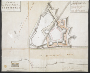
PLAN of the NEW FORT at PITSBURGH November 1759
296.
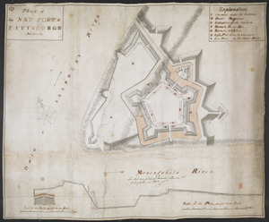
PLAN of the NEW FORT at PITTSBURGH November 1759
297.
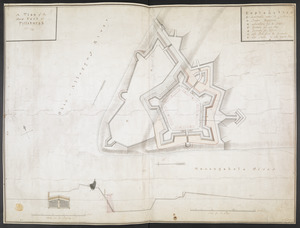
A plan of the New Fort at Pittsburgh Novr 1759
298.
PLAN OF THE PENINSULA OF CHESOPEAK BAY
299.
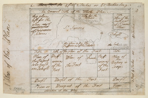
A Plan of the Plan
300.
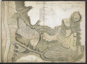
PLAN of the Position of the Army under the command of Lieut:t Gen:l Burgoyne near Still Water in which it encamped on ye 20th...
‹ Prev
Next ›
1
2
…
11
12
13
14
15
16
17
18
19
20