Toggle navigation
LMEC Home
Exhibitions
Georeferencing
Tools for Teachers
Collections
My Favorites
Sign Up / Log In
Search
Search the map portal
Map Collection
Map Collection
Map Sets
Search
Search
Search for
Search In
All Fields
Creator
Title
Subject
Place
Search All Digital Collections
Advanced Search
614 Results
My Search
Start Over
More Like
commonwealth:hx11z5837
Remove constraint More Like: commonwealth:hx11z5837
Filter your Search
Place
North and Central America
523
United States
247
North America
227
Canada
119
Essex (county)
24
Louisbourg
22
Saint Lawrence River
19
New York
17
more
Place
»
Topic
North America--Maps--Early works to 1800
240
United States--History--French and Indian War, 1754-1763--Maps, Manuscript--Early works to 1800
58
Great Britain--Colonies--America--Maps--Early works to 1800
18
Louisbourg (N.S.)--Maps, Manuscript--Early works to 1800
18
Fort Edward (N.Y.)--Maps, Manuscript--Early works to 1800
16
Fort Ticonderoga (N.Y.)--Maps, Manuscript--Early works to 1800
15
Saint Lawrence River--Maps, Manuscript--Early works to 1800
15
Louisbourg (N.S.)--History--Siege, 1745--Maps, Manuscript--Early works to 1800
14
more
Topic
»
Date
Date range begin
–
Date range end
Current results range from
1528
to
1850
View distribution
Creator
Royal United Services Institute for Defence and Security Studies
160
George, III, King of Great Britain, 1738-1820
152
George, IV, King of Great Britain, 1762-1830
151
Amherst, Jeffery Amherst, Baron, 1717-1797
128
Skinner, Monier
28
Skinner, William, 1700-1780
28
Mitchell, John, 1711-1768
18
Brasier, William
16
more
Creator
»
Format
Maps/Atlases
597
Manuscripts
152
Drawings/Illustrations
15
Georeferenced
Yes
11
No
603
Collection
American Revolutionary War-Era Maps
528
British Library Collection
376
Norman B. Leventhal Map & Education Center Collection
113
MacLean Collection Map Library
59
New York Public Library Collection
32
Boston and New England Maps
21
Richard H. Brown Revolutionary War Map Collection at Mount Vernon
18
Mapping Boston Collection
10
more
Collection
»
Available to use
Creative Commons license
437
No known restrictions
107
Search Constraints
Sort by relevance
relevance
title
date (asc)
date (desc)
Number of results to display per page
20 per page
10
per page
20
per page
50
per page
100
per page
View results as:
grid view
map view
Search Results
581.
SKETCH of FORTS CLINTON & MONTGOMERY Stormed 6.th October 1777 by the Troops under the Command of Sir Henry Clinton K.B. L.t...
582.
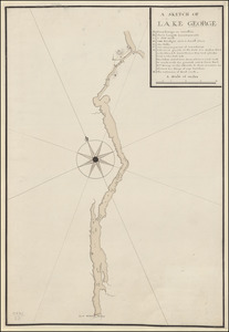
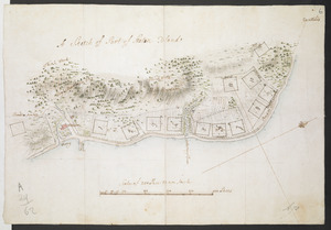
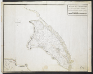
A SKETCH OF LAKE GEORGE
583.
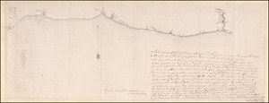
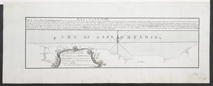
A Sketch of Lake Ontario between Oswego and Niagara and from thence up the River to the upper end of the Carrying place
584.
A SKETCH of LAKE ONTARO between OSWEGO and NIAGARA and from thence up the River to the upper End of the Carrying Place
585.
Sketch Of Part of S.t John's Harbour and River= Plan of Fort Frederick with the Necessary Alterations= Plan of the Ramainder of...
586.
A Sketch of Part of Staten Island
587.
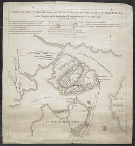
A SKETCH OF THE ACTION BETWEEN THE BRITISH FORCES AND THE AMERICAN PROVINCIALS, on the Heights of the Peninsula of Charlestown,...
588.
SKETCH OF THE CHEROKEE COUNTRY And March of the Troops Under the Command of Luet. Col. Grant to the Middle & Back Settlem:ts. 1761
589.
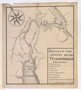
SKETCH OF THE COUNTRY ROUND TYCONDEROGA
590.
Sketch of the Isthmus to the NE of Crown Point
591.
SKETCH of the MARCH of the BRITISH ARMY, under GENERAL ROSS, from the 19th to the 29th Aug.t
592.
A SKETCH of the Ouabache &c from Post Vincent to the Ohio
593.
A Sketch of the Provinces of New York, New Jersey, Pensilvania, Maryland & Virginia shewing the line of forts lately built on...
594.
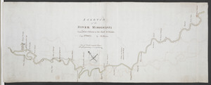
A SKETCH of the RIVER MISSISIPPI from New Orleans to the Rock of Davion
595.
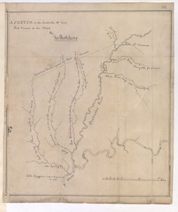
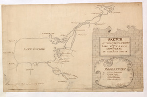
SKETCH OF THE RIVER S.T LAWRENCE From LAKE ONTARIO to MONTREAL by AN ONONDAGA INDIAN
596.
A SMALL MAP of the SEA COAST of NEW ENGLAND Together with the out Lines of Several of the Provinces Lying theron. 1738
597.
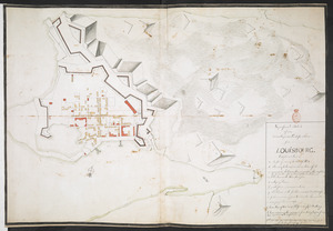
Superficial Sketch of an advantagious Fortification for LOUISBOURG
598.
A Survey of the Coast from FORT WILLIAM near S.t Iuans River to Mosquito River
599.
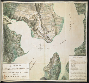
A SURVEY of the FORT at TIENDEROGA and its Environs, with the FRENCH LINES and part of LAKE CHAMPLAIN 1759
600.
This discription and [?] of the South Line of the Massachusetts Province which divides between the said Province and the Colony...
‹ Prev
Next ›
1
2
…
26
27
28
29
30
31


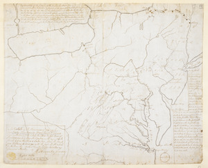

![This discription and [?] of the South Line of the Massachusetts Province which divides between the said Province and the Colony of Connecticut was made and Taken the Twenty Sixth day of October 1713 In Presence of Col. Samuel Partridge, Col. John Pynchon and [?] William Dudley Commissioners for the Massachusetts, and William Pithkin and William Whiting Esqrs for Connecticut wherein is discribed and Set down the Sain Line from Woodward and Saffery Station [?] to Connecticut River with the Several Towns farms and grants adjacent and Lying near the Same](https://bpldcassets.blob.core.windows.net/derivatives/images/commonwealth:hx11z566k/image_thumbnail_300.jpg)