Toggle navigation
LMEC Home
Exhibitions
Georeferencing
Tools for Teachers
Collections
My Favorites
Sign Up / Log In
Search
Search the map portal
Map Collection
Map Collection
Map Sets
Search
Search
Search for
Search In
All Fields
Creator
Title
Subject
Place
Search All Digital Collections
Advanced Search
614 Results
My Search
Start Over
More Like
commonwealth:hx11z5837
Remove constraint More Like: commonwealth:hx11z5837
Filter your Search
Place
North and Central America
523
United States
247
North America
227
Canada
119
Essex (county)
24
Louisbourg
22
Saint Lawrence River
19
New York
17
more
Place
»
Topic
North America--Maps--Early works to 1800
240
United States--History--French and Indian War, 1754-1763--Maps, Manuscript--Early works to 1800
58
Great Britain--Colonies--America--Maps--Early works to 1800
18
Louisbourg (N.S.)--Maps, Manuscript--Early works to 1800
18
Fort Edward (N.Y.)--Maps, Manuscript--Early works to 1800
16
Fort Ticonderoga (N.Y.)--Maps, Manuscript--Early works to 1800
15
Saint Lawrence River--Maps, Manuscript--Early works to 1800
15
Louisbourg (N.S.)--History--Siege, 1745--Maps, Manuscript--Early works to 1800
14
more
Topic
»
Date
Date range begin
–
Date range end
Current results range from
1528
to
1850
View distribution
Creator
Royal United Services Institute for Defence and Security Studies
160
George, III, King of Great Britain, 1738-1820
152
George, IV, King of Great Britain, 1762-1830
151
Amherst, Jeffery Amherst, Baron, 1717-1797
128
Skinner, Monier
28
Skinner, William, 1700-1780
28
Mitchell, John, 1711-1768
18
Brasier, William
16
more
Creator
»
Format
Maps/Atlases
597
Manuscripts
152
Drawings/Illustrations
15
Georeferenced
Yes
11
No
603
Collection
American Revolutionary War-Era Maps
528
British Library Collection
376
Norman B. Leventhal Map & Education Center Collection
113
MacLean Collection Map Library
59
New York Public Library Collection
32
Boston and New England Maps
21
Richard H. Brown Revolutionary War Map Collection at Mount Vernon
18
Mapping Boston Collection
10
more
Collection
»
Available to use
Creative Commons license
437
No known restrictions
107
Search Constraints
Sort by relevance
relevance
title
date (asc)
date (desc)
Number of results to display per page
20 per page
10
per page
20
per page
50
per page
100
per page
View results as:
grid view
map view
Search Results
521.
PLAN OF THE PENINSULA OF CHESOPEAK BAY
522.
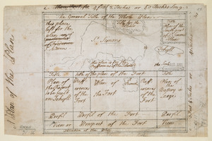
A Plan of the Plan
523.
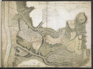
PLAN of the Position of the Army under the command of Lieut:t Gen:l Burgoyne near Still Water in which it encamped on ye 20th...
524.
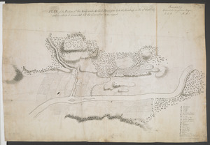
PLAN of the Position w:ch the Army under L.t Gen:l Burgoyne took at Saratoga on the 10th Sept.r 1777 and in which it remained...
525.
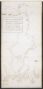
A PLAN OF THE RIVER KENNEBECK AS IT WAS SVRVEYED BY ORDER OF THE GOVERNMENT OF MASSACHUSETS BAY IN THE YEAR MDCCLXI From the...
526.
A Plan Of the River of Chibenaccadie from its Source To its Discharge into the Bay of Mines Surveyed in August 1754 : The...
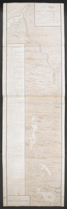
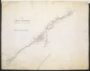
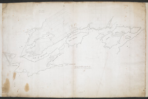
527.
A Plan of the RIVER S.T LAURENCE from Lake Ontario to the Island Orleans
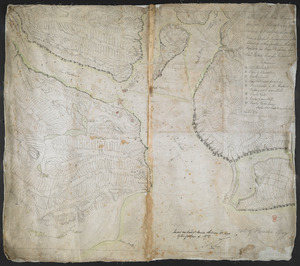
528.
A PLAN of the Rivers and Boundary Lines referr'd to in ye Proceedings & Judgment of ye Commissioners for adjusting the Bounds...
529.
A Plan of the Road, Harbour and Town of Placentia in the Island of Newfoundland From an Actual Survey shewing the Situation of...
530.
A PLAN of the SEA COAST from CAPE ELIZABETH to the ENTRANCE of SAGADAHOCK or KENNEBECK RIVER Including Casco Bay with all it's...
531.
Plan of the Settlement on the Bay of Quinte
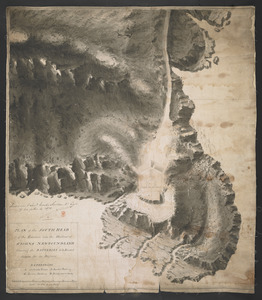
532.
PLAN of the SOUTH HEAD of the Entrance into the Harbour of St IOHNS NEWFOUNDLAND Shewing the BATTERIES to be Erected theron for...
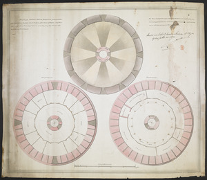
533.
PLAN of the TOWER at POINT PLEASANT for the protection of the Sea Batteries at that place and for the defence of the Harbour of...
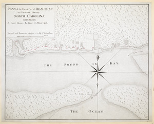
534.
PLAN of the Town & Port of BEAUFORT in Carteret County NORTH CAROLINA
535.
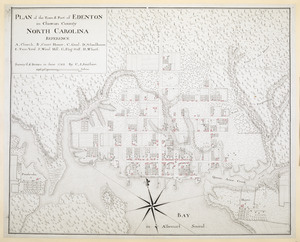
PLAN of the Town & Port of EDENTON in Chowan County NORTH CAROLINA
536.
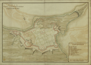
PLAN of the TOWN and FORTIFICATIONS of LOUISBOURG
537.
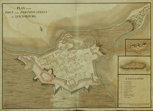
PLAN of the TOWN and FORTIFICATIONS of LOUISBOURG
538.
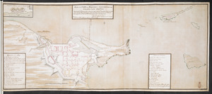
PLAN of the TOWN and FORTRESS of LOUISBOURG on the ISLAND CAPE BRETON : Surrender'd ye 16th June 1745 after a Seige of 12 days...
539.
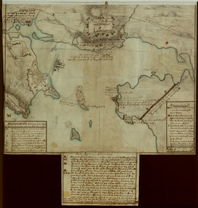
Plan of the Town and Harbour of Louisbourg
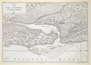
540.
PLAN of the TOWN and HARBOUR of S.T AUGUSTIN
‹ Prev
Next ›
1
2
…
23
24
25
26
27
28
29
30
31