Toggle navigation
LMEC Home
Exhibitions
Georeferencing
Tools for Teachers
Collections
My Favorites
Sign Up / Log In
Search
Search the map portal
Map Collection
Map Collection
Map Sets
Search
Search
Search for
Search In
All Fields
Creator
Title
Subject
Place
Search All Digital Collections
Advanced Search
1116 Results
My Search
Start Over
More Like
commonwealth:hx11z579n
Remove constraint More Like: commonwealth:hx11z579n
Filter your Search
Place
North and Central America
1,074
United States
951
Suffolk (county)
745
Boston
743
Canada
103
Massachusetts
75
Downtown Boston
35
Essex (county)
24
more
Place
»
Topic
Boston (Mass.)--Maps
740
City planning--Massachusetts--Boston--Maps
103
Real property--Massachusetts--Boston--Maps
98
Landowners--Massachusetts--Boston--Maps
73
Urban renewal--Massachusetts--Boston--Maps
63
United States--History--French and Indian War, 1754-1763--Maps, Manuscript--Early works to 1800
58
Local transit--Massachusetts--Boston--Maps
47
Massachusetts--Maps
45
more
Topic
»
Date
Date range begin
–
Date range end
Current results range from
1664
to
2023
View distribution
Creator
Royal United Services Institute for Defence and Security Studies
160
George, III, King of Great Britain, 1738-1820
152
George, IV, King of Great Britain, 1762-1830
151
Amherst, Jeffery Amherst, Baron, 1717-1797
128
Boston Redevelopment Authority
114
Skinner, Monier
28
Skinner, William, 1700-1780
28
Geo. H. Walker & Co
27
more
Creator
»
Format
Maps/Atlases
1,099
Manuscripts
159
Drawings/Illustrations
15
Georeferenced
Yes
103
No
1,013
Collection
Norman B. Leventhal Map Center Collection
603
Boston and New England Maps
587
Urban Maps
489
American Revolutionary War-Era Maps
376
British Library Collection
376
Boston Redevelopment Authority Collection
120
Mapping Boston Collection
20
Massachusetts Real Estate Atlases
12
more
Collection
»
Available to use
No known restrictions
674
Creative Commons license
409
Search Constraints
Sort by date (asc)
relevance
title
date (asc)
date (desc)
Number of results to display per page
20 per page
10
per page
20
per page
50
per page
100
per page
View results as:
grid view
map view
Search Results
1.
A DESCRIPTION OF THE TOWNE OF MANNADOS OR NEW AMSTERDAM as it was in September 1661 lying in Latitude 40 de: and 40,: Anno...
2.
A chart of the province of New England, with the soundings on the coast; drawn about 1670, on a scale of 1 2/3 English league...
3.
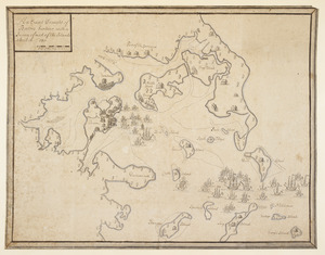
[A map of the east coast of America from Newfoundland to the Bay of Honduras]
4.
A= draught of Boston Harbor
5.
A Mappe of Colonel Römers Voyage to ye: 5 Indian nations going from New Yorck to Albany thence west to ye 3 Macquas Castle and...
6.
A new Mappe of a part of Hutsons or the North River, Rareton River which have there aiet lett in to the Sea by Sandy hoocke,...
7.
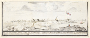
Fort William & Mary on Piscataqua River in the Province of New Hampshire on the Continent of America
8.
[Fort William and Mary on Piscataqua River]
9.
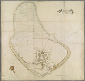
The Icqnographical draft of Castle Island where upon is built Her Maj.ties Castle and by Her Maj.ties Special Command named...
10.
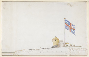
The Profil belonging to the Iconographycal Draft of the Fort William & Mary on Piscataqua River in America
11.
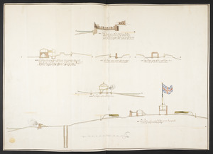
The Respective Profiles belonging to the great Iconografical Draughts of Castle Island in the Bay of Boston
12.
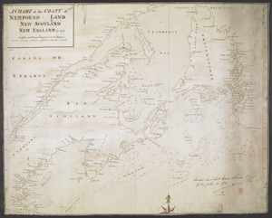
A CHART of the COAST OF NEWFOUND-LAND NEW SCOTLAND NEW ENGLAND &c. 1711
13.
An Exact Draught of Bostone harbour, with a Survey of most of the Islands about it
14.
[Map showing the boundary line between the provinces of Massachusetts Bay and Connecticut by Woodward and Saffery in 1642 and...
15.
Plan de la ville de Montreal en Canada levé en l'annee 1713
16.
This discription and [?] of the South Line of the Massachusetts Province which divides between the said Province and the Colony...
17.
Plan de la ville de Montreal en Canada levé en l'année 1713 et enceinte a Este rectifiée
18.
[A map of part of New York, comprehending the country between New York and Quebec, the river Connecticut, &c., to shew "the way...
19.
[A map of part of New York, comprehending the country between New York and Quebec, the river Connecticut, &c., to shew "the way...
20.
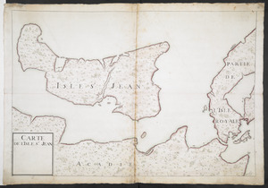
CARTE DE L'ISLE ST JEAN
‹ Prev
Next ›
1
2
3
4
5
…
55
56

![[A map of the east coast of America from Newfoundland to the Bay of Honduras]](https://bpldcassets.blob.core.windows.net/derivatives/images/commonwealth:hx11z584h/image_thumbnail_300.jpg)

![[Fort William and Mary on Piscataqua River]](https://bpldcassets.blob.core.windows.net/derivatives/images/commonwealth:6108vv71t/image_thumbnail_300.jpg)
![[Map showing the boundary line between the provinces of Massachusetts Bay and Connecticut by Woodward and Saffery in 1642 and as run in 1713]](https://bpldcassets.blob.core.windows.net/derivatives/images/commonwealth:hx11z5641/image_thumbnail_300.jpg)
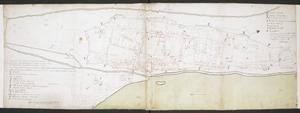
![This discription and [?] of the South Line of the Massachusetts Province which divides between the said Province and the Colony of Connecticut was made and Taken the Twenty Sixth day of October 1713 In Presence of Col. Samuel Partridge, Col. John Pynchon and [?] William Dudley Commissioners for the Massachusetts, and William Pithkin and William Whiting Esqrs for Connecticut wherein is discribed and Set down the Sain Line from Woodward and Saffery Station [?] to Connecticut River with the Several Towns farms and grants adjacent and Lying near the Same](https://bpldcassets.blob.core.windows.net/derivatives/images/commonwealth:hx11z566k/image_thumbnail_300.jpg)
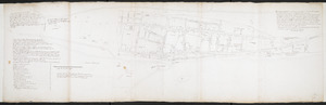
![[A map of part of New York, comprehending the country between New York and Quebec, the river Connecticut, &c., to shew "the way from Albany to Canada ..... part by land and part by water;" drawn about 1720, on a scale of 31 miles to an inch]](https://bpldcassets.blob.core.windows.net/derivatives/images/commonwealth:6108vw070/image_thumbnail_300.jpg)
![[A map of part of New York, comprehending the country between New York and Quebec, the river Connecticut, &c., to shew "the way from Albany to Canada ..... part by land and part by water;" drawn about 1720, on a scale of 31 miles to an inch]](https://bpldcassets.blob.core.windows.net/derivatives/images/commonwealth:6108vw09j/image_thumbnail_300.jpg)