Toggle navigation
LMEC Home
Exhibitions
Georeferencing
Tools for Teachers
Collections
My Favorites
Sign Up / Log In
Search
Search the map portal
Map Collection
Map Collection
Map Sets
Search
Search
Search for
Search In
All Fields
Creator
Title
Subject
Place
Search All Digital Collections
Advanced Search
9123 Results
My Search
Start Over
More Like
commonwealth:ht250q02z
Remove constraint More Like: commonwealth:ht250q02z
Filter your Search
Place
North and Central America
6,354
United States
5,270
Massachusetts
2,200
Suffolk (county)
1,469
Boston
1,442
Europe
1,396
Canada
449
Asia
438
more
Place
»
Topic
Boston (Mass.)--Maps
752
City planning--Massachusetts--Boston--Maps
418
United States--Maps
282
Urban renewal--Massachusetts--Boston--Maps
252
Real property--Massachusetts--Boston--Maps
225
Massachusetts--Maps
166
Landowners--Massachusetts--Boston--Maps
144
New England--Maps
104
more
Topic
»
Date
Date range begin
–
Date range end
Current results range from
1482
to
2023
View distribution
Creator
United States. Hydrographic Office
595
Boston Redevelopment Authority
398
O.H. Bailey & Co
148
Des Barres, Joseph F. W. (Joseph Frederick Wallet), 1722-1824
124
United States. Post Office Dept
120
Ptolemy, 2nd cent
100
Walling, Henry Francis, 1825-1888
94
Geological Survey (U.S.)
87
more
Creator
»
Format
Maps/Atlases
9,063
Manuscripts
215
Prints
56
Books
36
Objects/Artifacts
10
Drawings/Illustrations
8
Posters
5
Georeferenced
Yes
885
No
8,238
Collection
Norman B. Leventhal Map & Education Center Collection
8,723
Boston and New England Maps
2,619
Urban Maps
2,401
Maritime Charts and Atlases
1,083
American Revolutionary War-Era Maps
638
Boston Redevelopment Authority Collection
453
Mapping Boston Collection
20
Massachusetts Real Estate Atlases
12
more
Collection
»
Available to use
No known restrictions
8,926
Creative Commons license
70
Search Constraints
Sort by relevance
relevance
title
date (asc)
date (desc)
Number of results to display per page
20 per page
10
per page
20
per page
50
per page
100
per page
View results as:
grid view
map view
Search Results
6821.
Plan of modern Rome
6822.
Plan of Mount Auburn
6823.
Plan of Mount Hope Cemetery : including the City Cemetery belonging to the City of Boston and situated in West Roxbury &...
6824.
Plan of Mount Hope Cemetery belonging to the City of Boston
6825.
Plan of Mystic River showing the Harbor Commissioners lines : Dec. 1854
6826.
Plan of Nashua River from Lancaster Mills to S. Harris
6827.
Plan of Neponset River and part of Dorchester Bay showing the harbor lines proposed by the Commissioners 1854
6828.
Plan of New Orleans the capital of Louisiana : with the disposition of its quarters and canals as they have been traced by Mr....
6829.
Plan of New Orleans the capital of Louisiana : with the disposition of its quarters and canals as they have been traced by Mr....
6830.
Plan of New Orleans the capital of Louisiana
6831.
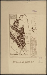
Plan of New York
6832.
A plan of New York Island, part of Long Island &c. shewing the position of the American and British Armies, before, at, and...
6833.
A plan of New York Island, with part of Long Island, Staten Island & east New Jersey, with a particular description of the...
6834.
A plan of New York Island, with part of Long Island, Staten Island & east New Jersey, with a particular description of the...
6835.
Plan of Newburyport Mass. from an actual survey
6836.
Plan of Newton & Needham
6837.
Plan of Newton Terraces, Newton, Mass
6838.
Plan of Oak Bluffs, Marthas Vineyard
6839.
Plan of Ocean View, Pigeon Cove, Mass
6840.
Plan of Orient Heights, Boston, Mass
‹ Prev
Next ›
1
2
…
338
339
340
341
342
343
344
345
346
…
456
457