Toggle navigation
LMEC Home
Exhibitions
Georeferencing
Tools for Teachers
Collections
My Favorites
Sign Up / Log In
Search
Search the map portal
Map Collection
Map Collection
Map Sets
Search
Search
Search for
Search In
All Fields
Creator
Title
Subject
Place
Search All Digital Collections
Advanced Search
8630 Results
My Search
Start Over
More Like
commonwealth:ht24zz732
Remove constraint More Like: commonwealth:ht24zz732
Filter your Search
Place
North and Central America
5,925
United States
4,849
Massachusetts
2,088
Europe
1,359
Suffolk (county)
1,114
Boston
1,087
Canada
448
Asia
422
more
Place
»
Topic
Boston (Mass.)--Maps
579
United States--Maps
273
Real property--Massachusetts--Boston--Maps
192
Massachusetts--Maps
160
City planning--Massachusetts--Boston--Maps
138
Landowners--Massachusetts--Boston--Maps
136
North America--Maps--Early works to 1800
103
New England--Maps
99
more
Topic
»
Date
Date range begin
–
Date range end
Current results range from
1482
to
2023
View distribution
Creator
United States. Hydrographic Office
594
O.H. Bailey & Co
148
Boston Redevelopment Authority
142
Des Barres, Joseph F. W. (Joseph Frederick Wallet), 1722-1824
123
United States. Post Office Dept
120
Ptolemy, 2nd cent
100
Walling, Henry Francis, 1825-1888
94
Geological Survey (U.S.)
86
more
Creator
»
Format
Maps/Atlases
8,571
Manuscripts
215
Prints
56
Books
36
Objects/Artifacts
10
Drawings/Illustrations
8
Posters
4
Georeferenced
Yes
870
No
7,760
Collection
Norman B. Leventhal Map & Education Center Collection
8,551
Boston and New England Maps
2,280
Urban Maps
2,012
Maritime Charts and Atlases
1,081
American Revolutionary War-Era Maps
616
Boston Redevelopment Authority Collection
162
Massachusetts Real Estate Atlases
4
Mapping Boston Collection
1
Available to use
No known restrictions
8,484
Creative Commons license
47
Search Constraints
Sort by relevance
relevance
title
date (asc)
date (desc)
Number of results to display per page
20 per page
10
per page
20
per page
50
per page
100
per page
View results as:
grid view
map view
Search Results
61.
A new & complete map of the city of Boston, with part of Charlestown, Cambridge & Roxbury
62.
Parcel 22
63.
Plan of Boston and Roxbury
64.
Plan of Fort Hill showing street improvements as adopted by the city council : 1869
65.
Plan of house lots in Boston belonging to Otis H. Weed
66.
Plan of land in Roxbury belonging to the heirs of Alfred Evans
67.
A plan of the salt marsh and upland in Roxbury, lying the east side of the Mill Creek
68.
Topographical map of Cedar Square, Roxbury
69.
Views of the area around Dudley Station in Roxbury
70.
Woodland Cemetery in Dorchester and Roxbury main entrance on Walk-Hill Street : five miles from Boylston market, direct route...
71.
City of Boston topographic and planimetric survey
72.
Herald Street improvements
73.
Illustrative site plan : a proposal for community review South End/Lower Roxbury development policy
74.
Illustrative site plan : South End urban renewal area, Massachusetts r-56
75.
Illustrative site plan : a proposal for community review South End/Lower Roxbury development policy
76.
Land use New York streets - South Cove 1953
77.
Relationship of TNEMC development plan area to New York streets land assembly and redevelopment project
78.
South End project no. Mass. r-56 : existing land use
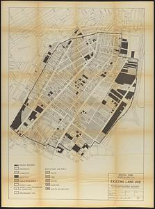
79.
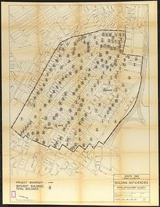
South End project no. Mass. r-56 : building deficiencies
80.
South End renewal area : locality map
‹ Prev
Next ›
1
2
3
4
5
6
7
8
…
431
432