Toggle navigation
LMEC Home
Exhibitions
Georeferencing
Tools for Teachers
Collections
My Favorites
Sign Up / Log In
Search
Search the map portal
Map Collection
Map Collection
Map Sets
Search
Search
Search for
Search In
All Fields
Creator
Title
Subject
Place
Search All Digital Collections
Advanced Search
320 Results
My Search
Start Over
More Like
commonwealth:hq37vw00x
Remove constraint More Like: commonwealth:hq37vw00x
Filter your Search
Place
North America
228
North and Central America
226
United States
63
New England
24
Massachusetts
17
Canada
16
New York
10
Rhode Island
8
more
Place
»
Topic
North America--Maps--Early works to 1800
240
Great Britain--Colonies--America--Maps--Early works to 1800
18
New England--Maps--Early works to 1800
18
United States--Maps--Early works to 1800
13
World maps--Early works to 1800
13
America--Maps--Early works to 1800
12
Canada--Maps--Early works to 1800
11
British--America--Maps--Early works to 1800
10
more
Topic
»
Date
Date range begin
–
Date range end
Current results range from
1482
to
1990
View distribution
Creator
Mitchell, John, 1711-1768
17
Sayer, Robert, 1725-1794
15
Gibson, J. (John), active 1750-1792
14
Jefferys, Thomas, -1771
14
Bowen, Emanuel, 1693 or 1694-1767
11
Moll, Herman, d. 1732
11
Anville, Jean Baptiste Bourguignon d', 1697-1782
10
Palairet, Jean, 1697-1774
8
more
Creator
»
Format
Maps/Atlases
320
Manuscripts
2
Books
1
Georeferenced
Yes
13
No
307
Collection
American Revolutionary War-Era Maps
198
Norman B. Leventhal Map & Education Center Collection
113
Sidney R. Knafel Map Collection at Phillips Academy
87
MacLean Collection Map Library
59
New York Public Library Collection
32
Richard H. Brown Revolutionary War Map Collection at Mount Vernon
18
Mapping Boston Collection
10
British Library Collection
3
more
Collection
»
Available to use
No known restrictions
107
Creative Commons license
64
Search Constraints
Sort by relevance
relevance
title
date (asc)
date (desc)
Number of results to display per page
20 per page
10
per page
20
per page
50
per page
100
per page
View results as:
grid view
map view
Search Results
121.
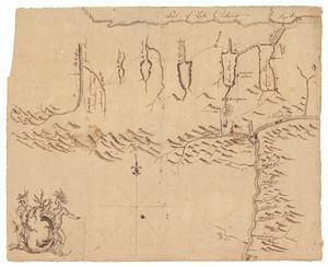
A map of North America, with the European settlements & whatever else is remarkable in ye West Indies, from the latest and best...
122.
Map of Sullivan's expedition from Wyoming on the Susquehanna River, in Pennsylvania, to the Seneca Village on the Genesee River...
123.
A map of the Britisch Empire in America with the French Spanish and the Dutch settlements adjacent thereto
124.
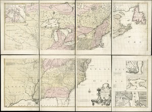
A map of the British and French dominions in North America : with the roads, distances, limits, and extent of the settlements
125.
A map of the British and French dominions in North America : with the roads, distances, limits, and extent of the settlements,...
126.
A map of the British and French dominions in North America : with the roads, distances, limits, and extent of the settlements,...
127.
A map of the British and French dominions in North America : with the roads, distances, limits, and extent of the settlements,...
128.
A map of the British and French dominions in North America : with the roads, distances, limits, and extent of the settlements,...
129.
A map of the British and French dominions in North America, with the roads, distances, limits, and extent of the settlements
130.
A map of the British and French dominions in North America with the roads, distances, limits, and extent of the settlements,...
131.
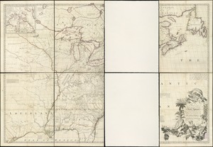
A Map of the British and French settlements in North America : (part the second) containing part of New York, Pensilvania, New...
132.
A Map of the British and French settlements in North America
133.
A Map of the British and French settlements in North America
134.
A map of the British and French settlements in North America
135.
A map of the British colonies in North America : with the roads, distances, limits, and extent of the settlements, humbly...
136.
A map of the British colonies in North America : with the roads, distances, limits, and extent of the settlements, humbly...
137.
A MAP of the BRITISH COLONIES in North America : WITH THE Roads, Distances, Limits, and Extent of the SETTLEMENTS, Humbly...
138.
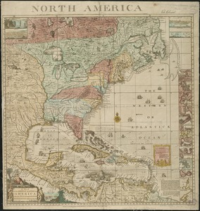
A map of the British Empire in America with the French and Spanish settlements adjacent thereto
139.
A map of the British Empire in America with the French and Spanish settlements adjacent thereto
140.
A map of the discoveries made by the Russians on the North West coast of America
‹ Prev
Next ›
1
2
3
4
5
6
7
8
9
10
11
…
15
16