Toggle navigation
LMEC Home
Exhibitions
Georeferencing
Tools for Teachers
Collections
My Favorites
Sign Up / Log In
Search
Search the map portal
Map Collection
Map Collection
Map Sets
Search
Search
Search for
Search In
All Fields
Creator
Title
Subject
Place
Search All Digital Collections
Advanced Search
233 Results
My Search
Start Over
More Like
commonwealth:hq37vv48w
Remove constraint More Like: commonwealth:hq37vv48w
Filter your Search
Place
North and Central America
180
United States
171
New England
101
Massachusetts
37
Canada
22
Middle Atlantic
21
Rhode Island
19
Connecticut
17
more
Place
»
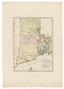
Topic
New England--Maps--Early works to 1800
97
United States--History--Revolution, 1775-1783--Maps--Early works to 1800
38
Middle Atlantic States--Maps--Early works to 1800
20
Massachusetts--Maps--Early works to 1800
18
Connecticut--Maps--Early works to 1800
16
Rhode Island--Maps--Early works to 1800
15
North America--Maps--Early works to 1800
14
New Hampshire--Maps--Early works to 1800
13
more
Topic
»
Date
Date range begin
–
Date range end
Current results range from
1482
to
1999
View distribution
Creator
Jefferys, Thomas, -1771
8
Jefferys, Thomas, d. 1771
8
Lodge, John, -1796
6
Bellin, Jacques Nicolas, 1703-1772
5
Bohn, Carl Ernst
5
Bowles, Carington, 1724-1793
5
Faden, William, 1749-1836
5
Ortelius, Abraham, 1527-1598
5
more
Creator
»
Format
Maps/Atlases
233
Manuscripts
4
Books
1
Georeferenced
Yes
18
No
215
Collection
American Revolutionary War-Era Maps
127
Norman B. Leventhal Map & Education Center Collection
89
Sidney R. Knafel Map Collection at Phillips Academy
87
Boston and New England Maps
46
Mapping Boston Collection
23
Richard H. Brown Revolutionary War Map Collection at Mount Vernon
17
MacLean Collection Map Library
15
Maritime Charts and Atlases
12
more
Collection
»
Available to use
No known restrictions
69
Creative Commons license
57
Search Constraints
Sort by relevance
relevance
title
date (asc)
date (desc)
Number of results to display per page
20 per page
10
per page
20
per page
50
per page
100
per page
View results as:
grid view
map view
Search Results
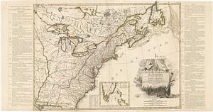
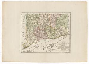
41.
Connecticut
42.
Connecticut and parts adjacent
43.
Connecticut and parts adjacent
44.
A correct map of Connecticut from actual survey
45.
To the right honourable, the Earl of Shelbourne, His Majesty's principal Secretary of State for the Southern Department : this...
46.
1. Prise de Newport par d'Estaing, 1778 : 2. Embossage de Ternay à Newport, 1780
47.
[Coast of New England from Chatham Harbor to Naragansett Bay]
48.
[Coast of New England from Chatham Harbor to Naragansett Bay]
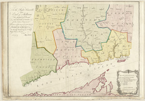
49.
A map of the country adjacent to the north boundary line of the colony of Rhode Island as the same was run by commissioners...
50.
[Plan de defense de New-Port] : [dans l'Isle Rhode (Amerique Septentrionalle) par l'escadre du Roy aux ordres de Monsieur le...
51.
Rhode Island
52.
Boston, its environs and harbour, with the rebel works raised against that town in 1775 : from the observations of Lieut. Page...
53.
Boston with its environs
54.
Carte de l'Amérique Septle. pour servir à l'intelligence de la guerre entre les Anglois et les insurgents
55.
Carte de l'Amerique Sept.le pour servir à l'intelligence de la guerre entre les anglois et les insurgents : dédiée à M.gr de...
56.
Carte des Etats-Unis d'Amérique, et du cours du Mississippi : rédigée d'après différentes cartes et relations Anglaises et...
57.
Carte des Etats-Unis de l'Amerique suivant le Traité de Paix de 1783
58.
Carte des Etats-Unis de l'Amerique suivant le Traité de Paix de 1783
59.
Carte des Etats-Unis de l'Amerique suivant le traité de paix de 1783 : dédiée et présentée a s. excellence M.r Benjamin...
60.
Carte du théatre de la guerre entre les Anglais et les Américains
‹ Prev
Next ›
1
2
3
4
5
6
7
…
11
12


![[Coast of New England from Chatham Harbor to Naragansett Bay]](https://bpldcassets.blob.core.windows.net/derivatives/images/commonwealth:7h149x27g/image_thumbnail_300.jpg)
![[Coast of New England from Chatham Harbor to Naragansett Bay]](https://bpldcassets.blob.core.windows.net/derivatives/images/commonwealth:7h149z37x/image_thumbnail_300.jpg)

![[Plan de defense de New-Port]](https://bpldcassets.blob.core.windows.net/derivatives/images/commonwealth:z603vn044/image_thumbnail_300.jpg)