Toggle navigation
LMEC Home
Exhibitions
Georeferencing
Tools for Teachers
Collections
My Favorites
Sign Up / Log In
Search
Search the map portal
Map Collection
Map Collection
Map Sets
Search
Search
Search for
Search In
All Fields
Creator
Title
Subject
Place
Search All Digital Collections
Advanced Search
395 Results
My Search
Start Over
More Like
commonwealth:h989xm80h
Remove constraint More Like: commonwealth:h989xm80h
Filter your Search
Place
North and Central America
343
United States
216
North America
73
Canada
63
New York
24
Pennsylvania
19
Asia
17
Great Lakes Region
16
more
Place
»
Topic
North America--Maps--Early works to 1800
64
United States--Maps--Early works to 1800
44
Canada--Maps--Early works to 1800
42
Great Lakes Region (North America)--Maps--Early works to 1800
17
Indians of North America--Maps--Early works to 1800
14
Pennsylvania--Maps--Early works to 1800
12
Northeastern States--Maps--Early works to 1800
10
New York (State)--Maps--Early works to 1800
9
more
Topic
»
Date
Date range begin
–
Date range end
Current results range from
1623
to
1999
View distribution
Creator
Jefferys, Thomas, -1771
20
Bellin, Jacques Nicolas, 1703-1772
15
Gibson, J. (John), active 1750-1792
14
Robert Sayer and John Bennett (Firm)
14
Carleton, Osgood, 1742-1816
13
Faden, William, 1749-1836
13
Sayer, Robert, 1725-1794
12
Bowles, Carington, 1724-1793
10
more
Creator
»
Format
Maps/Atlases
393
Manuscripts
5
Paintings
3
Ephemera
1
Objects/Artifacts
1
Prints
1
Georeferenced
Yes
1
No
394
Collection
MacLean Collection Map Library
379
American Revolutionary War-Era Maps
339
Norman B. Leventhal Map & Education Center Collection
7
Richard H. Brown Revolutionary War Map Collection at Mount Vernon
4
Newberry Library Collection
2
Mapping Boston Collection
1
Massachusetts Historical Society Map Collection
1
New York Public Library Collection
1
more
Collection
»
Available to use
Creative Commons license
7
No known restrictions
7
Search Constraints
Sort by relevance
relevance
title
date (asc)
date (desc)
Number of results to display per page
20 per page
10
per page
20
per page
50
per page
100
per page
View results as:
grid view
map view
Search Results
181.
A map of North America
182.
Map of North and South Carolina
183.
Map of northern Vermont townships
184.
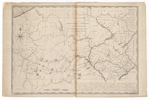
Map of part of Pennsylvania & Maryland intended to illustrate proposals for a communication between the waters of the Delaware...
185.
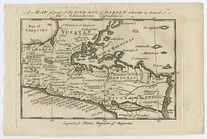
A map of part of the Isthmus of Darien, whereon is traced the adventurers expedition
186.
Map of Pennsylvania
187.
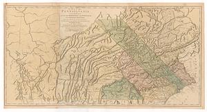
A map of Pennsylvania exhibiting not only the improved parts of that province, but also its extensive frontiers : laid down...
188.
A map of Pensylvania, with part of the adjacent states, from the latest surveys
189.
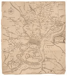
A map of Philadelphia and parts adjacent
190.
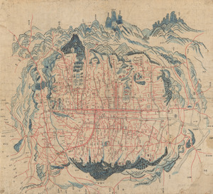
Map of Seoul
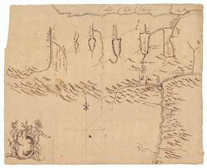
191.
Map of Sullivan's expedition from Wyoming on the Susquehanna River, in Pennsylvania, to the Seneca Village on the Genesee River...
192.
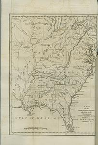
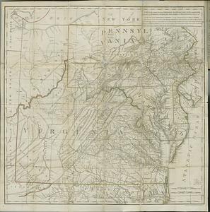
A map of the American Indian nations, adjoining to the Missisippi, west & east Florida, Georgia, S. & N. Carolina, Virginia, &c.
193.
A map of the Britisch Empire in America with the French Spanish and the Dutch settlements adjacent thereto
194.
A map of the British and French dominions in North America : with the roads, distances, limits, and extent of the settlements,...
195.
Map of the city of New-York extending northward to Fiftieth Street
196.
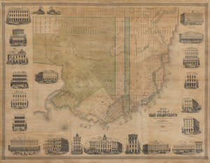
Map of the city of San Francisco
197.
A map of the country between Albemarle Sound, and Lake Erie, comprehending the whole of Virginia, Maryland, Delaware and...
198.
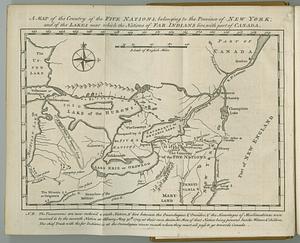
A map of the country of the Five Nations, belonging to the province of New York; and of the lakes near which the nations of far...
199.
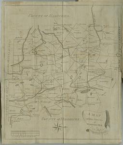
A map of the county of Worcester
200.
Map of the middle states, of America : comprehends New-York, New-Jersey, Pennsylvania, Delaware, and the territory n:w: of Ohio
‹ Prev
Next ›
1
2
…
6
7
8
9
10
11
12
13
14
…
19
20