Map of Seoul
Item Information
- Title:
- Map of Seoul
- Description:
-
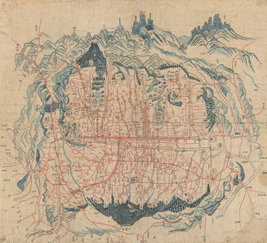
Seoul has been a capital city for more than six hundred years. Seoul, like the entire Korean peninsula, is surrounded by mountains. The ring of mountains that surround the city are presented here in an elevated three-quarters view as seen in traditional East Asian landscape painting. The overall perspective is that of the “worm’s eye-view,” as if one were a worm in the center of the city looking out in a 360-degree view. In other words, the viewer positioned on any given side reads the names written in Korean characters on the other side of the map, as the characters on the side closest will read upside down. This creates a unique perspective and manner of considering mapped space, a common feature found in maps of East Asia. Mount Pugak in the north and Mount Namsan in the south are prominent. Directly south of Mount Pugak can be seen the Royal palaces and grounds including those of Kyongbok Palace and Changdok Palace, as well as numerous other important sites and buildings. Seven foreign embassies are also indicated on the map, those of the United States, England, France, Germany, Russia, China and Japan. This map was one of two commissioned by the French embassy and can be dated by the presence of the embassies.
- Date:
-
[ca. 1890]
- Format:
-
Maps/Atlases
- Location:
- MacLean Collection Map Library
- Collection (local):
-
MacLean Collection Map Library
- Subjects:
-
Seoul (Korea)--Maps
Worm's-eye views
- Places:
-
Seoul
- Extent:
- 1 map : color ; 70 cm x 96 cm
- Terms of Use:
-
Public Domain/No known restrictions on use. Contact host institution to download image.
Contact host institution for more information.
- Place of origin:
-
Seoul
- Language:
-
Korean
- Notes:
-
Map showing all 7 Foreign Consulate offices in Seoul in the late 19th century.
The first map, showing the Catholic Church in Seoul.
Wood block print.
- Identifier:
-
MacLeanColl_33095_Seoul
- Call #:
-
33095