Toggle navigation
LMEC Home
Exhibitions
Georeferencing
Tools for Teachers
Collections
My Favorites
Sign Up / Log In
Search
Search the map portal
Map Collection
Map Collection
Map Sets
Search
Search
Search for
Search In
All Fields
Creator
Title
Subject
Place
Search All Digital Collections
Advanced Search
965 Results
My Search
Start Over
More Like
commonwealth:h128th20m
Remove constraint More Like: commonwealth:h128th20m
Filter your Search
Place
North and Central America
953
United States
948
Suffolk (county)
817
Boston
816
Massachusetts
765
Downtown Boston
37
Middlesex (county)
30
Boston Harbor
24
more
Place
»
Topic
Boston (Mass.)--Maps
752
City planning--Massachusetts--Boston--Maps
170
Urban renewal--Massachusetts--Boston--Maps
110
Land use--Massachusetts--Boston--Maps
102
Real property--Massachusetts--Boston--Maps
100
Landowners--Massachusetts--Boston--Maps
74
Massachusetts--Maps
64
Local transit--Massachusetts--Boston--Maps
48
more
Topic
»
Date
Date range begin
–
Date range end
Current results range from
1743
to
2023
View distribution
Creator
Boston Redevelopment Authority
181
Applied Geographics, Inc.
61
MassGIS (Office : Mass.)
56
Massachusetts. Executive Office of Environmental Affairs
32
Geo. H. Walker & Co
27
Boynton, George W., d. 1884
21
Sampson, Davenport & Co
21
Sampson, Murdock & Co
20
more
Creator
»
Format
Maps/Atlases
964
Manuscripts
9
Ephemera
1
Georeferenced
Yes
97
No
868
Collection
Boston and New England Maps
764
Norman B. Leventhal Map & Education Center Collection
762
Urban Maps
587
Boston Redevelopment Authority Collection
187
Applied Geographics, Inc. Records
143
American Revolutionary War-Era Maps
25
Mapping Boston Collection
20
Maritime Charts and Atlases
17
more
Collection
»
Available to use
No known restrictions
898
Creative Commons license
34
Search Constraints
Sort by relevance
relevance
title
date (asc)
date (desc)
Number of results to display per page
20 per page
10
per page
20
per page
50
per page
100
per page
View results as:
grid view
map view
Search Results
81.
Illustrative site plan : South End urban renewal area, Massachusetts r-56
82.
Illustrative site plan : Government Center urban renewal area, Massachusetts R-35
83.
Illustrative site plan : Washington Park urban renewal area, Massachusetts R-24
84.
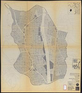
Jamaica Plain urban renewal area r-49 : proposed land use
85.
Jamaica Plain urban renewal area r-49 : existing land use
86.
Land use New York streets - South Cove 1953
87.
Map of Boston inner harbor to accompany report under chapter 93, resolves of 1907, December 1, 1907
88.
Mattapan project : land use and disposition plan
89.
Mattapan project : existing land use
90.
Metropolitan District Commission combined sewer overflow project Dorchester Bay area
91.
North Harvard project area : land use of project area
92.
Parker Hill-Fenway urban renewal area r-48 : proposed land use
93.
Parker Hill-Fenway urban renewal area r-48 : existing land use
94.
Plan for Boston
95.
Roxbury - N. Dorchester G.N.R.P. : preliminary land use plan
96.
Roxbury-N. Dorchester G.N.R.P. r-50 : proposed land use
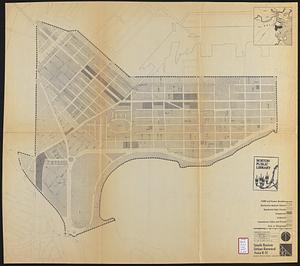
97.
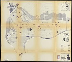
South Boston urban renewal area r-51 : proposed land use
98.
South Boston urban renewal area r-51 : existing land use
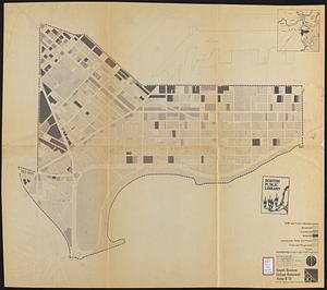
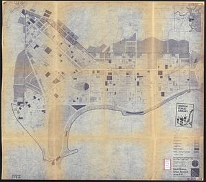
99.
South Boston urban renewal area r-51 : existing land use
100.
South Boston urban renewal area r-51 : proposed land use
‹ Prev
Next ›
1
2
3
4
5
6
7
8
9
…
48
49