Toggle navigation
LMEC Home
Exhibitions
Georeferencing
Tools for Teachers
Collections
My Favorites
Sign Up / Log In
Search
Search the map portal
Map Collection
Map Collection
Map Sets
Search
Search
Search for
Search In
All Fields
Creator
Title
Subject
Place
Search All Digital Collections
Advanced Search
8703 Results
My Search
Start Over
More Like
commonwealth:fn107c53c
Remove constraint More Like: commonwealth:fn107c53c
Filter your Search
Place
North and Central America
5,926
United States
4,844
Massachusetts
2,078
Europe
1,395
Suffolk (county)
1,045
Boston
1,018
Canada
449
Asia
437
more
Place
»
Topic
Boston (Mass.)--Maps
586
United States--Maps
282
Real property--Massachusetts--Boston--Maps
175
Massachusetts--Maps
162
Landowners--Massachusetts--Boston--Maps
133
North America--Maps--Early works to 1800
103
New England--Maps
102
World maps
82
more
Topic
»
Date
Date range begin
–
Date range end
Current results range from
1482
to
2023
View distribution
Creator
United States. Hydrographic Office
595
O.H. Bailey & Co
148
Des Barres, Joseph F. W. (Joseph Frederick Wallet), 1722-1824
123
United States. Post Office Dept
120
Ptolemy, 2nd cent
100
Walling, Henry Francis, 1825-1888
94
Geological Survey (U.S.)
86
Jefferys, Thomas, -1771
85
more
Creator
»
Format
Maps/Atlases
8,643
Manuscripts
219
Prints
56
Books
36
Objects/Artifacts
10
Drawings/Illustrations
8
Posters
5
Georeferenced
Yes
869
No
7,834
Collection
Norman B. Leventhal Map & Education Center Collection
8,700
Boston and New England Maps
2,233
Urban Maps
2,023
Maritime Charts and Atlases
1,083
American Revolutionary War-Era Maps
616
Boston Redevelopment Authority Collection
87
Sidney R. Knafel Map Collection at Phillips Academy
2
Richard H. Brown Revolutionary War Map Collection at Mount Vernon
1
Available to use
No known restrictions
8,553
Creative Commons license
51
Search Constraints
Sort by relevance
relevance
title
date (asc)
date (desc)
Number of results to display per page
20 per page
10
per page
20
per page
50
per page
100
per page
View results as:
grid view
map view
Search Results
1.
Newsmap : week of December 16 to December 22, 224th week of the war, 106th week of U.S. Participation. Monday, December 27, 1943
2.
USAF cloth chart, Western Mediterranean
3.
Burmah
4.
Map of Burma : prepared for the Ireland report on colonial administration in the Far East
5.
Map of China, Burma, Siam, Annam &c
6.
Art forms of the Pacific area
7.
Naval chart of the Pacific and western Atlantic
8.
Peoples of the Pacific
9.
B. F. Stevens's facsimile of the unpublished British head quarters coloured manuscript map of New York & environs (1782) :...
10.
Map of military reconnaissance from Fort Taylor to the Coeur d'Alene mission, Washington Territory
11.
Map of military road from Fort Walla Walla on the Columbia to Fort Benton on the Missouri
12.
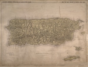
Military map, island of Puerto Rico
13.
Bloys
14.
The country around Herat : projected from Major Holditch's map
15.
Seagull Harbour, Gretton Bay, Wollaston Island, Tierra del Fuego
16.
Views of the Boston Harbor Islands
17.
Airways of the world on Mercator's projection
18.
American Radiator Company trade card
19.
Bartholomew's chart of the world on Mercator's projection
20.
Caerte van de voornaemste reysen ende ontdeckingen door de Hollanders gedaen, alsook vande landen, plaetsen ende factoriën in...
‹ Prev
Next ›
1
2
3
4
5
…
435
436