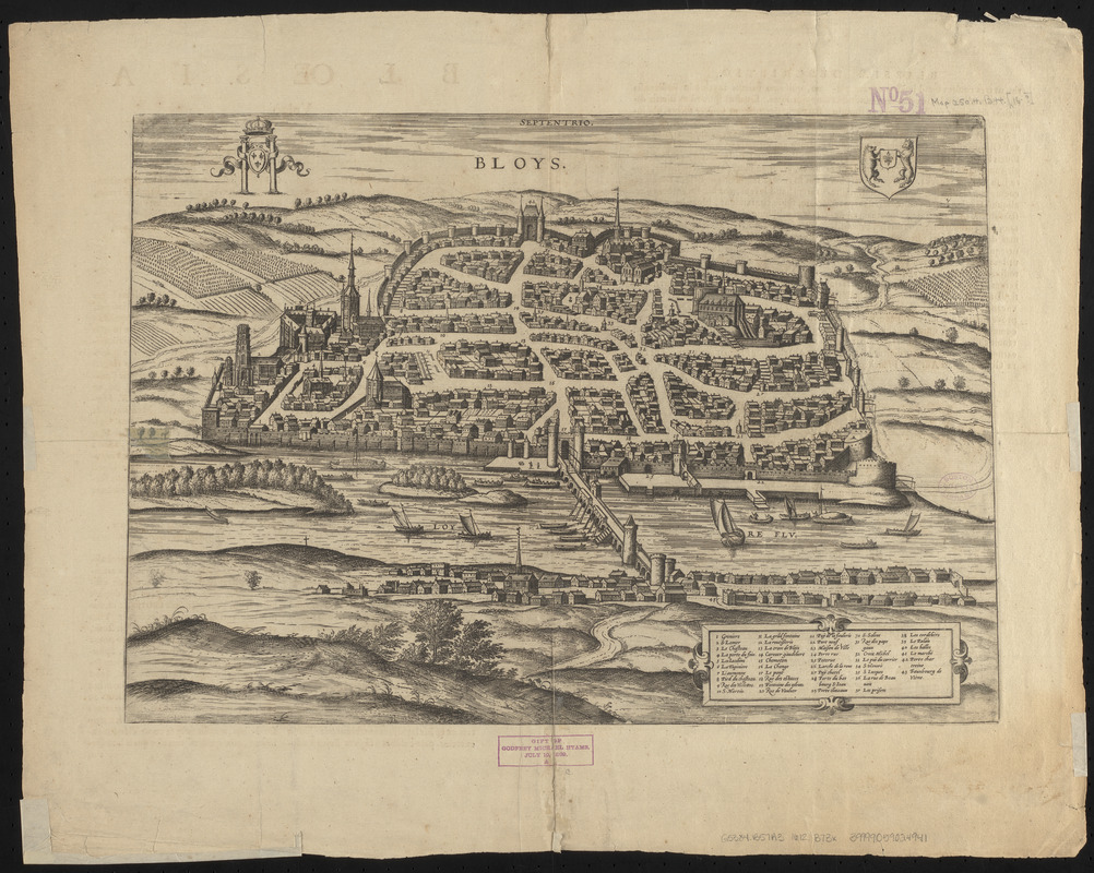
Bloys
Item Information
- Title:
- Bloys
- Cartographer:
- Braun, Georg, 1540 or 1541-1622
- Date:
-
[1612–1618]
- Format:
-
Maps/Atlases
- Location:
-
Boston Public Library
Norman B. Leventhal Map & Education Center - Collection (local):
-
Norman B. Leventhal Map & Education Center Collection
- Subjects:
-
Aerial views
Blois (France)--Aerial views--Early works to 1800
- Places:
-
FranceCentre (region)Blois
- Extent:
- 1 view ; 31 x 45 cm
- Terms of Use:
-
No known copyright restrictions.
No known restrictions on use.
- Publisher:
-
Coloniae Agripinae :
sumptibus auctorum
- Scale:
-
Not drawn to scale
- Language:
-
French
- Notes:
-
Descriptive text in Latin on verso.
Appears in the author's Civitates Orbis Terrarum. Coloniae Agripinae, 1612-1618. Vol. 2.
- Notes (date):
-
This date is inferred.
- Notes (citation):
-
Phillips. A list of geographical atlases, 3292
- Identifier:
-
06_01_006354
- Call #:
-
G5834.B57A3 1612 .B73x
- Barcode:
-
39999059024941


