Toggle navigation
LMEC Home
Exhibitions
Georeferencing
Tools for Teachers
Collections
My Favorites
Sign Up / Log In
Search
Search the map portal
Map Collection
Map Collection
Map Sets
Search
Search
Search for
Search In
All Fields
Creator
Title
Subject
Place
Search All Digital Collections
Advanced Search
8706 Results
My Search
Start Over
More Like
commonwealth:fb496t06f
Remove constraint More Like: commonwealth:fb496t06f
Filter your Search
Place
North and Central America
5,937
United States
4,849
Massachusetts
2,080
Europe
1,396
Suffolk (county)
1,046
Boston
1,019
Canada
450
Asia
438
more
Place
»
Topic
Boston (Mass.)--Maps
586
United States--Maps
282
Real property--Massachusetts--Boston--Maps
175
Massachusetts--Maps
163
Landowners--Massachusetts--Boston--Maps
133
New England--Maps
103
North America--Maps--Early works to 1800
103
Europe--Maps
79
more
Topic
»
Date
Date range begin
–
Date range end
Current results range from
1482
to
2023
View distribution
Creator
United States. Hydrographic Office
595
O.H. Bailey & Co
148
Des Barres, Joseph F. W. (Joseph Frederick Wallet), 1722-1824
123
United States. Post Office Dept
120
Ptolemy, 2nd cent
100
Walling, Henry Francis, 1825-1888
94
Geological Survey (U.S.)
86
Jefferys, Thomas, -1771
85
more
Creator
»
Format
Maps/Atlases
8,646
Manuscripts
215
Prints
56
Books
36
Objects/Artifacts
10
Drawings/Illustrations
8
Posters
5
Georeferenced
Yes
869
No
7,837
Collection
Norman B. Leventhal Map & Education Center Collection
8,694
Boston and New England Maps
2,232
Urban Maps
2,023
Maritime Charts and Atlases
1,083
American Revolutionary War-Era Maps
627
Boston Redevelopment Authority Collection
87
American Antiquarian Society Collection
6
William L. Clements Library Collection
5
more
Collection
»
Available to use
No known restrictions
8,552
Creative Commons license
47
Search Constraints
Sort by relevance
relevance
title
date (asc)
date (desc)
Number of results to display per page
20 per page
10
per page
20
per page
50
per page
100
per page
View results as:
grid view
map view
Search Results
1.
Rand McNally official 1924 auto trails map Maine ; Rand McNally official 1924 auto trails map New Hampshire, Vermont
2.
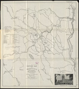
Driving map of Woodstock & vicinity, Vermont
3.
Lake Champlain streamline ferries : direct routes to Whiteface Mtn., Ausable Chasm, scenic short-cuts between Green Mountains,...
4.
Colton's Vermont
5.
Complete map of Vermont showing highways & natural features with an index of all cities, villages, post-offices and railroad...
6.
An improved map of Vermont : compiled from the latest authorities
7.
Library map of Vermont, 1914
8.
Map of Maine, New Hampshire, and Vermont : compiled from the latest authorities
9.
Map of Maine, New Hampshire and Vermont, from the most authentic sources
10.
Map of the country copied from Hale's map of N. E. with railroad route from Boston to Lake Champlain : through Keene, N. H
11.
Map of the rail road from Boston to Stanstead
12.
A map of the State of Vermont
13.
Post route map of the states of New Hampshire, Vermont showing post offices with the intermediate distances on mail routes in...
14.
Railroad Commissioners' map of the State of Vermont
15.
The state of New York with part of the adjacent states
16.
Vermont
17.
Vermont, from actual survey : with all the late additions & improvements
18.
Vermont from actual survey
19.
Vermont from actual survey
20.
A chorographical map of the northern department of North-America : drawn from the latest and most accurate observations
‹ Prev
Next ›
1
2
3
4
5
…
435
436