Search Constraints
Search Results

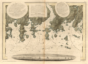
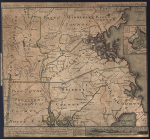
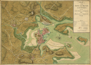
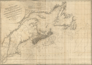
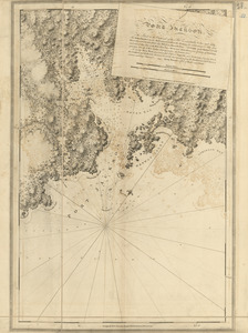
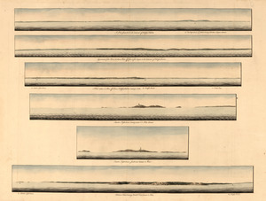
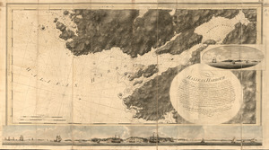
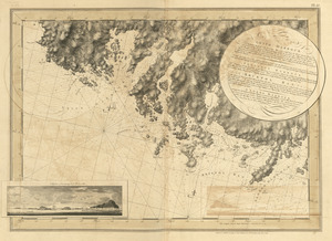
![[Boston Harbour, with the surroundings, &c]](https://bpldcassets.blob.core.windows.net/derivatives/images/commonwealth:t722hs94d/image_thumbnail_300.jpg)


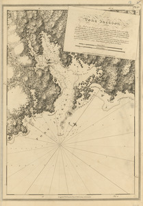
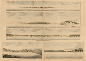
4. White Haven
5. White Haven
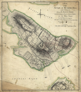
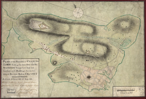
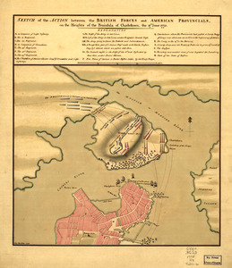
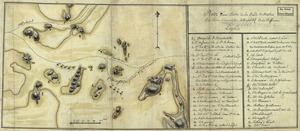
![[Battle of Bunker Hill]](https://bpldcassets.blob.core.windows.net/derivatives/images/commonwealth:z603vj11x/image_thumbnail_300.jpg)


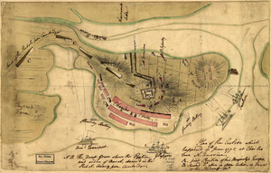
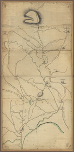
![[Bunker Hill--rough sketch]](https://bpldcassets.blob.core.windows.net/derivatives/images/commonwealth:z603vj151/image_thumbnail_300.jpg)

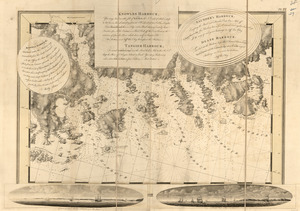
10. Canso Harbor
11. Canso Harbor


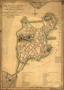
![A Plan oe [i.e. of] the British lines on Boston Neck in August 1775](https://bpldcassets.blob.core.windows.net/derivatives/images/commonwealth:z603vj41n/image_thumbnail_300.jpg)

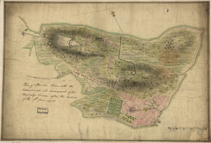

![[Plan of the Neck and environs]](https://bpldcassets.blob.core.windows.net/derivatives/images/commonwealth:z603vj436/image_thumbnail_300.jpg)
![[Plan of the "Neck" and fortifications]](https://bpldcassets.blob.core.windows.net/derivatives/images/commonwealth:z603vj23q/image_thumbnail_300.jpg)

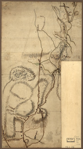
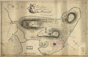
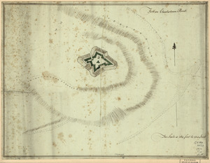
![[Rough draft of Charlestown, in water colour]](https://bpldcassets.blob.core.windows.net/derivatives/images/commonwealth:z603vj49v/image_thumbnail_300.jpg)
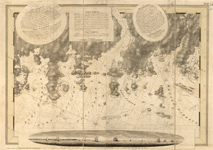
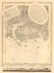
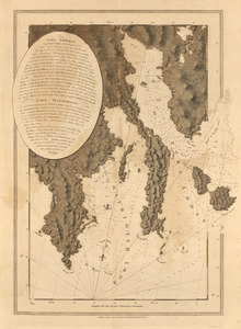
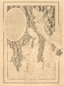
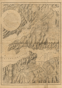
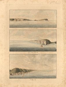
![[Torbay]](https://bpldcassets.blob.core.windows.net/derivatives/images/commonwealth:z603vj95z/image_thumbnail_300.jpg)
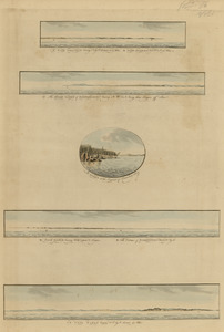
36. [Torbay]
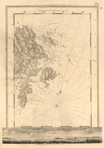
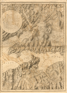
![[Torbay]](https://bpldcassets.blob.core.windows.net/derivatives/images/commonwealth:z603vk01w/image_thumbnail_300.jpg)
37. [Torbay]


40. Barrington Bay


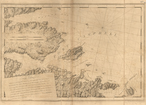
47. Port Campbell
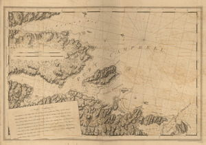
48. Port Campbell
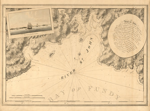
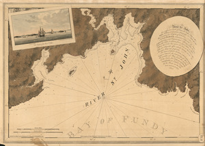
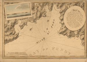
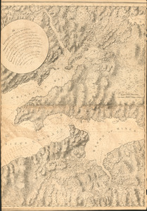
![[River St. John]](https://bpldcassets.blob.core.windows.net/derivatives/images/commonwealth:dz010t93f/image_thumbnail_300.jpg)
50. [River St. John]
![[Rough draught of Boston and harbour]](https://bpldcassets.blob.core.windows.net/derivatives/images/commonwealth:z603vj39m/image_thumbnail_300.jpg)
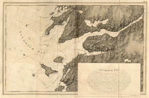
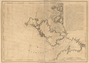
53. Sandwich Bay
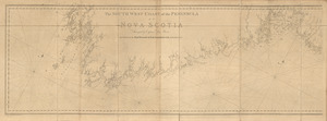
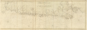
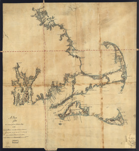
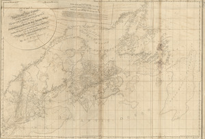
![[Southwest coast of Nova Scotia from Cape Sable to Cape St. Mary]](https://bpldcassets.blob.core.windows.net/derivatives/images/commonwealth:t722hs70t/image_thumbnail_300.jpg)

![[Chignecto Bay and vicinity]](https://bpldcassets.blob.core.windows.net/derivatives/images/commonwealth:z603vj878/image_thumbnail_300.jpg)
![[Chignecto Bay and vicinity]](https://bpldcassets.blob.core.windows.net/derivatives/images/commonwealth:z603vj85q/image_thumbnail_300.jpg)
72. Port Jackson

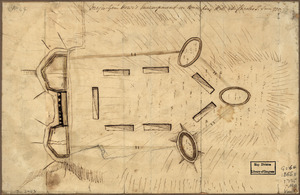
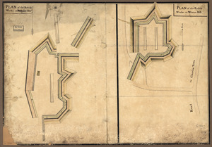
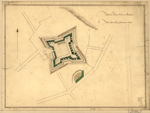
![A Temporary project for a star redout [sic] to contain 150 men](https://bpldcassets.blob.core.windows.net/derivatives/images/commonwealth:z603vj703/image_thumbnail_300.jpg)

![[Chignecto Bay and vicinity]](https://bpldcassets.blob.core.windows.net/derivatives/images/commonwealth:z603vj89t/image_thumbnail_300.jpg)


88. Egmont Harbor

89. Egmont Harbor
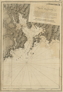
95. Port Jackson