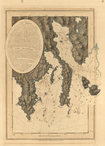
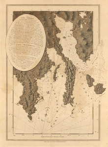
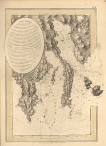
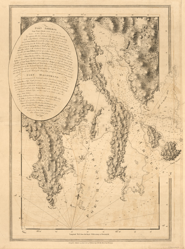
Port Amherst ; Port Haldimand
This map is also available in American Revolutionary Geographies Online (ARGO), a collections portal especially built for material relating to the American Revolutionary War Era. Visit ARGO to learn more about this item and explore the historical geography of North America in the late eighteenth century.
Item Information
- Title:
- Port Amherst ; Port Haldimand
- Publisher:
- Des Barres, Joseph F. W. (Joseph Frederick Wallet), 1722-1824
- Date:
-
1775
- Format:
-
Maps/Atlases
- Location:
- Library of Congress Geography and Map Division
- Collection (local):
-
Library of Congress Geography and Map Division
- Subjects:
-
Coasts--Nova Scotia--Maps
Port Amherst (N.S.)--Maps
Port Haldimand (N.S.)--Maps
Port Latour (N.S.)--Maps
- Places:
-
Port La Tour
North East Harbour
- Extent:
- 1 map ; 71 x 53 cm.
- Terms of Use:
-
No known copyright restrictions.
This work is licensed for use under a Creative Commons Attribution Non-Commercial Share Alike License (CC BY-NC-SA).

- Publisher:
-
[London] :
J.F.W. Des Barres
- Scale:
-
Scale [ca. 1:28,300]
- Language:
-
English
- Catalog Record:
-
https://lccn.loc.gov/75332514
- Notes:
-
State 3. Stippling added to shoals and flats.