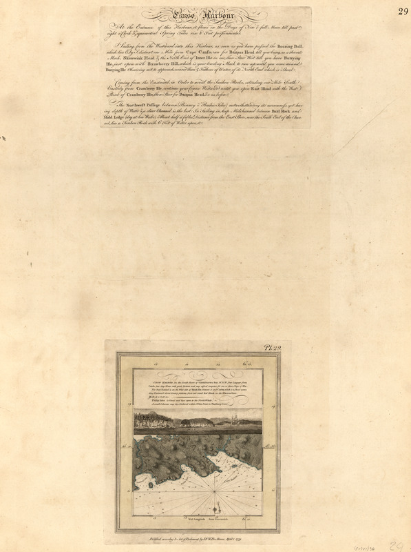
Crow Harbor, on the south shore of Chedabuctou Bay
This map is also available in American Revolutionary Geographies Online (ARGO), a collections portal especially built for material relating to the American Revolutionary War Era. Visit ARGO to learn more about this item and explore the historical geography of North America in the late eighteenth century.
Item Information
- Title:
- Crow Harbor, on the south shore of Chedabuctou Bay
- Publisher:
- Des Barres, Joseph F. W. (Joseph Frederick Wallet), 1722-1824
- Date:
-
1779
- Format:
-
Maps/Atlases
- Location:
- Library of Congress Geography and Map Division
- Collection (local):
-
Library of Congress Geography and Map Division
- Subjects:
-
Coasts--Nova Scotia--Maps
Chedabucto Bay (N.S.)--Maps
Crow Harbour (N.S.)--Maps
Philips Harbour (N.S.)--Maps
- Places:
-
CanadaNova Scotia (province)Chedabucto Bay
Blackduck Cove
Dover Harbour
Louse Harbour
- Extent:
- 1 map : hand col. ; 27 x 25 cm.
- Terms of Use:
-
No known copyright restrictions.
This work is licensed for use under a Creative Commons Attribution Non-Commercial Share Alike License (CC BY-NC-SA).

- Publisher:
-
[London] :
J.F.W. Des Barres
- Scale:
-
Scale [ca. 1:29,100]
- Language:
-
English
- Catalog Record:
-
https://lccn.loc.gov/75332518
- Notes:
-
State 4. Engraved plate number changed to "Pl. 29."


