Toggle navigation
LMEC Home
Exhibitions
Georeferencing
Tools for Teachers
Collections
My Favorites
Sign Up / Log In
Search
Search the map portal
Map Collection
Map Collection
Map Sets
Search
Search
Search for
Search In
All Fields
Creator
Title
Subject
Place
Search All Digital Collections
Advanced Search
8837 Results
My Search
Start Over
More Like
commonwealth:dj52zm95d
Remove constraint More Like: commonwealth:dj52zm95d
Filter your Search
Place
North and Central America
6,011
United States
4,860
Massachusetts
2,078
Europe
1,395
Suffolk (county)
1,045
Boston
1,018
Canada
454
Asia
441
more
Place
»
Topic
Boston (Mass.)--Maps
586
United States--Maps
282
North America--Maps--Early works to 1800
240
Real property--Massachusetts--Boston--Maps
175
Massachusetts--Maps
162
Landowners--Massachusetts--Boston--Maps
133
New England--Maps
102
Europe--Maps
79
more
Topic
»
Date
Date range begin
–
Date range end
Current results range from
1482
to
2023
View distribution
Creator
United States. Hydrographic Office
595
O.H. Bailey & Co
148
Des Barres, Joseph F. W. (Joseph Frederick Wallet), 1722-1824
123
United States. Post Office Dept
120
Ptolemy, 2nd cent
100
Walling, Henry Francis, 1825-1888
94
Jefferys, Thomas, -1771
93
Sayer, Robert, 1725-1794
88
more
Creator
»
Format
Maps/Atlases
8,777
Manuscripts
220
Prints
56
Books
36
Objects/Artifacts
10
Drawings/Illustrations
8
Posters
5
Georeferenced
Yes
872
No
7,965
Collection
Norman B. Leventhal Map & Education Center Collection
8,703
Boston and New England Maps
2,233
Urban Maps
2,023
Maritime Charts and Atlases
1,083
American Revolutionary War-Era Maps
744
Boston Redevelopment Authority Collection
87
MacLean Collection Map Library
60
New York Public Library Collection
32
more
Collection
»
Available to use
No known restrictions
8,555
Creative Commons license
114
Search Constraints
Sort by relevance
relevance
title
date (asc)
date (desc)
Number of results to display per page
20 per page
10
per page
20
per page
50
per page
100
per page
View results as:
grid view
map view
Search Results
21.
Dominia anglorum in præcipuis insulis Americæ ut sunt insula : S. Christophori, Antegoa, Iamaica, Barbados : nec non insulae...
22.
A generall mapp of the continent and islands which bee adjacent to Jamaica : A new mapp of the Island of Jamaica
23.
Grand theatre de la guerre en Amerique suivant les plus nouvelles observations des Espagnols, Anglois, François & Hollandois
24.
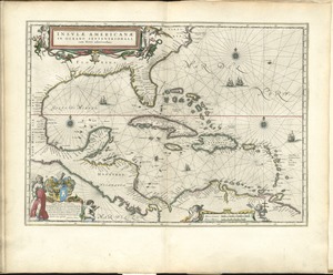
Les grandes et petites isles Antilles, et les isles Lucayes avec une partie de la mer du Nord
25.
Insulæ Americanæ in Oceano Septentrionali ac regiones adiacentes : a C. de May usque ad Lineam Æquinoctialem
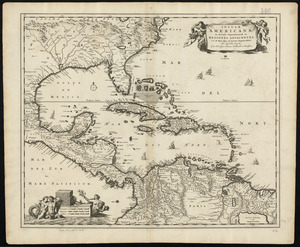
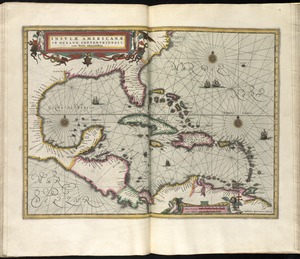
26.
Insulæ Americanæ in Oceano Septentrionali ac regiones adiacentes : a C. de May usque ad Lineam Æquinoctialem
27.
Insulæ Americanæ in Oceano Septentrionali ac regiones adiacentes : a C. de May usque ad Lineam Æquinoctialem
28.
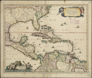
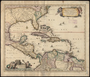
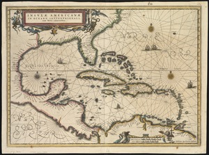
Insulae Americanae in Oceano Septentrionali, cum terris adiacentibus
29.
Insulae Americanae in Oceano Septentrionali cum terris adiacentibus
30.
Insulae Americanae in Oceano Septentrionali cum terris adiacentibus
31.
Insulae Americanae in Oceano Septentrionali, cum terris adiacentibus
32.
Les isles Antilles &c. entre lesquelles sont les Lucayes, et les Caribes
33.
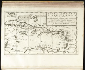
Isole Antili, la Cuba, la Spagnuola
34.
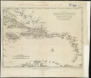
A map of the English, French, Spanish, Dutch, & Danish Islands, in the West Indies, taken from an improved map of the...
35.
A map of the West-Indies &c. Mexico or New Spain : also ye trade winds, and ye several tracts made by ye galeons and flota from...
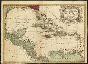
36.
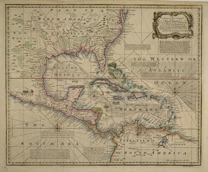
A map of the West-Indies or the islands of America in the North Sea : with ye adjacent countries; explaning [sic] what belongs...
37.
A map of the West-Indies or the islands of America in the North Sea : with ye adjacent countries; explaning [sic] what belongs...
38.
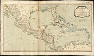
A new & accurate map of the West Indies and the adjacent parts of North & South America
39.
A new and accurate chart of the West Indies : with the adjacent coasts of North and South America
40.
A new and complete map of the West Indies : comprehending all the coasts and islands known by that name
‹ Prev
Next ›
1
2
3
4
5
6
…
441
442