Toggle navigation
LMEC Home
Exhibitions
Georeferencing
Tools for Teachers
Collections
My Favorites
Sign Up / Log In
Search
Search the map portal
Map Collection
Map Collection
Map Sets
Search
Search
Search for
Search In
All Fields
Creator
Title
Subject
Place
Search All Digital Collections
Advanced Search
857 Results
My Search
Start Over
More Like
commonwealth:d7920269f
Remove constraint More Like: commonwealth:d7920269f
Filter your Search
Place
North and Central America
804
United States
644
New York
131
New England
130
Canada
86
New Jersey
79
North America
69
Massachusetts
49
more
Place
»
Topic
United States--History--Revolution, 1775-1783--Maps
330
New England--Maps
127
North America--Maps--Early works to 1800
59
Railroads--New England--Maps
50
United States--Maps--Early works to 1800
44
New Jersey--Maps
40
Canada--Maps--Early works to 1800
38
New York (State)--Maps
35
more
Topic
»
Date
Date range begin
–
Date range end
Current results range from
1623
to
2015
View distribution
Creator
Faden, William, 1749-1836
21
Robert Sayer and John Bennett (Firm)
19
Jefferys, Thomas, -1771
18
Clinton, Henry, Sir, 1738?-1795
17
Bellin, Jacques Nicolas, 1703-1772
16
Gibson, J. (John), active 1750-1792
14
Hills, John, active 1777-1819
14
Montrésor, John, 1736-1799
14
more
Creator
»
Format
Maps/Atlases
850
Manuscripts
9
Drawings/Illustrations
5
Paintings
3
Ephemera
1
Objects/Artifacts
1
Prints
1
Georeferenced
Yes
35
No
822
Collection
American Revolutionary War-Era Maps
673
MacLean Collection Map Library
379
William L. Clements Library Collection
310
Norman B. Leventhal Map & Education Center Collection
132
Boston and New England Maps
83
American Antiquarian Society Collection
19
David Judkins Weaver Papers
4
Sidney R. Knafel Map Collection at Phillips Academy
4
more
Collection
»
Available to use
No known restrictions
134
Creative Commons license
8
Search Constraints
Sort by relevance
relevance
title
date (asc)
date (desc)
Number of results to display per page
20 per page
10
per page
20
per page
50
per page
100
per page
View results as:
grid view
map view
Search Results
281.
Part of the modern counties of Manhattan, Westchester and Queens
282.
Part of the modern counties of Princess Anne, Norfolk, and Nansemond, Virginia
283.
Part of the modern counties of Union and Middlesex, New Jersey
284.
Part of the modern counties of Union, Middlesex, and Somerset, New Jersey and Staten Island, New York
285.
Part of the modern counties of Union, Middlesex, and Somerset, New Jersey and Staten Island, New York
286.
Part of the modern counties of Westchester and Bronx
287.
Part of the modern county of Newcastle in Delaware and Cecil in Maryland
288.
A particular discription of that part of the coast of Connecticut extending from Byram River to Stratford Point : these...
289.
Partie de l'état de Rhode-Island et position des armées Américaine et Britannique au siege de Newport et à l'affaire du 29 Août...
290.
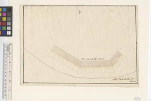
Patterson Battery
291.
Paulus Hook
292.
Paulus Hook and Bergen : surveyed and draughted from the 22d. to 29th June 1781
293.
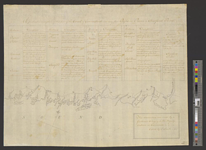
[Perspecti]ve view of the environs of [Bosto]n from Beacon Hill shewing the rebels [works?] & encampmentss, July 22d, 1775
294.
Philadelphia : dedicated to his excellency Sir Henry Clinton K.B. general and commander in chief of his majesty's forces,...
295.
Philadelphia
296.
Plan de la baie de Narragansett dans la Nouvelle Angleterre avec toutes les îles qu'elle renferme parmi lesquelles se trouvent...
297.
Plan de la rade de la ville du Carénage, isle Ste. Lucie
298.
Plan de la ville, rade, et environs de Newport en Rode Island, avec le campement de l'armée Françoise prés de cette place en...
299.
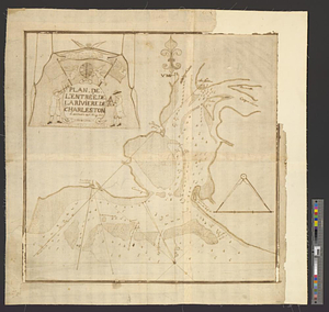
Plan de l'entrée de la rivière de Charleston le 30 Dexbre 1776
300.
Plan des environs de Brookland &c a Bettford : levé à coup d'oeil
‹ Prev
Next ›
1
2
…
11
12
13
14
15
16
17
18
19
…
42
43


![[Perspecti]ve view of the environs of [Bosto]n from Beacon Hill shewing the rebels [works?] & encampmentss, July 22d, 1775](https://bpldcassets.blob.core.windows.net/derivatives/metadata/commonwealth-oai:6d573t29z/image_thumbnail_300.jpg)